
Route: Clauchlands Point, Lamlash Bay
Area: Scotland, Isle of Arran
Date of walk: 17th October 2021
Walkers: Andrew, Gilly and James
Distance: 2.7 miles
Ascent: 600 feet
Weather: Mostly cloudy with a few patches of sun
The landscape of Arran was hidden under clag this morning so we’d opted for a garden visit at Brodick Castle. This left the afternoon free and by good fortune the clouds parted at around 3pm and there were some glimpses of decent light
Without ado we planned a short walk near to our base in the village of Lamlash. We could have walked to the start, but time was short and so we drove further around Lamlash Bay and parked near the Outdoor Education Centre. There are a few parking spaces dotted around the bay and the walk could be started from any of them
We followed the lane until it ended near Kerr’s Point and turned into a path, part of the Arran Coastal Way. This part of the bay is a Marine Conservation Area and a ‘No Take Zone’ – an area of sea and seabed where no fish may be taken by any method. We had some good wildlife sightings, including grey seals, curlew and oystercatchers. Otters may be seen here too, though we had no luck today
As we followed the easy path there were good views across the bay to Holy Island, where we would have walked today but for the poor weather. We arrived at the far point of the walk, Clauchlands Point, and after watching the wildlife for a while retraced our steps back to the start
With more time to spare, we could have continued along the coast path and followed a circular route by returning via paths over the Clauchland Hills. As it was, we’d enjoyed this short but sweet little walk
Click on the icon below for the route map (subscribers to OS Maps can view detailed maps of the route, visualise it in aerial 3D, and download the GPX file. Non-subscribers will see a base map)

Scroll down – or click on any photo to enlarge it and you can then view as a slideshow

After rain and low cloud for most of the day, some good light on Holy Island seen from our rented cottage in Lamlash

This encouraged us to go for a short walk, starting at the edge of the village

Looking across to the Buddhist retreat on Holy Island

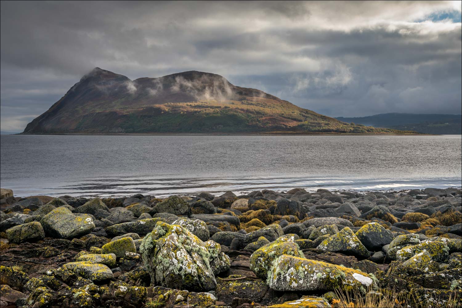
Mullach Mor, the highest point on the island, in the cloud


We enter the Lamlash Bay Community Marine Conservation Area - this is a 'no take' zone where fish may not be removed by any method, in order to protect the area for otter and other wildlife

Mullach Mor again

Looking across Lamlash Bay to Lamlash

Curlew

Oystercatcher

Lamlash Bay again...

...and Holy Island

Herring gull and cormorants

Seal on a rock

Holy Island seen from the rocky beach at Clauchlands Point

A small rock outcrop known as Hamilton Isle, home to cormorants, shags and gulls

Lamlash Bay from Clauchlands Point

A closer view, showing the seal on its rock

Hamilton Isle again

We climb uphill for a wider view of Lamlash Bay

Holy Island and its lighthouse

The path, part of the long distance Arran Coastal Way, may be continued here, but we retraced our steps from this point...


Zooming in on the lighthouse at the southern end of Holy Island

The mainland of Scotland in the distance

More lolling seals on the way back
Follow the link for more walks in Scotland (44)
