
Route: Huggate
Area: East Yorkshire
Date of walk: 15th December 2020
Walkers: Andrew
Distance: 6.8 miles
Ascent: 700 feet
Weather: Cloudy with a few sunny patches
Although Huggate village lies in a hollow, it is claimed to be the highest village on the Yorkshire Wolds at around 558 feet above sea level. However nearby Fridaythorpe makes the same claim and is said to be 561 feet. I’m not sure which is correct. The village is home to one of the deepest wells in England. I started today’s walk from Huggate, although Fridaythorpe, which is further to the north, would be an equally convenient starting point
I parked on the road near Grade I listed St Mary’s Church and headed north along the lane, turning left to join a track which passed by Glebe Farm. I’d followed this path last year, as part of the long distance Chalkland Way. Beyond the farm there followed a descent into Horse Dale, and then a climb out of it, along a very muddy path along West Lands. It was a relief to arrive at the track leading to Wold House Farm, and I followed the waymarked path through the farmyard and onto Huggate Wold. There were huge views from here but unfortunately the weather was overcast at this point, and so they weren’t seen at their best
An easy walk across the top of the wold was followed by a descent into Holm Dale, a classic chalk valley. My arrival here was greeted with some patches of sun, and there were some good bird sightings as I walked along the valley floor, including a buzzard, red kite, and flocks of fieldfare. I climbed out of Holm Dale, walked over North Field and then descended into another valley, Rabbit Dale, which merges with Cow Dale further along
At the far end of Cow Dale I climbed up to a quiet lane and from here it was a short stroll back into Huggate to complete a walk which had visited five chalk valleys
For other walks here, visit my Find Walks page and enter the name in the ‘Search site’ box
Click on the icon below for the route map (subscribers to OS Maps can view detailed maps of the route, visualise it in aerial 3D, and download the GPX file. Non-subscribers will see a base map)

Scroll down – or click on any photo to enlarge it and you can then view as a slideshow

The day before the walk, garden birds in the crab apple tree

The start of the walk as I pass by St Mary's Church Huggate

I leave the lane and join the Yorkshire Wolds Way

This tree shows me the way ahead

I join the track which passes by Glebe Farm

Beyond the farm I leave the track to join this path

I arrive at a gate above Horse Dale and turn left

Looking along Horse Dale - my route lies the other way...

I descend into the dale and climb out of it via a path on the right

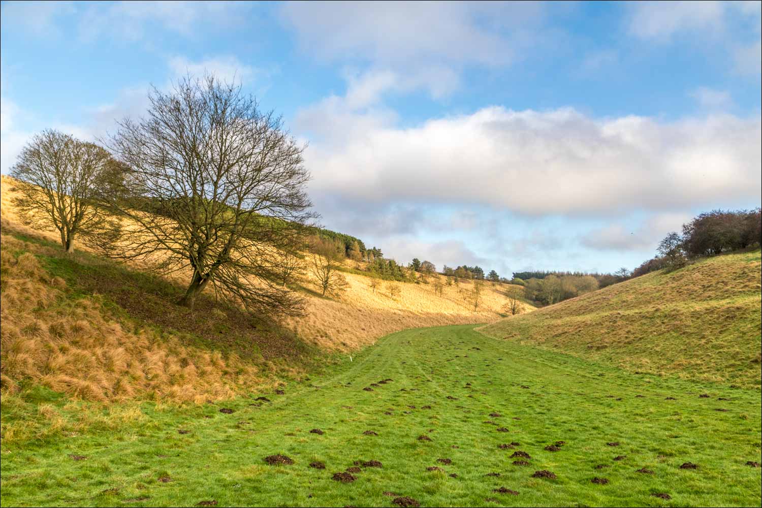
After passing through Wold House Farm and over Huggate Wold, the path descends into Holm Dale

Some welcome breaks in the clouds as I walk along Holm Dale

At the end of Holm Dale I turn left and enter into the adjoining valley of Harper Dale...


A last look back along Holm Dale as the light continues to improve

I pass through the gate and enter into Harper Dale

Harper Dale

I'd passed by one end of Horse Dale at the start of the walk, and here look back to the other end, with Horsedale Plantation in the background

More photos of Harper Dale as I follow the path along the valley floor...


Looking back

Harper Dale Plantation ahead, and I climb up the side of the dale to join a track mid-right of picture

Another view back

The path gently rises out of Harper Dale

A final look back along Harper Dale

A huge view across the Wolds from the edge of Harper Dale Plantation

I turn left at the sign

Another view across North Field in the direction of Wetwang

I arrive at the fourth of five dales along the route - Rabbit Dale. Rabbit Hill and Rabbit Wood are ahead

Views along Rabbit Dale...


The final valley on the itinerary - Cow Dale

I follow the path along Cow Dale and after a short distance climb up to the right to join the lane into Huggate

St Mary's Church Huggate at the end of an enjoyable walk
Follow the link for more walks in East Yorkshire (117)
