
Route: Hayburn Wyke
Area: North Yorkshire
Date of walk: 13th November 2020
Walkers: Andrew and Gilly
Distance: 4.5 miles
Ascent: 600 feet
Weather: Sunny
The name ‘Hayburn Wyke’ hints as to the history of this part of North Yorkshire. Hayburn is an Anglo Saxon word meaning ‘hunting enclosure by a stream’ and Wyke is the Norse word for ‘sea inlet or creek’ – which combine to describe the landscape which is the subject of today’s walk
We parked just outside the village of Cloughton in one of the few roadside spaces along Newlands Lane. We walked along the lane with enticing views of the North Sea ahead as we did so and, after about ½ mile at the end of the lane, we joined the Cleveland Way which runs along the top of the cliffs. There are wonderful views, both looking back to Scarborough and looking ahead along the clifftops
We followed the cliff top path with its innumerable ups and downs as far as Hayburn Wyke, owned and managed by the National Trust. We descended a slippery path to the stony beach where there is a waterfall marking the end of Hayburn Beck. This drops into a pool at the head of the beach, and it was on good form today following recent heavy rain. From here we retraced our steps for a short distance before climbing up to join the access road which runs past the Hayburn Wyke Inn
Just beyond the hotel we turned off to start the return leg along the ‘Cinder Track’, which is the course of the disused Yorkshire Coast Railway. This provided a very easy and quick way back to the start of a superb short coastal walk
For other walks here, visit my Find Walks page and enter the name in the ‘Search site’ box
Click on the icon below for the route map (subscribers to OS Maps can view detailed maps of the route, visualise it in aerial 3D, and download the GPX file. Non-subscribers will see a base map)

Scroll down – or click on any photo to enlarge it and you can then view as a slideshow

View on our right at the start of the walk as we head towards the North Sea

We follow Newlands Lane, which ends near the sea

Windswept tree along Newlands Lane

Hundale Scar on our right...


The end of the road

We join the Cleveland Way and head north

Looking back to Hun Dale and Hundale Scar...


Windswept bushes on the cliff edge

Scarborough Castle in the distance, right of picture

We continue along the Cleveland Way

Bench with a view


Looking inland - our return path is along Newlands Dale below


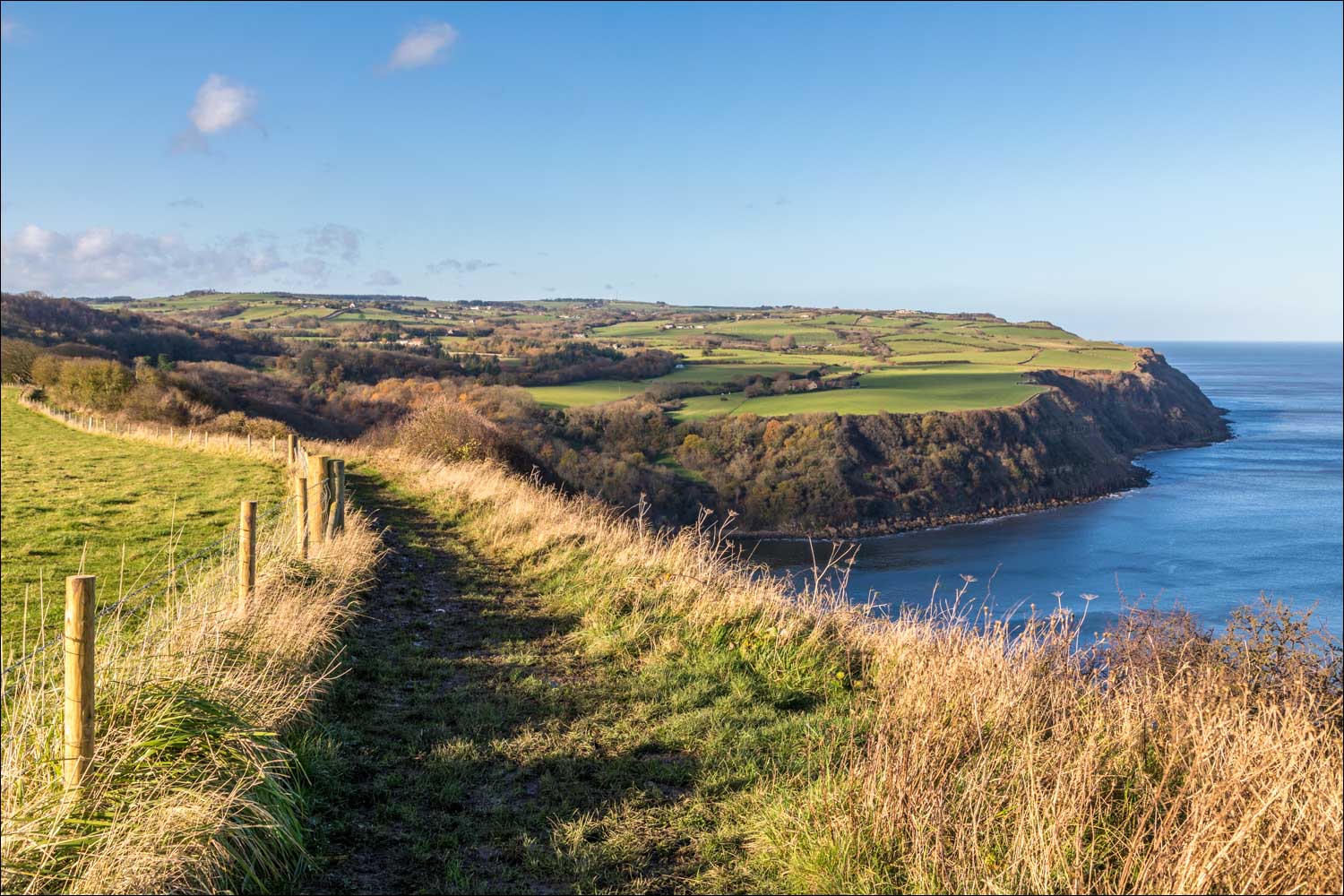
Hayburn Wyke comes into view

We're aiming for the rocky beach bottom left of picture


Looking back along the path

We enter into a wooded area and descend to the stony beach at Hayburn Wyke

Waterfall in Hayburn Beck as it flows out into the North Sea


After climbing back up a rocky staircase we pass by the Hayburn Wyke Inn

Start of the return leg along the Cinder Track, the route of a former railway line

Quick progress can be made along this section thanks to the level gradient and the cinder surface

Newlands Dale on our left

A view out to sea near the end of the walk, with Scarborough Castle in the distance

We arrive at a tunnel , which we'd walked over at the start of the walk. We climb the steps on the right to end a wonderful coastal walk
Follow the link for more walks in North Yorkshire (151)
