
Route: The Golden Valley
Area: Herefordshire
Date of walk: 26th July 2022
Walkers: Andrew and Gilly
Distance: 4.6 miles
Ascent: 700 feet
Weather: Cloudy but bright
This morning’s walk had taken us to the far west of Herefordshire and, inspired by the beauty of the area, we decided on another local walk in the Golden Valley. We parked in a public car park by the Peterchurch picnic area. The village church is adjacent, and dates back to Norman times but has been updated in two respects. Part of the interior has been transformed into a modern hub with a variety of activity spaces, including a community kitchen, library, and bell-ringing chamber. The other remarkable feature is the elegant spire, which is made of fibreglass. A casual observer wouldn’t notice this, and it’s a job well done
From the car park we walked out of the village and joined well named Long Lane, which took us gently uphill past a succession of cottages. We left the lane via a stile in a hedge, easily missed as the hedge was overgrown and the stile barely visible. The path continued gently uphill, passing through a barley field. We had to make a minor detour here to leave the official path, since an impenetrable hedge made a stile inaccessible (shown near Holbrook Wood on the OS map)
We continued through Oatley Farm to reach the far point of the walk. There were good views back along the Golden Valley from here. Much of the return leg consisted of a gentle descent down a quiet lane, which we left near a bridge to start an easy climb uphill followed by another descent back into Peterchurch
Click on the icon below for the route map (subscribers to OS Maps can view detailed maps of the route, visualise it in aerial 3D, and download the GPX file. Non-subscribers will see a base map)

Scroll down – or click on any photo to enlarge it and you can then view as a slideshow

St Peter's Church Peterchurch at the start of the walk. The original stone spire was built in 1320 but when it fell into disrepair, its replacement was made out of fibreglass

Walking out of Peterchurch

We follow a lane through nearby Hinton

We join Long Lane and look out for a stile on the left

Looking back to the stile, easily missed in the hedgerow, and we had to do some light pruning to get through

Looking back

We cross another stile near The Hostley's

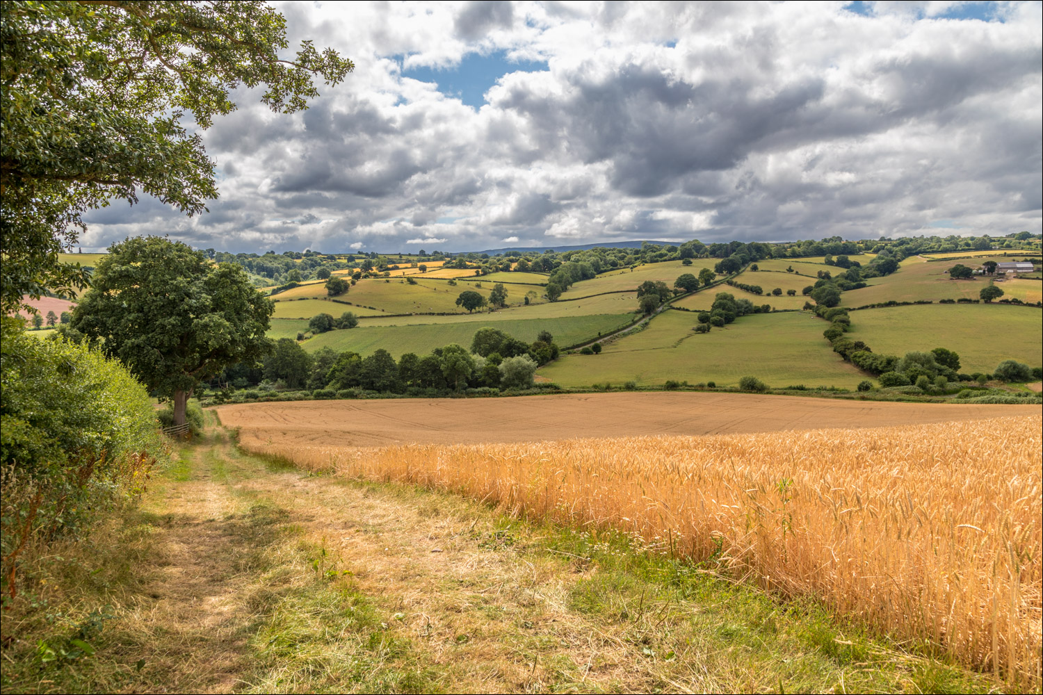
Looking across the Golden Valley - despite appearances, the name has nothing to do with the colour gold, and derives from the Welsh 'dwr' - water

We pass through this gate and enter into a cornfield

We head for Oatley Farm, upper left of picture

Beyond Oatley Farm we follow the access track

Views across the Golden Valley, looking towards the Malverns....

Looking back

We join a quiet lane heading east and follow it downhill for about one mile...


Near a bridge over Trenant Brook we leave the lane and head back towards Peterchurch, which involves a gentle climb uphill

Lovely views looking back as we gain height....


Peterchurch comes into view

From here it's an easy downhill walk back to the start
Follow the link for more walks in Herefordshire (6)
