
Route: Craswall
Area: Herefordshire
Date of walk: 27th July 2022
Walkers: Andrew and Gilly
Distance: 5.3 miles
Ascent: 600 feet
Weather: Thin cloud, pale skies and hazy views
Today’s walk would take us below the flanks of Black Hill, one of the Black Mountains which form the boundary between England and Wales. There is limited roadside parking beside the Bull’s Head in Craswall. We had hoped to end the walk with refreshments here, but it’s closed on Wednesdays
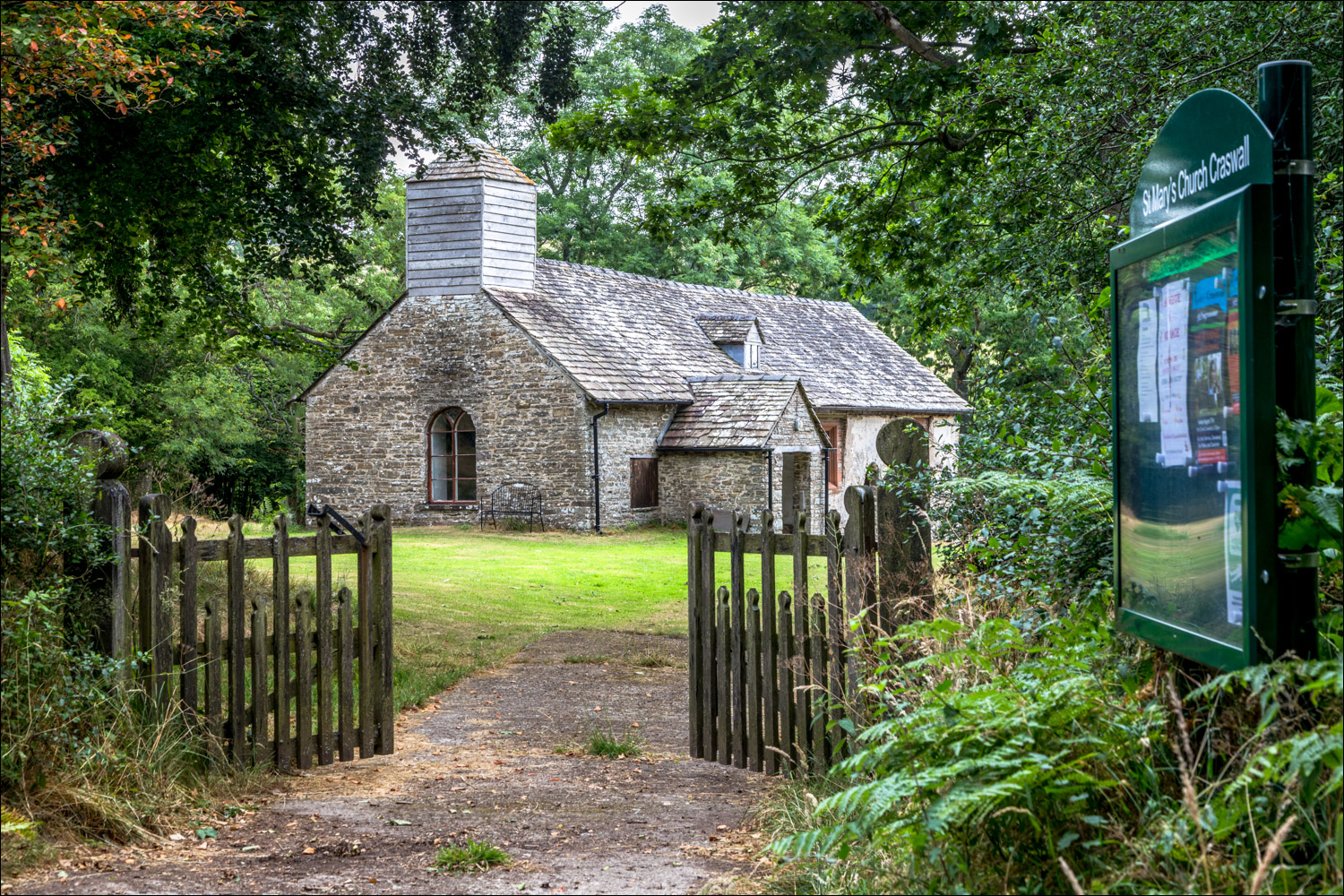
We followed a narrow lane to a bridge over the infant River Monnow and beyond the bridge visited the grounds of St Mary’s Church, which dates back 800 years. The church stands in a small field which is too rocky to be used for burials. Beyond the church we followed tracks and paths across fields before encountering an obstacle near Whiteoak Farm. A herd of Herefordshire cattle ran towards the gate which we were about to enter, and made it clear that we were not welcome into their domain. They stood staring at us, blocking the gate and protecting a young calf in their midst. An inspection of the OS map revealed no alternative route, and if we wanted to continue the walk we’d have to go off piste. Half an hour later, and after a convoluted detour involving many ungainly manouevres over barbed wire fences and streams, we managed to regain our planned route beyond the field of cows (the official route and mileage is the one shown here, our diversion added a mile to the walk)
At Abbey Farm we headed west towards Black Hill and after a short road section joined a bridleway known as Three Rivers Ride. The path rose gently to give extensive views over Hay-on-Wye, though it was very hazy today. Beyond Coed Major Farm we reached some remote terrain and joined a path which gently descended back to Craswall via an ancient holloway and a quiet lane
Click on the icon below for the route map (subscribers to OS Maps can view detailed maps of the route, visualise it in aerial 3D, and download the GPX file. Non-subscribers will see a base map)

Scroll down – or click on any photo to enlarge it and you can then view as a slideshow

The start of the walk from one of the roadside spaces by the Bull's Head, Craswall

We'd hoped to have a pub lunch here after the walk - but today is Wednesday

We turn right by this old outbuilding opposite the pub

We follow the lane downhill

We pass by the tiny Norman church of St Mary's - there's no graveyard here as the ground is too rocky for burials

We leave the lane at the church to head across fields

A well laid hedge on our right

Looking back, with Black Hill on the right

A short woodland section

Cattle in the field ahead, and as soon as they spotted us they raced over to the gate

There was a calf in their midst, so we didn't risk entering. There followed a circuitous detour and much cursing as we clambered over barbed wire fences and forded streams

Half an hour later we're back on track, and we walk to the top of this field

Looking back along the Monnow Valley with Black Hill on the right


Hay Bluff in the distance. Our route will take us to its foot

We pass through Abbey Farm and follow the track downhill

Looking back to Abbey Farm below Cefn Hill

After a short road section we go through this gate to join the Three Rivers Ride bridleway


The bridleway takes us to the right of Coed Major Farm and around the back of the plantation below Hay Bluff

Hazy views of the Monnow Valley on our left

Remote terrain below Hay Bluff

The start of the long descent back into Craswall


A short down and up over a ford

We cross the stream, here looking up to Hay Bluff

We follow an old sunken path or holloway...


We arrive at a lane and follow it back down into Craswall to end the walk
Follow the link for more walks in Herefordshire (6)
