
Route: Forge Valley to Hackness
Area: North Yorkshire
Date of walk: 4th May 2019
Walkers: Andrew and Gilly
Distance: 5.6 miles
Weather: Mixed sun and showers, a hailstorm, strong winds
Our son James was staying with us at Derwent View in Hackness and gave us a lift to the village of West Ayton, as our route was a linear one. We started our walk from the road bridge over the River Derwent and walked out of the village along Castle Rise. The road is a dead end, and we left it via a gate to follow a grassy path past the ruins of Ayton Castle, built in 1410
After passing the castle we walked downhill to join another path on the bank of the River Derwent – the river would our constant companion until the end of the walk
Before long we entered into Forge Valley Woods, a National Nature Reserve. A wooden boardwalk follows the riverside, and along it are various viewing platforms and seats. It’s a delightful place, a haven for a variety of woodland birds. The path was lined with wild garlic, bluebells, anemone, marsh marigold and other wildflowers
At the end of the woods there’s a choice of paths along the valley, one higher and the other lower and closer to the Derwent. Whichever one is chosen there is some boggy ground to negotiate and walking boots are bound to become clogged with thick mud at most times of year. The higher path is the drier of the two and we opted for this today. There are lovely views across the valley from the elevated path, though at one point a violent hailstorm hit us, borne on very cold and strong winds
We eventually arrived at the quiet village of Wrench Green and after walking through it we crossed the wooden footbridge over the Derwent. From here we followed the lane back to Derwent View in Hackness. Anyone not staying at the cottage could park in the village hall car park
For other walks here, visit my Find Walks page and enter the name in the ‘Search site’ box
Click on the icon below for the route map (subscribers to OS Maps can view detailed maps of the route, visualise it in aerial 3D, and download the GPX file. Non-subscribers will see a base map)

Scroll down – or click on any photo to enlarge it and you can then view as a slideshow

Male bullfinch in our crab apple tree earlier in the week

The start of today's walk from the road bridge over the River Derwent, which divides East and West Ayton

We walk beside the river, which will accompany us all the way to our destination in Hackness

Derwent Mill West Ayton, a Grade 2 Listed Building dating back to about 1800

We walk along Castle Rise towards Forge Valley...


At the end of Castle Rise we pass through a gate leading into Castle Field, owned by Scarborough Council

Ayton Castle

The ruined tower is all that remains of a fortified house built in 1410 by Sir Ralph Eure, a wealthy landowner

Looking across the River Derwent to East Ayton

We head towards Forge Valley woods

The River Derwent

The field gradually narrows as we approach Forge Valley

We enter Forge Valley, a National Nature Reserve

We've walked this boardwalk many times over the years. It's still perfectly serviceable but there are signs of deterioration and its days are numbered...

...plans are afoot to replace it with a new one, along with the construction of a new bridge

We pause to watch as the Women's Race in the Tour de Yorkshire passes by on the other side of the river

This is an idyllic place at any time of the year, but especially so in spring...

...wildflowers line the path...

Stitchwort...

...unfurling fern fronds

Primrose

Wild garlic

Stitchwort, bluebell, bugle and wild garlic

Flag iris yet to come into flower

We continue along the boardwalk...


We fork left here to leave the woodland

We take the higher and drier of two paths along the valley

Looking across the valley towards Suffield Heights...

...Scarborough and the North Sea are just a couple of miles away from here

A view back to Raincliffe Woods

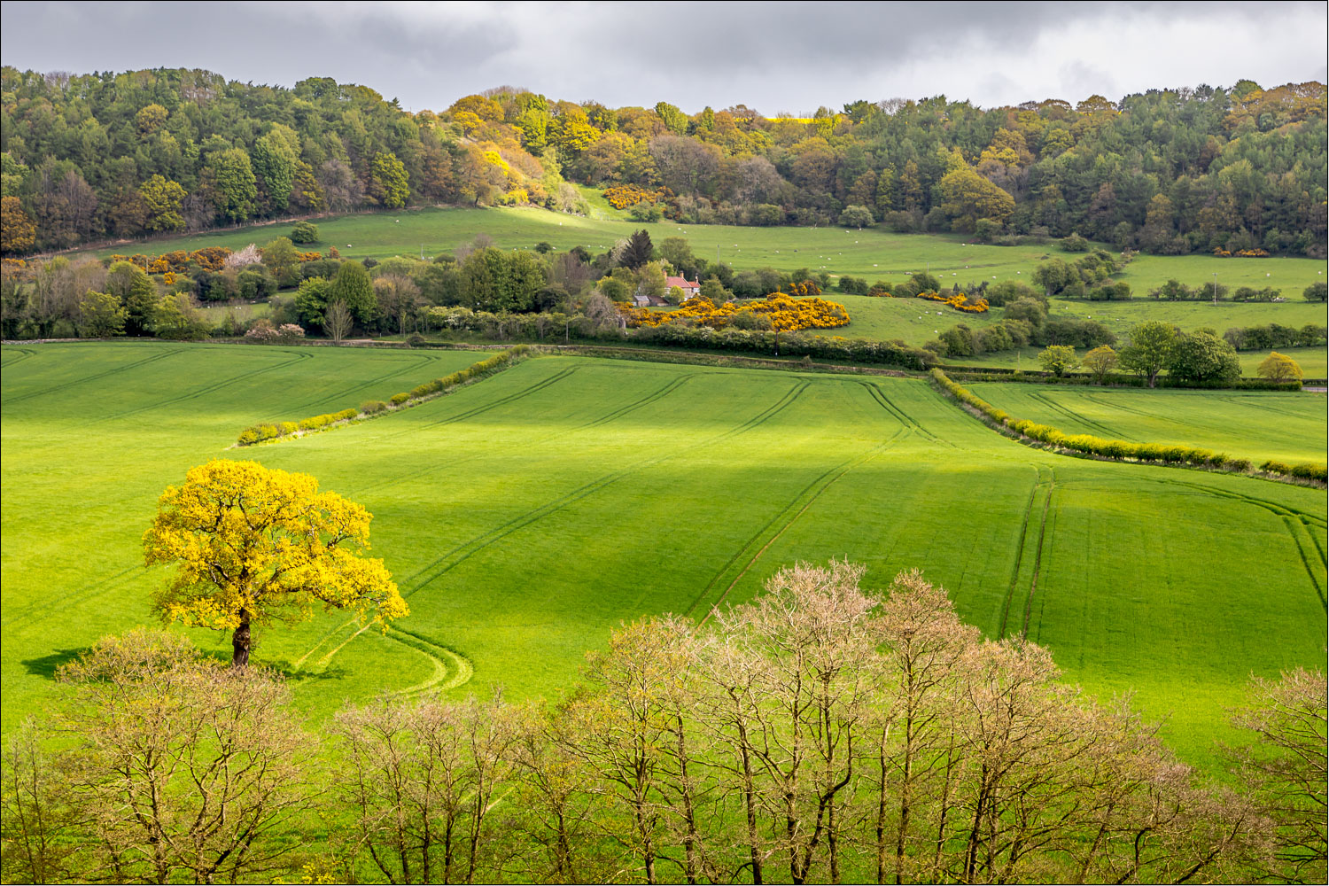
Looking along the valley towards our destination, Hackness...


Everley Bank Wood

Raincliffe Woods again

Our path takes us past North Stile Cottage below (we'd normally approach it head on but had climbed a little higher in order to avoid a herd of cows)

Looking back to Mowthorp Farm

We walk past North Stile Cottage

Everley Bank Wood again

Highland cattle, despite the large horns these are gentle creatures

Hackness comes into view after a violent hailstorm comes and goes...


Everley

Looking back along the valley...

...and across to Everley again after another brief shower

We arrive in Wrench Green

We follow the path through Wrench Farm

Pond near Wrench Farm

We cross the footbridge over the River Derwent

We walk along the lane into Hackness

A short diversion to catch the Tour de Yorkshire at the start of the climb up the 'Cote de Silpho'...


We walk back through Hackness village...


Derwent View, and the end of a wonderful walk (as mentioned in the introduction, anyone not staying here could start and end the walk from the village hall)

Later that day, in aptly named Walker's Fish Restaurant East Ayton, the piece of cod that passeth all understanding - the best fish and chips that money can buy
Follow the link for more walks in North Yorkshire (152)
