
Route: Rannerdale bluebells
Area: Western Lake District
Date of walk: 7th May 2019
Walkers: Andrew
Distance: 2.0 miles
Ascent: 200 feet
Weather: cloudy with spots of rain
Today’s walk hardly qualifies as such, and is better described as a stroll. However it’s worth recording in these pages in order to draw attention both to the spectacular Rannerdale bluebells and also to the threat they are under from visitors
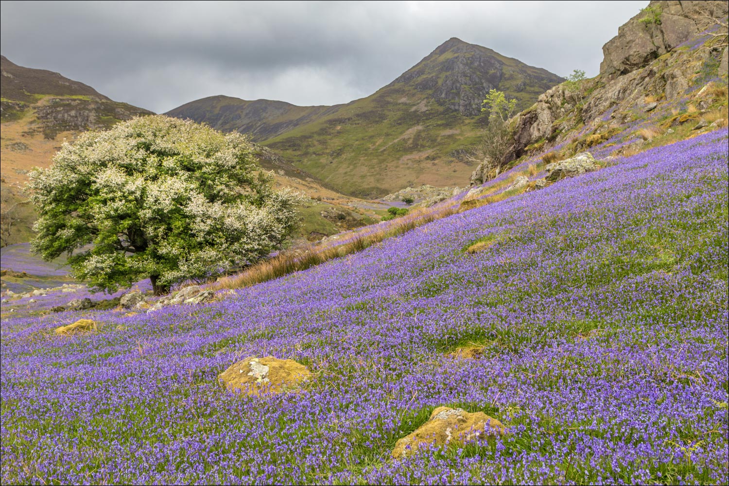
Rannerdale is a picturesque valley between Crummock Water and Buttermere and is famous for its bluebells, which are unusual in that they grow on open fellside as opposed to their more usual woodland habitat. The area is owned by the National Trust, who are the joint guardians of the bluebells along with their tenant farmers
An issue has arisen in recent years, since the display is in decline on account of careless feet. It’s estimated by the Trust that 25% of the plants have been lost in the last 4 years. Every time a person steps on the bluebells they crush 7-10 plants which then cannot photosynthesise. As a result, the plant either dies completely or takes years to recover
I parked in one of the two car parks at Cinderdale Common and headed along the grassy track towards the valley, wondering whether the display would live up to my usual expectations. After 10 minutes or so I reached the gate which leads into the bluebell area and was greeted by the wonderful sight and scent of countless bluebells
The Trust has taken extra precautions this year – areas have been fenced off (very discreetly), and there are signs asking visitors to stick to the main paths and not to trample the plants. I wandered along the valley to the end of the bluebell area and then crossed the footbridge over Squat Beck. The path passes under the steep rocky flanks of Rannerdale Knotts and emerges onto the Buttermere road. From here I walked back along the road to the start. It had been an hour well spent
For a longer low level walk, it’s possible to continue to the head of Rannerdale and then return via Crummock Water (click here), or to ascend Rannerdale Knotts and return via the bluebell area (click here). Whatever route is chosen could I please urge anyone walking in Rannerdale at bluebell time to keep to the main paths. There are plenty of photo opportunities from here, and there’s no need to wander off the paths in search of a better viewpoint, as I hope to demonstrate below…
For other walks here, visit my Find Walks page and enter the name in the ‘Search site’ box
Click on the icon below for the route map (subscribers to OS Maps can view detailed maps of the route, visualise it in aerial 3D, and download the GPX file. Non-subscribers will see a base map)

Scroll down – or click on any photo to enlarge it and you can then view as a slideshow

A variety of finches in our crab apple tree earlier this week...

...and in keeping with the floral theme of today's walk, spring flowers in the garden...


The start of the walk as I head towards the steep north face of Rannerdale Knotts from Cinderdale Common

The bluebells come into view

A carpet of blue on the fellside

Looking back to Crummock Water, and Low Fell in the distance

The foot of Rannerdale Knotts...


I enter the bluebell area

The old sign on the entrance gate - I'm not sure why it's spelt 'Rannadale' here

The National Trust has stepped up its protection of the area by adding extra signage and fencing...

I head along the main path into Rannerdale

I wish I could convey the scent as well as the sight...


Looking across to Crummock Water

Rannerdale Farm, which I'll walk past on the way back


I cross the footbridge over Squat Beck and turn right - anyone wishing to extend the walk could turn left here and walk up to the head of the valley

Looking back along the path...


I walk below the foot of Rannerdale Knotts...


Mellbreak on the far side of Crummock Water

A sea of bluebells on Rannerdale Knotts

Looking back

High Ling Crag on the far shore on Crummock Water

Looking back to Whiteless Pike


Leaving the bluebell area

I follow the path between the dry stone walls in the direction of Crummock Water

Another view back, with Grasmoor on the left

I arrive at the Buttermere road

A view back along the road, with Red Pike in the background

Looking across to Lad Hows

I pass by Rannerdale Farm...

...and Rannerdale Cottage

The end of the walk as I arrive back at Cinderdale Common - tek care!
