
Route: Eskdale
Area: Southern Lake District
Date of walk: 26th July 2019
Walkers: Andrew and Gilly
Distance: 6.0 miles
Ascent: 800 feet
Weather: Mostly cloudy, quite warm,
Eskdale is one of the most beautiful valleys in lakeland, but it’s very remote – it takes over an hour to drive here from the north of the district. However its remoteness is part of the charm, and guarantees that a walk here is unlikely to be spoilt by hordes of other walkers
We parked in the car park at Dalegarth Station, which is the terminus of the Ravenglass to Eskdale miniature railway, known as La’al Ratty (meaning “little railway“ in old Cumbrian dialect)
After walking along the valley road for a short distance we turned right to join a grassy path leading up Hollinghead Bank. The ascent seems steep when viewed from below, but a well graded path and a series of zigzags take the sting out of the climb. Eventually we arrived at Blea Tarn, set in a lovely position below the craglets of Bleatarn Hill. The weather was rather dull and overcast, and didn’t show the remote terrain in its best light today
We then made our way over to nearby Siney Tarn, which is split into several smaller pools and is set in the middle of some extremely boggy terrain. Navigation is quite tricky around here, paths appear and disappear, and some of those shown on the OS map don’t seem to exist at all. It’s likely that a degree of improvisation will be needed, as happened today when we deviated from our route last time here. The detour, which avoided a particularly boggy area, added about half a mile to the itinerary
We joined a delightful grassy path which contoured around the fellside, with wonderful views over Eskdale along the way, enhanced by some improving weather. We descended to the valley floor, crossing in turn the railway line, the road and the River Esk, to start the return journey along the other side of Eskdale. An easy path took us through Low Wood, past Dalegarth Hall and back to the road. From here we retraced our steps back to the start of a delightful walk
For other walks here, visit my Find Walks page and enter the name in the ‘Search site’ box
Click on the icon below for the route map (subscribers to OS Maps can view detailed maps of the route, visualise it in aerial 3D, and download the GPX file. Non-subscribers will see a base map)

Scroll down – or click on any photo to enlarge it and you can then view as a slideshow

The start of today's walk from Dalegarth Station, terminus of the Ravenglass to Eskdale miniature railway

We arrive back at Dalegarth Station at the end of our walk

We turn right out of the station car park and follow the valley road for a short distance

At Beckfoot we cross the railway line to start the climb up Hollinghead Bank

Looking back to Beckfoot as we start the climb

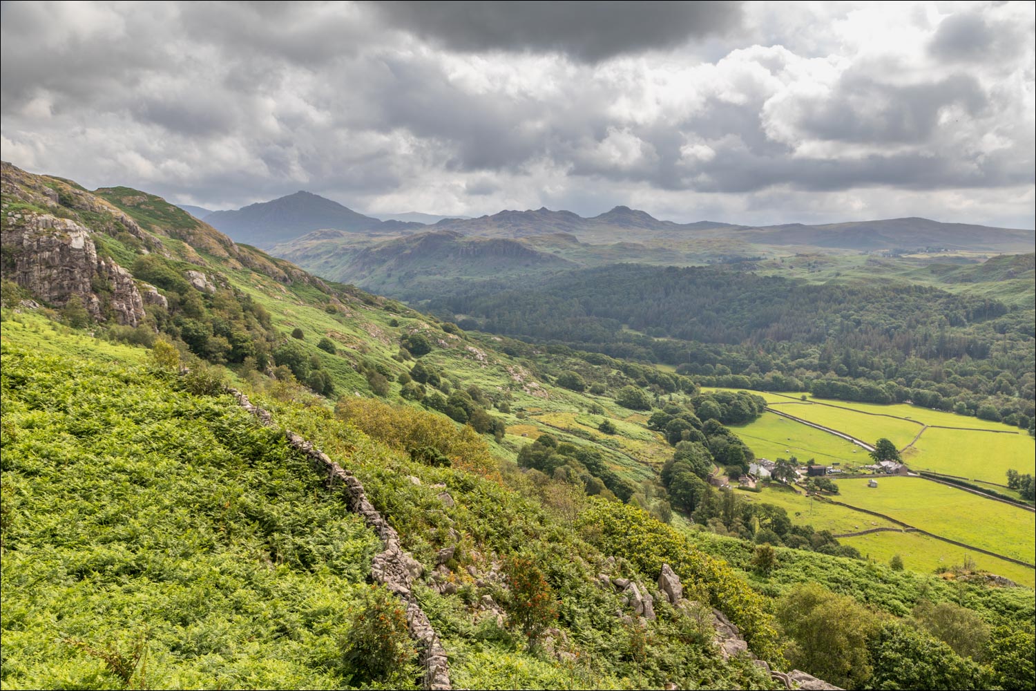
Looking along Eskdale, with Harter Fell prominent in the background

Hollinghead Bank

Views to the head of Eskdale and the foot of the Hardknott Pass...


The Ulpha Fells on the far side of Eskdale

The top of Hollinghead Bank, and behind it lies Blea Tarn

Blea Tarn

We pass by Siney Tarn in the middle of a very juicy area known as Sineytarn Moss

Route finding isn't easy here, especially when the bracken is high

We follow a path by the edge of woodland, here looking back to the lakeland giants of Great Gable, Lingmell and Scafell

Start of the descent back to valley level

Ulpha Fells again

Ever improving views into Eskdale as we continue the gentle descent...


Harter Fell left and Green Crag to its right

We pass by a ruined barn

Muncaster Fell...

...and beyond it a rather hazy view of the Irish Sea


Looking down into Eskdale. The River Esk is behind the green fields and this will be our return route

Views to the head of Eskdale...


The Irish Sea again in the distance as we continue the descent...


We take a left turn here at the halfway point of the walk. Notice the hinges on two successive gates... ...


La'al Ratty, the Ravenglass and Eskdale miniature railway, passes by as we cross the track

We arrive at valley level and follow the path between the dry stone walls to Fisherground Farm

Beyond the farm we cross the valley road to head back towards the start

We cross a wobbly suspension bridge over the River Esk

Path beside the Esk

A lovely woodland section follows...


We pass by Grade II Listed Dalegarth Hall, dating back to 1599
