
Route: Eskdale
Area: Southern Lake District
Date of walk: 17th October 2018
Walkers: Andrew
Distance: 5.5 miles
Ascent: 800 feet
Weather: Mixture of cloud, rain and sun
Eskdale is one of the most beautiful valleys in lakeland, but it’s very remote – it takes over an hour to drive here from the north of the district. However its remoteness is part of the charm, and guarantees that a walk here is unlikely to be spoilt by hordes of other walkers
I parked in the car park at Dalegarth Station, which is the terminus of the Ravenglass to Eskdale miniature railway, known as La’al Ratty (meaning “little railway“ in old Cumbrian dialect)
After walking along the valley road for a short distance I turned right to join a grassy path leading up Hollinghead Bank. It seemed as though I was in for a steep ascent, but the path was well graded and a series of zigzags took the sting out of the climb. Eventually I arrived at Blea Tarn, set in a lovely position below the craglets of Bleatarn Hill. The weather was dull and overcast, but I could see a break in the weather approaching and waited for 10 minutes in order to enjoy the scene in better light
I then made my way over to nearby Siney Tarn, which is split into several smaller pools and is set in the middle of some extremely boggy terrain. The faint path is easily lost here, and anyone who emerges from this section with dry feet can is lucky. My feet were sodden by the time I navigated my way to the next section of the walk, which turned out to be the highlight of the circuit
I joined a delightful grassy path which contoured around the fellside, with wonderful views over Eskdale along the way, enhanced by some welcome sunshine. I descended to the valley floor, crossing in turn the railway line, the road and the River Esk, to start the return journey along the other side of Eskdale. An easy path took me through Low Wood, past Dalegarth Hall and back to the road. From here I retraced my steps back to the start of a delightful walk
For other walks here, visit my Find Walks page and enter the name in the ‘Search site’ box
Click on the icon below for the route map (subscribers to OS Maps can view detailed maps of the route, visualise it in aerial 3D, and download the GPX file. Non-subscribers will see a base map)

Postscript: I walked this route again on 26th July 2019 and found a drier way around Sineytarn Moss, adding about half a mile to the walk, click here for that
Scroll down – or click on any photo to enlarge it and you can then view as a slideshow

On the way to Eskdale I made a short detour to Wast Water to admire the classic view to the head of Wasdale

A short while later I arrive at Dalegarth and park in the station car park to start today's walk

I head west along the valley road for 200 yards or so

I cross the miniature railway line at Beckfoot

The start of the ascent of Hollinghead Bank

An early view back along the valley

The weather is fairly miserable as I trudge up the fellside

La'al Ratty passes by below

A view back along the path

Herdies

Atmospheric light over the Ulpha Fells on the far side of the valley...


Blea Tarn, with Bleatarn Hill behind it, after I'd waited 10 minutes for the light to arrive...

...and again

Heading for Siney Tarn

Siney Tarn and beyond it Whin Rigg above Miterdale

Sineytarn Moss is beyond the tarn and my feet are soon soaking as I try in vain to find a dry way across - there has been torrential rain recently making the place even soggier than usual

Sineytarn Moss

It's a relief to reach drier ground at the start of the wonderful path leading gently down into Eskdale

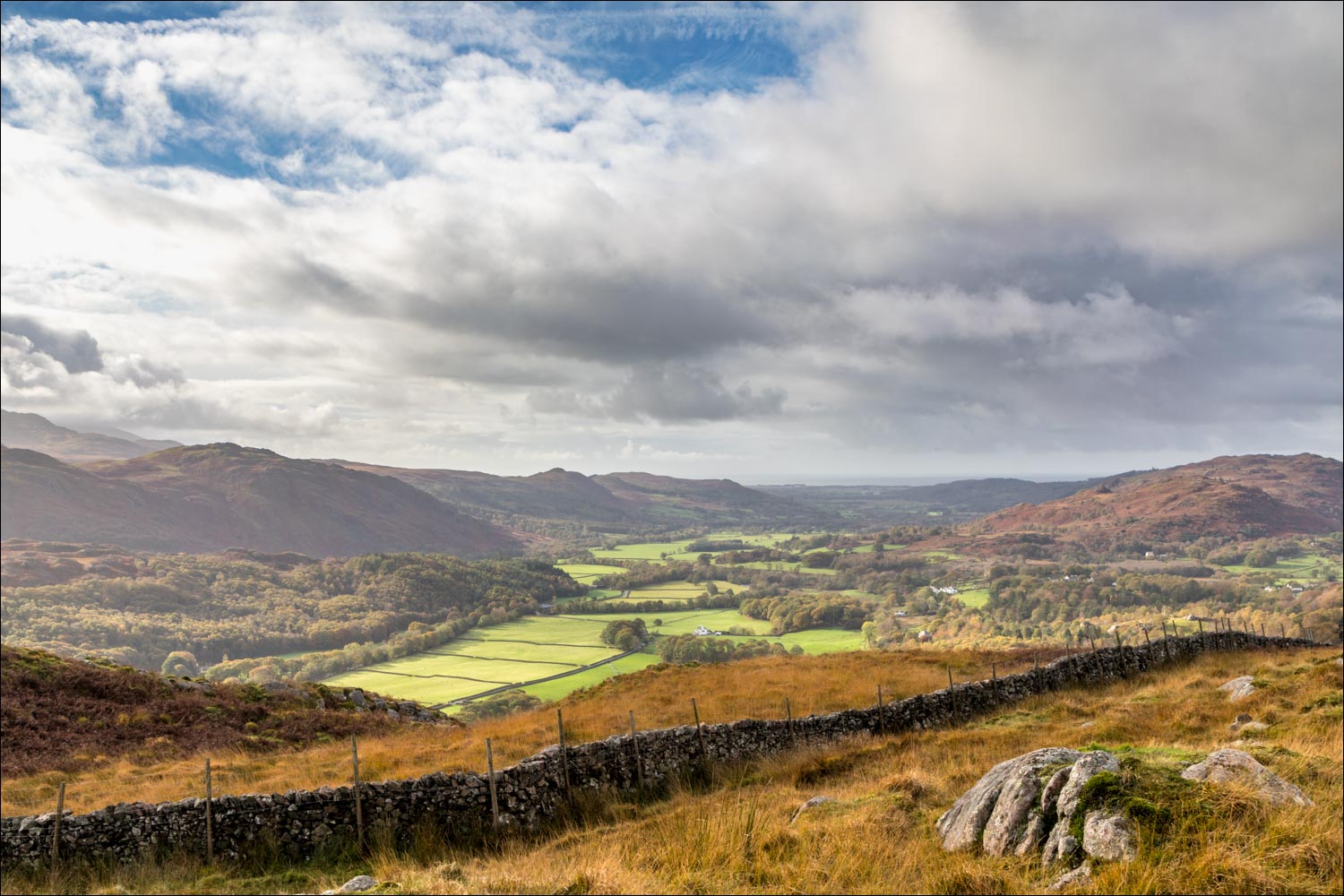
Looking down into the valley

The Irish Sea in the distance

I pass by a ruined barn

Late blooming heather

Looking back

My route will take me through Fisherground Farm, below left

Muncaster Fell seen as I start to descend into Eskdale

A view back up the path

Descending through the trees...


I cross the miniature railway line again as an inquisitive herdy looks on

Having passed through Fisherground Farm, I cross the road and walk across the field to the far side of Eskdale

I cross the wobbly suspension bridge over the River Esk

The return leg is along the valley floor with the river on the left

Low Wood...


After emerging from the wood I cross the bridge over the Esk and retrace my steps back to the start

La'al Ratty pulls out of Dalegarth Station as I reach the end of the walk

Another visit to Wast Water on the way home
