
Route: Holme Fell
Area: Southern Lake District
Date of walk: 10th October 2018
Walkers: Andrew and Gilly
Distance: 5.9 miles
Ascent: 1,100 feet
Weather: Sunshine and blue skies, very warm but also very hazy
Standing at 1,040 feet, Holme Fell ranks 213 out of 214 in the list of Wainwright fells, but it’s a rugged place with good views and set in the middle of some wonderful countryside, and is well worth a visit
It took us nearly 1.5 hours to drive from the north west to the south of the district, such is the complicated nature of the terrain between the two areas, and when we finally arrived we parked in the car park at Low Tilberthwaite, owned by the Lake District National Park Authority
We walked along the road for a few yards and after crossing Yewdale Beck we headed east into the woodland. This brought us to Holme Ground, signalling the start of the ascent of Holme Fell. It was easy going and before long we reached Ivy Crag, a prominent rocky area about 200 yards away from the main summit, which is slightly higher. Sadly the long distance views, which are normally extensive, could hardly be seen thanks to a thick haze. In view of this we didn’t bother to detour across to the main summit, but made our way down the fellside, aiming for a prominent tarn (which is a disused reservoir)
After passing by the tarn we arrived at the chasm which is Hodge Close Quarry, a former slate mine which is now a playground for intrepid abseilers and divers. The narrow road petered out here and we followed a track to Stang End, with some lovely views across Little Langdale. From here we started out on the return leg as we followed a path to ancient Slater Bridge (which we detoured to admire but didn’t cross). Leaving the bridge, we turned south and walked back up the valley to Tilberthwaite. It was a delightful walk, although a shame that the long distance views weren’t shown in their best light
For other walks here, visit my Find Walks page and enter the name in the ‘Search site’ box
Click on the icon below for the route map (subscribers to OS Maps can view detailed maps of the route, visualise it in aerial 3D, and download the GPX file. Non-subscribers will see a base map)

Scroll down – or click on any photo to enlarge it and you can then view as a slideshow

Before we set off for the South Lakes, I made a quick dawn visit to the head of Crummock Water...

Woodhouse Islands

Autumn in the garden...


...and a red squirrel

Later that morning, the start of the walk from Low Tilberthwaite

We follow a path through Low Coppice

We then follow the road to Hodge Close for a short distance

Looking back to the Coniston Fells

Holme Ground, where we start the ascent of Holme Fell

We leave the main path to take a fainter one up the fellside

Looking back down to Holme Ground, with Wetherlam beyond

Holme Fell (not the summit)

As we look back we realise that the long distance views are almost lost in the haze

The Langdale Pikes top right

Ivy Crag on Holme Fell

The highest point of the fell, which is only a couple of hundred yards away, but we decide to give it a miss

Coniston

The hazy views gave us no reason to linger, and so we started our descent, aiming for the tarn below

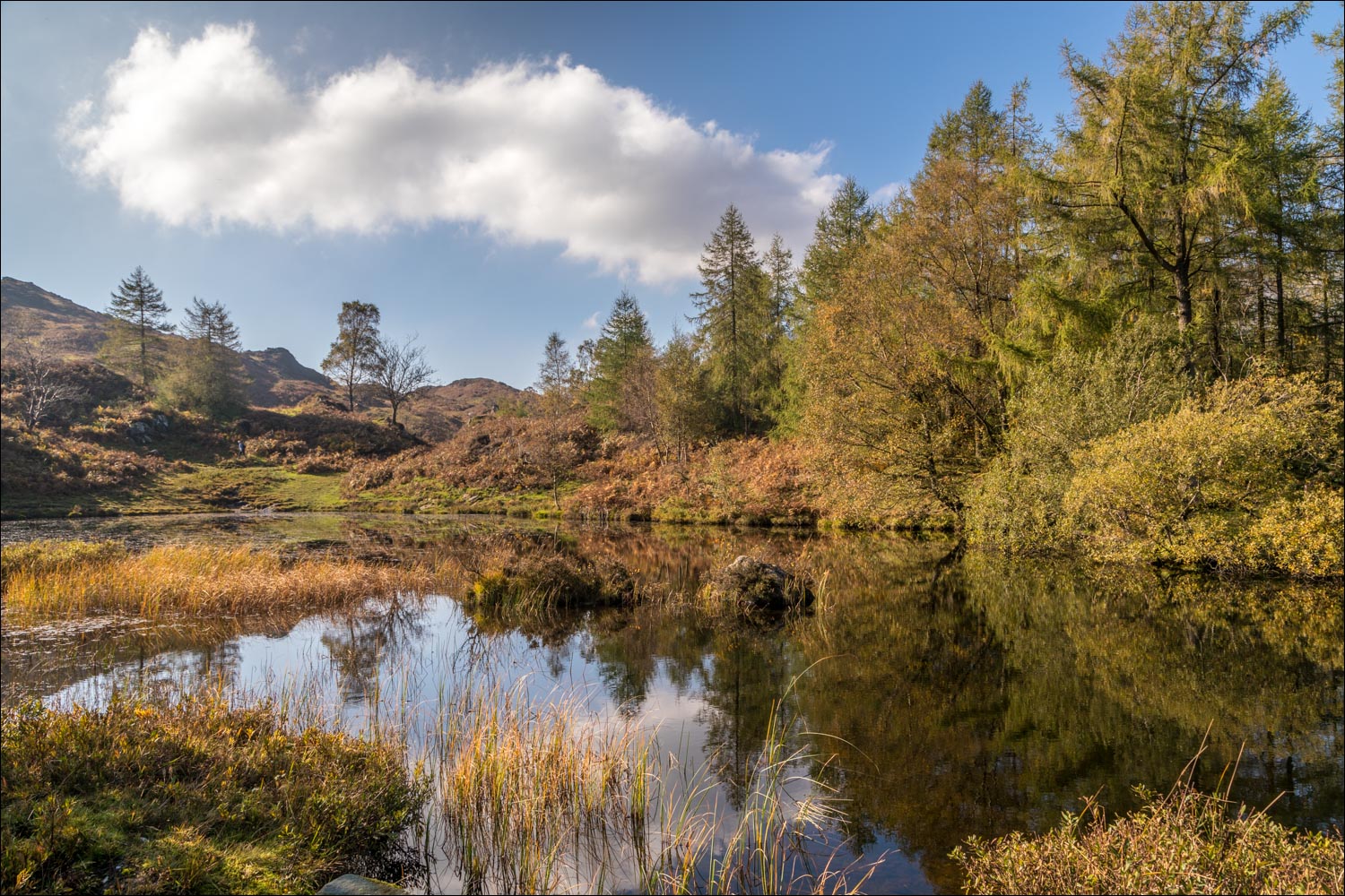
We arrive at the beautiful tarn, which is a disused reservoir

Path to Hodge Close

Hodge Close Quarry - 150 feet of sheer rock face, extending a further 150 feet below the surface of the water

Birch trees by the quarry

The road ends, but walkers can continue along the track...


More views of the quarry as we continue along the track,...


We pass by an attractive old cottage

Autumn colours in the woodland

Heading towards Little Langdale, with Lingmoor Fell in the background...


Bowfell in the distance...

...and again

Beyond Stang End now, we follow this path along Little Langdale


A short detour to see ancient Slater Bridge - we don't cross the bridge, and from here we turn south to head back up the valley

Looking back across Little Langdale from a faint path up the hillside

Pike o'Stickle and Loft Crag

We join an old mining track

Highland cattle

Further along the track

We arrive at High Tilberthwaite, and from here it's a short stroll back along the road to the end of the walk

The next day, - torrential rain, and several visits from the red squirrel we'd seen yesterday
