
Route: Eriskay
Area: Outer Hebrides
Date of walk: 7th September 2022
Walkers: Andrew and Gilly
Distance: 3.2 miles
Ascent: 300 feet
Weather: Sunny and warm with thin cloud
The island of Eriskay, population circa 130, has several claims to fame. The stunning white sands of Coilleag a’Phrionnsa are where Bonnie Prince Charlie landed to begin the great Jacobite Rising of 1745-46; in 1941 the S.S Politician ran aground here and its contents of 22,000 cases of malt whisky were plundered by the locals, inspiring Compton Mackenzie’s novel and the Whisky Galore film; the island is home to the rare Eriskay ponies, Scotland’s native horse and recognised as endangered; and the football pitch of Eriksay FC is credited by FIFA as one of “8 most remarkable places to play football in the world” for is quirky bumpy structure and its distracting views
The island can be approached via a causeway from South Uist, but we were staying in Barra so made use of the regular Calmac ferry service. Today’s walk started from the ferry terminal on Eriskay, so we were able to travel as foot passengers. The ferry ride lasted an enjoyable 40 minutes and along the way we had good sightings of seals and various seabirds
After disembarking we made our way to the adjacent ‘Bonnie Prince Charlie’s Beach’ and walked along its length, climbing up at the far end to follow a path up a grassy cliff. We continued around the headland and walked through the scattered village of Eriskay. We followed the road uphill out of the village, passing by The Statue of Our Lady of Fatima and shortly after this, at a stone bench, left the road to climb uphill. Occasional marker posts and a faint path were an aid to navigation as the terrain became rougher. Eventually we arrived at Loch Cracabhaig, which is the source of Eriskay’s fresh water. We traversed some very juicy ground and at a water treatment works joined a track which took us down to the road. From here it was a short stroll back to the ferry terminal and the end of a wonderful walk, which we enjoyed so much that we resolved to return for another walk tomorrow
Click on the icon below for the route map (subscribers to OS Maps can view detailed maps of the route, visualise it in aerial 3D, and download the GPX file. Non-subscribers will see a base map)

Scroll down – or click on any photo to enlarge it and you can then view as a slideshow

The Calmac ferry to Eriksay, which we board as foot passengers

A group of seals as the ferry sails past various islands

40 minutes later Eriskay comes into view

We disembark and walk directly onto the stunning beach

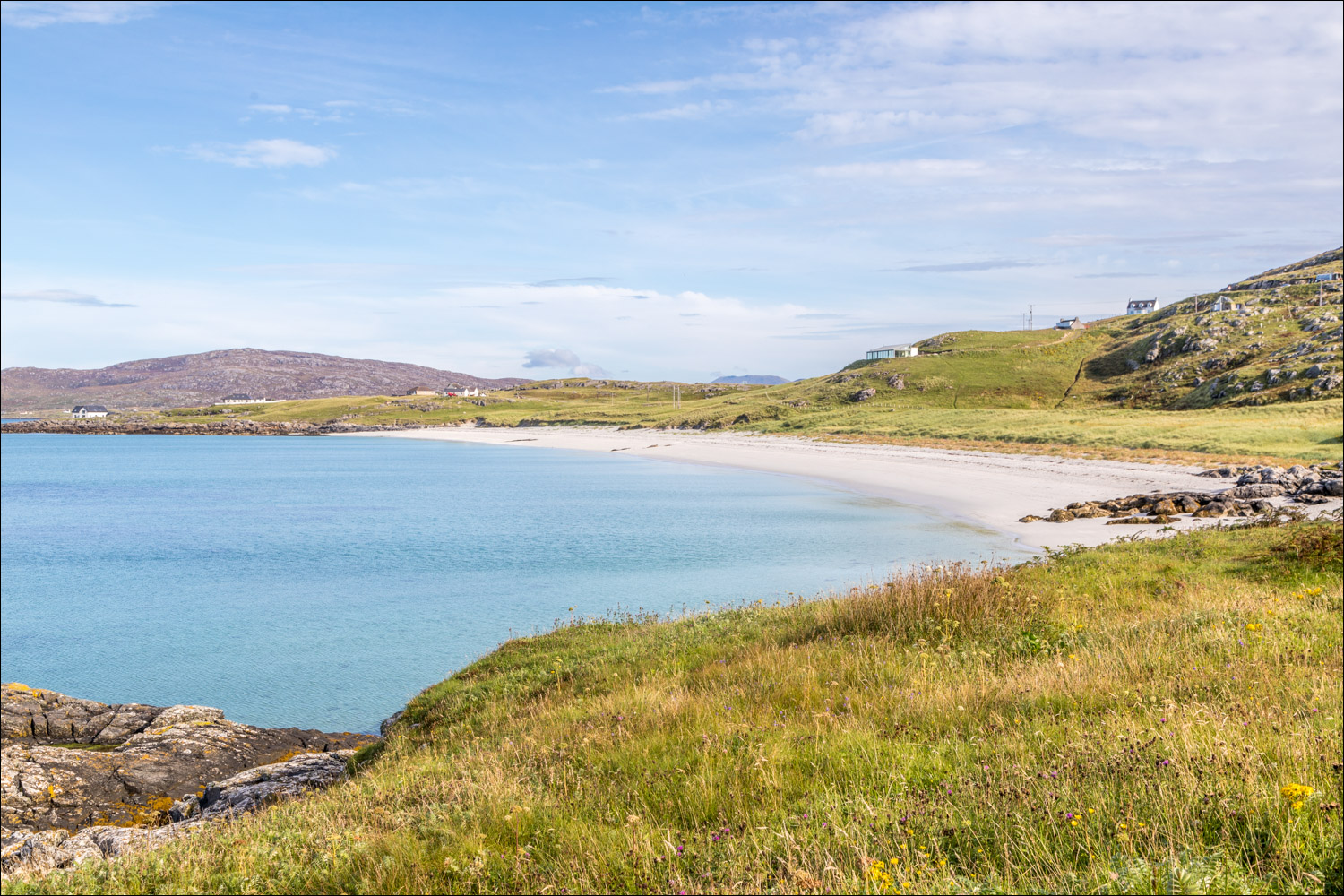
This is where Bonnie Prince Charlie first set foot on Scotland, and it is known as Coilleag a'Phrionnsa, Gaelic for the Prince's cockleshell strand

Looking back to the ferry

We walk to the far end of the beach

At the end of the beach we clamber up some rocks onto the coastal path

Looking back along the beach

We follow the path around the headland

Looking across to Barra

We head for the scattered township of Rubha Bàn

Looking out to sea

We join the road and pass by the local graveyard...


Traffic in Rubha Bàn

The only pub on the island, named after the ill-fated SS Politician

We follow the road uphill out of the village

We pass by the the Statue of Our Lady of Fatima

Looking back to Rubha Bàn

We leave the road just beyond the crest of the hill...

...a circular stone bench marks the spot

We follow a pathless course uphill, aided by occasional marker posts

Looking back to Rubha Bàn

The high point of the walk, looking east to Skye (I think) in the distance...


Loch Cracabhaig comes into view

A poor quality photo of some of the very rare Eriskay ponies, which are the last surviving remnants of the original native ponies of the Western Isles. They are under threat and are classified as critically endangered by the Rare Breed Survival Trust

Loch Cracabhaig

We descend from the loch with a view of Fuday ahead

Acairseid below

We join a track leading down to the road

We descend back to the start

Passing by the beach again

We've timed the walk well - our boat comes in

More seals seen from the ferry on the way back to Barra

We arrive back at the jetty on Barra

Later that day, a rainbow seen from our rented cottage at Northbay
Follow the link for more walks in Scotland (44)
