
Route: Acairseid, Eriskay
Area: Outer Hebrides
Date of walk: 8th September 2022
Walkers: Andrew and Gilly
Distance: 3.6 miles
Ascent: 300 feet
Weather: Sunny intervals
We enjoyed yesterday’s visit to the small island of Eriskay so much that we decided to return here for another walk. As we did yesterday, we caught the early morning Calmac ferry from Barra and 40 minutes later disembarked as foot passengers at the ferry terminal on Eriskay, the start of the walk
We headed up the road, passing by the beautiful white sands of Coilleag a’Phrionnsa where Bonnie Prince Charlie landed to begin the great Jacobite Rising of 1745-46. We turned right at a junction to head downhill and after a short distance turned right again onto a rougher road which climbed over a rise. Acairseid Mhor soon came into view, a deep inlet almost dividing the island and used as a sheltered harbour by the local fishing boats. We enjoyed a good sighting of several seals as we followed the narrow road around the head of the bay. Just before the last house in Acairseid we climbed a stile on the left side of the road, where there is a yellow marker post
We followed a rough and faint path across wet ground and passed Loch a’ Chapuill which was covered in waterlilies. Beyond the loch we followed the path to the coast to reach the destination of the walk, a small rocky cove. We’d heard that the cove is popular with otters and we lingered here for a while in the hope of a sighting, but were out of luck. All too soon it was time to be heading back in order to catch the ferry to Barra, so we retraced our steps back to the start of an excellent short walk
Click on the icon below for the route map (subscribers to OS Maps can view detailed maps of the route, visualise it in aerial 3D, and download the GPX file. Non-subscribers will see a base map)

Scroll down – or click on any photo to enlarge it and you can then view as a slideshow

After an enjoyable 40 minute ride aboard the Calmac Ferry we disembark at Eriskay Ferry Terminal...


The white sands of Coilleag a’Phrionnsa...

Yesterday's walk had taken us along the beach, but today we carrry on up the road...


We follow the sign for Acarsaid, or Acairseid

A pleasant stroll along the road...


We turn right along a track just around the corner

We follow the track to Acairseid

Looking back

We reach the deep inlet of Acairseid Mhor

Seals basking on the rocks below...


We follow the rough track around Acairseid Mhor

The scattered settlement of Acairseid

The Inner Hebrides in the far distance

The statue of a stag, which we mistook for the real thing at first glance

We continue around the shore of Acairseid Mhor…


On reaching the last house we cross this stile

A fishing boat leaves the small harbour....


Views out to sea, with the Inner Hebrides in the distance...


We pass by Loch a' Chapuill...


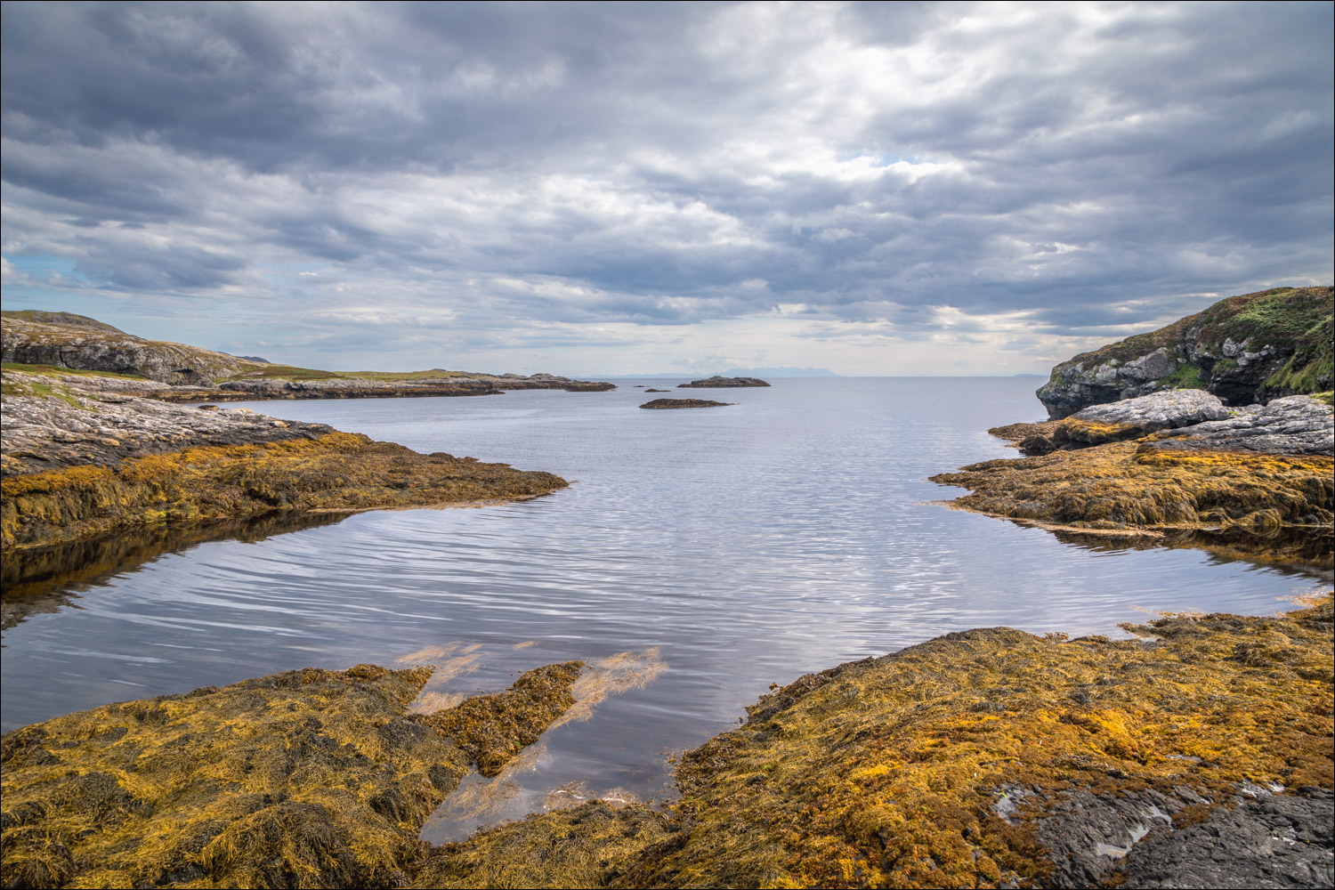
The far point of the walk. We spent some time here otter spotting, but without success

A final view out to sea. It's time to be heading back as we have a ferry to catch

Having retraced our steps we pass by Coilleag a’Phrionnsa again

We've timed it well - the Calmac ferry awaits and we sail back to Barra

Whales, basking sharks and dolphins may be spotted in the Sound of Barra. We had no sightings today, but the seals were lolling around in their usual place

A group of cormornants, or possibly shags

Later that day, sunset from our rented cottage in Northbay
Follow the link for more walks in Scotland (44)
