
Route: Eagle Crag and Sergeant’s Crag
Area: Central Lake District
Date of walk: 8th February 2013
Walkers: Andrew
Distance: 6.6 miles
Ascent: 1,800 feet
I parked at Stonethwaite and followed the path alongside Greenup Gill. Eagle Crag is a very imposing object on the approach. The first part of the climb up a steep grassy slope involved much turf clutching. The second part was completely different, as the summit of Eagle Crag (1,706 feet) is protected by sheer rock cliffs. There is a way through these, which involved climbing some steep gullies and crossing over exposed ledges. The task was made harder by the fact that many of the rocks were covered in sheet ice. It was a relief to reach the top. The microspikes were useful, as they have been several times this year.
From the summit it was an easy walk up to the next top Sergeant’s Crag (1,873 feet). The weather improved as the day went on and I had some fantastic views over Langstrath towards the Borrowdale fells and the Scafells. It was an easy descent down the slopes to Greenup Gill and the path leading back to Stonethwaite. Another memorable winter walk.
Click on the icon below for the route map (subscribers to OS Maps can view detailed maps of the route, visualise it in aerial 3D, and download the GPX file. Non-subscribers will see a base map)

Scroll down – or click on any photo to enlarge it and you can then view as a slideshow

First glimpse of Eagle Crag, from Stonethwaite Beck

Part of the Cumbrian Way, leading up Stonethwaite Beck

Further along the path

Looking back towards Stonethwaite

Crossing the Beck

The route goes off to the left, before turning right up the steep grassy slope

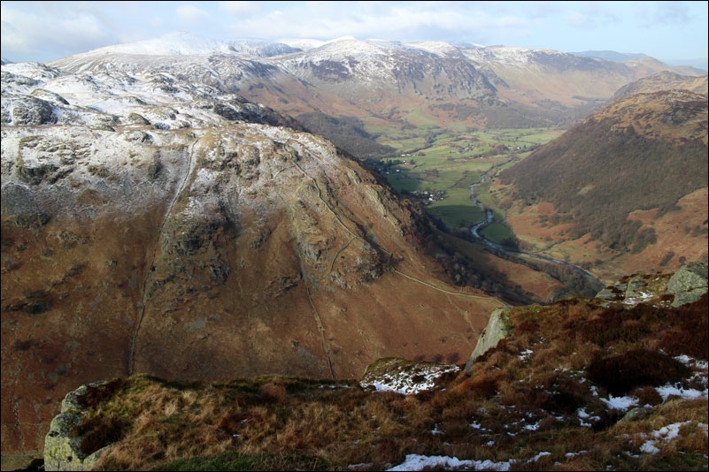
From the start of the ascent, looking back over Borrowdale

Looking back down the steep slope, still some distance to go

At the end of the grass section, a cliff is encountered, but a gully between the rocks provides access

Heading up the gully

Looking back over Borrowdale

It’s a case of finding a route between the rocky terraced cliffs that protect most sides of Eagle Crag

Icicles on the rocks, it was very slippery around here and I needed to take extra care

Looking back down one of the gullies

The summit at last, a few small rocks on top of a slab. Borrowdale Fells in the background

The weather improved as the day went on, and there were lovely views back over Borrowdale

Looking across Langstrath to the Borrowdale Fells

Further along Langstrath, Glaramara

The summit of Sergeant’s Crag, an easy ridge walk from Eagle Crag

Borrowdale Fells again, the pointed fell is Fleetwith Pike at the head of Buttermere

Looking back to Borrowdale from Sergeant’s Crag

Summit cairn of Sergeant’s Crag

Scafell Pike can be seen in the distance

The descent to Greenup Gill was pathless but easy

The upper reaches of Greenup Gill

Further along the path, approaching the point where I left it earlier to ascend Eagle Crag

A last look back to Eagle Crag
