
Route: Angletarn Pikes
Area: Far Eastern Lake District
Date of walk: 18th January 2020
Walkers: Andrew
Distance: 7.0 miles
Ascent: 1,900 feet
Weather: perfect
I’d intended to climb Angletarn Pikes yesterday, but the weather was dull so I walked round nearby Brothers Water instead – click here for that. Saving Angletarn Pikes for a day such as this proved to be a good decision – the photos will explain why
I parked in the small car park at the far end of the lovely unspoilt hamlet of Hartsop and headed uphill along a track past some sheep pens. I followed a stony track uphill beside Hayeswater Gill, which was easy going all the way. Just before Hayeswater I turned left to cross a footbridge over the gill where I joined a steeper grassy path, eventually gaining the ridge leading to Satura Crag. I kept a sharp lookout for red deer, as I’d seen a herd last time I was here. The Nab, which is nearby, is home to the oldest red deer herd in England – click here (and scroll down) for some close up photos taken on a previous walk up Beda Fell. I was out of luck today, but no matter as the weather was perfect and the surrounding fells were seen at their best
I soon arrived at Satura Crag, a rocky prominence from which there are some superb views and a couple of attractive unnamed tarns. I continued along the ridge and after a few minutes Angle Tarn then came into view, with my objective Angletarn Pikes beyond it. I followed the rocky undulating path past the tarn and its two small islands and then clambered up to the summit of Angletarn Pikes – the views from here were glorious. There are two pikes at the summit and I visited both of them today. The southern one has a good view of Angle Tarn, and Ullswater can be seen from the northern one, which is slightly higher. The Maps Page doesn’t record my exact track in the summit area, as I meandered around here for some time exploring the various nooks and crannies and different viewpoints. However navigation here isn’t difficult and it’s best to make your own way around depending on weather and time available
Having drunk my fill of the surrounding scenery I descended to Boredale Hause, enjoying ever improving views of Ullswater as I did so. On reaching the hause I turned south (left) to follow the path back to Hartsop. Part of this was the same path I trod yesterday – it’s a delight every step of the way. This was a wonderful end to a wonderful walk – one of the best
For other walks here, visit my Find Walks page and enter the name in the ‘Search site’ box
Click on the icon below for the route map (subscribers to OS Maps can view detailed maps of the route, visualise it in aerial 3D, and download the GPX file. Non-subscribers will see a base map)

Scroll down – or click on any photo to enlarge it and you can then view as a slideshow

Looking back over an old barn towards St Sunday Crag at the start of the walk

Another view back as I continue up the easy track beside Hayeswater Gill

Hayeswater Gill on my left

I leave the track just before Hayeswater, and cross the footbridge over the gill

Looking across to Fairfield and St Sunday Crag as I aim for the ridge leading to Angletarn Pikes


Having gained the ridge, I follow the easy path along it

Looking down to Brothers Water, the subject of yesterday's walk

I continue along the path, with Rest Dodd on my right

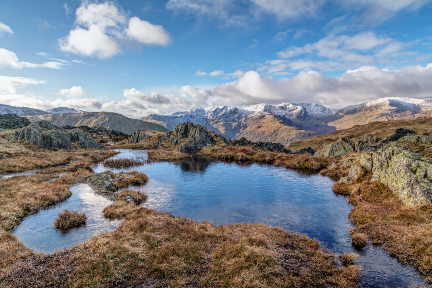
I climb up towars Satura Crag, one of the many highlights of the walk...


One of several unnamed tarns on Satura Crag, looking towards Fairfield and the eastern fells...


I continue over Satura Crag, following the line of this old dry stone wall...


Looking down into Dovedale - the white building between the wall gap is ancient Hartsop Hall

St Sunday Crag and Fairfield again

Looking back along the path towards Rest Dodd

Looking east into Bannerdale, home to the Martindale red deer


Another scenic highlight as Angle Tarn comes into view

Angle Tarn panorama - click to view

The two islands and the isthmus of Angle Tarn

I follow the path above the tarn to Angletarn Pikes ahead


Looking back to Angle Tarn as I climb towards the southerly of the two pikes

Brothers Water on my left as I make the steepish but not difficult climb to the top

Looking into Deepdale from the southern top of Angletarn Pikes

After a down and an up, a view of Ullswater from the northern pike

Start of the descent to Boredale Hause

Deepdale, with Hart Crag mid picture

Catstycam and Helvellyn as I continue to descend

Brothers Water below

I arrive at Boredale Hause, an important crossroads in these parts

I turn left at the hause to head back towards Hartsop

Glenridding and Ullswater on my right

Goldrill Beck and Deepdale

Deepdale again, and here I join the path along Patterdale which I'd followed on yesterday's walk

Looking back along the path

Waterfall in Angletarn Beck - the beck flows out of Angle Tarn, which featured earlier

Hartsop and Hartsop Dodd ahead, and the end of a wonderful walk
