
Route: Brackenthwaite Hows
Area: Western Lake District
Date of walk: 24th July 2019
Walkers: Andrew
Distance: 3.0 miles
Ascent: 400 feet
Weather: Sunny spells, windy and warm
Brackenthwaite Hows, known locally as Lanthwaite Hill, is one of my favourite places in the Lake District. This walk has featured on my site many times, but I take the view that no two walks are ever the same – changing seasons and variations in the light and weather make for an infinite number of possibilities – and there’s always something new to be seen. Since I was here last time, ownership of the hill has been acquired by the National Trust, which is good news in that its future is assured, but I do hope that the Trust respects the tranquil and unspoilt nature of the surroundings and doesn’t seek to commercialise it in any way
I parked as usual in the National Trust car park at Scale Hill. Instead of taking the obvious track ahead, which leads directly to the north shore of Crummock Water, I turned sharp left up a path through Lanthwaite Wood. At a junction I turned left again to continue uphill, climbing a steep rocky staircase along the way
After leaving the woods via a deer gate I was soon at the top of the hill, admiring the superb views in all directions over Lorton Vale, Loweswater, Crummock Water and towards the Western Fells. The light was good and I lingered here for a while as the clouds scudded across the sky, and admired patches of sunshine illuminate the surrounding fells. On the way down I stood by to let a huge group of walkers pass by – some 30 or 40 – all chattering away loudly and seemingly oblivious to the quiet beauty of their surroundings. I’ve never seen such a large group before and hope that this is a one off and is unconnected with the change of ownership of the hill
I then followed the easy path back down into Lanthwaite Wood, following a path which hugs the edge of the woods, giving good views across to Lanthwaite Green
The path descends to the eastern shore of Crummock Water, and from here I followed the path to the foot of the lake. The busload of walkers were occupying the whole of the stony beach, so I passed by quickly and made a short diversion (not shown on the Maps Page) as far as the Pump House further around the lake. From here I retraced my steps to the foot of the lake, where there are two choices – a path which follows the bank of the River Cocker, or the wide track leading through Lanthwaite Wood. I opted for the riverbank path today, and 5 minutes later was back to the car park to end a short but very sweet walk
For other walks here, visit my Find Walks page and enter the name in the ‘Search site’ box
Click on the icon below for the route map (subscribers to OS Maps can view detailed maps of the route, visualise it in aerial 3D, and download the GPX file. Non-subscribers will see a base map)

Scroll down – or click on any photo to enlarge it and you can then view as a slideshow

The night before the walk, clouds gradually engulfing Lorton Vale like a tidal wave as a thunderstorm passes over

Next morning, the start of the walk from nearby Scalehill car park, here looking over the River Cocker to Mellbreak

I ignore the obvious path through Lanthwaite Wood to the foot of Crummock Water, and turn sharp left uphill

Bonnie leads the way up a short, steep and rocky climb to the top of Brackenthwaite Hows

I leave Lanthwaite wood via the deer gate to enter onto Lanthwaite Hill

A narrow path between the trees leads to the hilltop

Looking back to another of my favourite places - the south top of Low Fell

The Loweswater Pheasant, Holme Wood, is well seen from here - can you spot it?

Sweet Lorton Vale from Brackenthwaite Hows

A short stroll to the top in the direction of Mellbreak and the Loweswater Fells

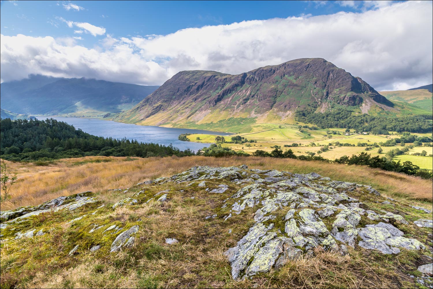
Views that I could never tire of - Crummock Water and Mellbreak from Brackenthwaite Hows...

...Loweswater

Zooming in to Loweswater village

Lanthwaite Green at the foot of Grasmoor

Lanthwaite Wood below Crummock Water and the knobbly outline of Rannerdale Knotts beyond it

Bonnie surveys her kingdom

The path descends gently into Lanthwaite Wood

I re-enter the wood via the deer gate below

Path to Lanthwaite Green, which I ignore, tempting though it is

I carry on around the edge of Lanthwaite Wood, with tantalising glimpses of the scenery on my left...


Lanthwaite Green

The path changes direction to descend to the shore of Crummock Water

The Boat House at the shore of Crummock Water

Looking across the lake to the foot of Mellbreak

A well placed bench on the stony beach by the Boat House

Low Fell beyond the Boat House

I follow the lakeshore path to the foot of the lake, here looking across to Mellbreak


The crowd scene mentioned in the introduction made it impossible to pause at the foot of Crummock Water, so I continued around the lakeshore path

Looking along Park Beck

The foot of Mellbreak...


Looking back to Low Fell...

...and now looking across the lake to the Boat House, where I'd been a few minutes ago

The High Stile Range beyond the head of Crummock Water

A final look along the lake before I retrace my steps to its foot

From the foot of Crummock Water I follow a narrow path beside the River Cocker (the wider track through Lanthwaite Wood is a shorter but slightly less interesting alternative)

Mellbreak on the far side of the river at the end of another wonderful visit to this place

Later that day, a young red squirrel in the garden
