
Route: Bessyboot, Rosthwaite Fell
Area: Southern Lake District
Date of walk: 6th June 2019
Walkers: Andrew
Distance: 6.5 miles
Ascent: 1,600 feet
Weather: mixed sunshine and clouds
It’s been over 5 years since I was last up Bessyboot, and on that occasion the weather was mixed, to put it mildly, with rain, sleet, hailstorms, gale force wind, along with a few brighter spells. We experienced a white out on the summit, and there were no views whatsoever. Conditions were much better today, and hopefully I’d be able to see a little more of the surroundings
Rosthwaite Fell is divided into two sections, divided by Tarn at Leaves. The highest point of the northern half is known as Bessyboot, and is treated by Alfred Wainwright as the summit of the fell, even though the southern half is higher. Anyone climbing all the 214 lakeland fells as described by Wainwright in his Pictorial Guides is entitled to tick off Rosthwaite Fell on reaching Bessyboot
I parked as before in the National Trust car park at Seatoller and walked out of the village along the Keswick road, leaving it near Strands Bridge. I followed a path towards the foot of the fell, and crossed the old stone packhorse bridge over Combe Gill. The climbing started immediately beyond the bridge as I followed a signed path uphill, with the gill on my right. The path gradually became fainter, and further up disappeared altogether. It’s a feature of this walk that above valley level the paths are very unclear, and frequently peter out. Despite this there were no difficulties. I knew my general direction of travel and made sure that I kept Rottenstone Gill on my right. Eventually I arrived at Tarn at Leaves, a lovely spot below the summit
A faint path leads from the north end of the tarn up to the summit cairn on the most prominent of nearby rocky humps. The views from here were superb. I was glad to have returned to this place to see what I’d missed last time. I decided to follow the same descent route as I’d done on that occasion, initially following the line of Tansey Gill, and then the line of a dry stone wall. I first read about this route in Bob Allen’s excellent ‘Short Walks in the Lake District’, in which no mention is made of the gradient. If it weren’t for that, and the fact that I’ve descended this way before, I’d have entertained doubts about proceeding. The route is completely pathless, and whilst there is no threat to life, there is a threat to limb – full concentration is needed during what I found to be a very steep and rather unpleasant way down
It was a relief to finally arrive back on the valley floor, where I joined the lovely path along Langstrath which leads to the hamlet of Stonethwaite. Just beyond the village I joined a path which brought me back to the Keswick road, and from here I retraced my steps back to the start
For other walks here, visit my Find Walks page and enter the name in the ‘Search site’ box
Click on the icon below for the route map (subscribers to OS Maps can view detailed maps of the route, visualise it in aerial 3D, and download the GPX file. Non-subscribers will see a base map)

Scroll down – or click on any photo to enlarge it and you can then view as a slideshow

The start of today's walk from Seatoller

I leave the village and follow the road to Keswick for a short distance

I continue past the cottages of Mountain View and leave the road just beyond them...

...here

The old packhorse bridge over Combe Beck

Immediately after crossing the bridge I climb up the stony path on the left

Old Mill Cottage below

I follow a faint path uphill

The path then branches off to the right to follow the lower slopes of Rosthwaite Fell

Looking back to the Jaws of Borrowdale - Castle Crag left and King's How right

A triangle of the buildings I'd passed so far - Seatoller top left, Mountain View cottages right and Old Mill Cottage below


Glaramara

Borrowdale, and a glimpse of Derwent Water in the distance

The path gradually peters out as the route turns towards Bessyboot

Glaramara again

The pointed outline of Fleetwith Pike top left, and Seatoller below on the right

I reach Tarn at Leaves, here looking back on the way up to nearby Bessyboot

The rocky summit of Bessyboot ahead

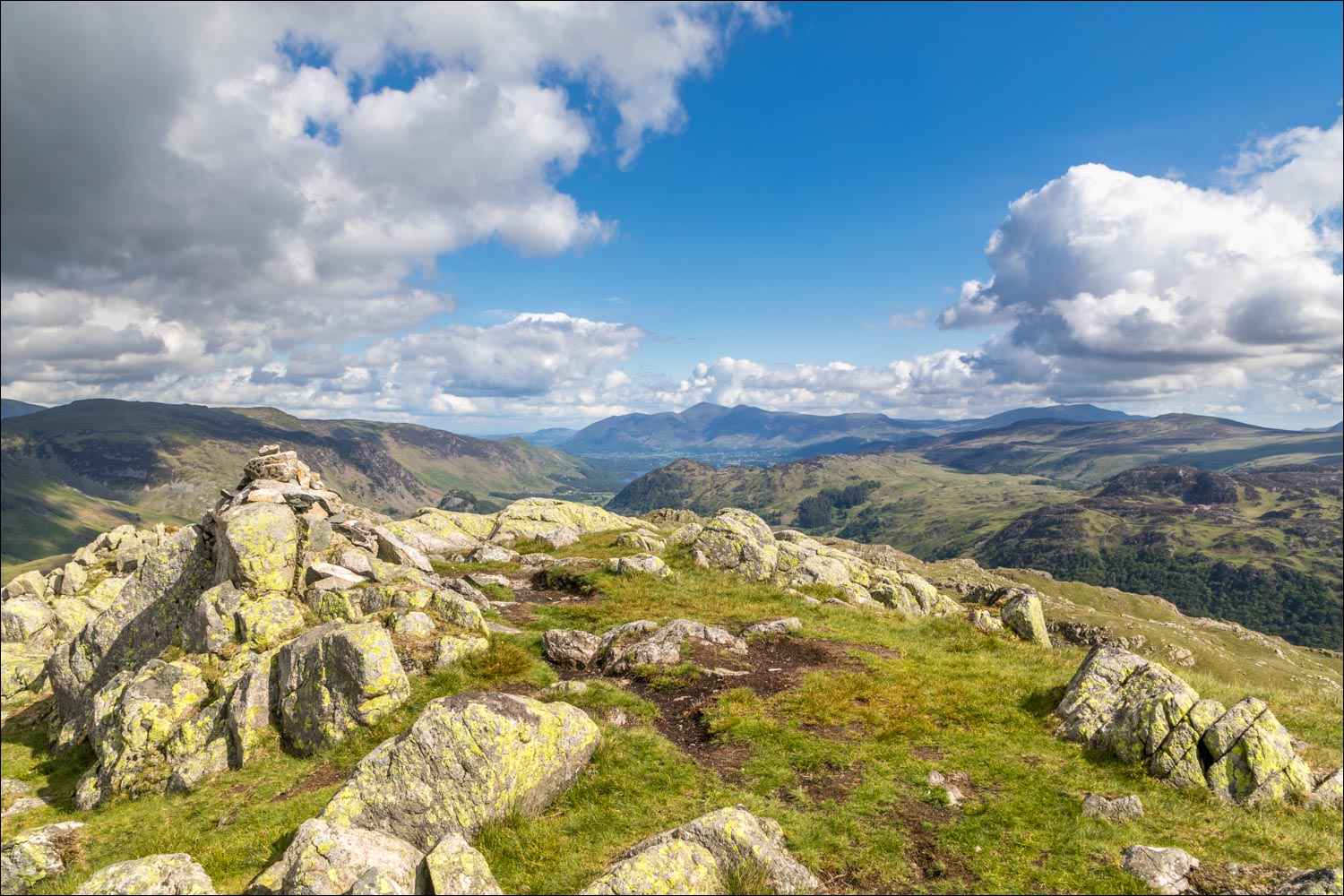
Summit cairn on Bessyboot

The view towards Derwent Water and Skiddaw, somewhat restricted by Grange Fell but lovely all the same...

...and now looking back to Rosthwaite Cam and Glaramara, with the pointed outline of Pike o'Stickle in the distance on the left

I retrace my steps down to Tarn at Leaves, here looking back to Bessyboot

After following a faint path past the tarn I start the long and very steep descent into Langstrath

The key to the initial section is locating this dry stone wall, and then following it as it traverses the fellside

Looking towards Stake Pass at the head of Langstrath

The start of the very steep pathless descent down to the valley

Lower down, a path finally appears

Looking along Langstrath and its beck...

...but my route lies the other way, and I'll turn left on reaching the valley floor

I pass through a flock of herdies

Langstrath Beck

Looking back up my descent route, which was much steeper than appears from this photo

Stonethwaite Fell

Langstrath Beck

The beck merges with Greenup Gill to become Stonethwaite Beck


I pass by Tilly's Barn

Farewell to Stonethwaite Beck, which continues into Borrowdale to join the River Derwent

I pass through the hamlet of Stonethwaite

A short road section

St Andrew's Church

Just beyond the church I join a path leading to the Keswick road...


After arriving back at the road I retrace my steps back into Seatoller
