
Route: Swineside Knott
Area: Eastern Lake District
Date of walk: 8th March 2019
Walkers: Andrew
Distance: 5.6 miles
Ascent: 1,500 feet
Weather: Grey but dry at first, deteriorating to snow and sleet on the tops and rain lower down
Swineside Knott is the highest point on Watermillock Common at a respectable height of 1,814 feet. It doesn’t qualify as a Wainwright fell as it’s merely part of the eastern ridge of Stybarrow Dodd. I was last here almost exactly 3 years ago, and although the weather conditions then were appalling I’d seen enough to know that the views of Ullswater from here are superb
I planned a different route today, and parked in the National Trust car park at Park Brow, near Aira Force. I crossed the road following a sign for Glencoyne Head to start the ascent, which was so gentle in the early stages that it was hardly noticeable. This is one of the best paths for viewing Ullswater, but the weather was rather dull and grey and the lake wasn’t seen in its best light today
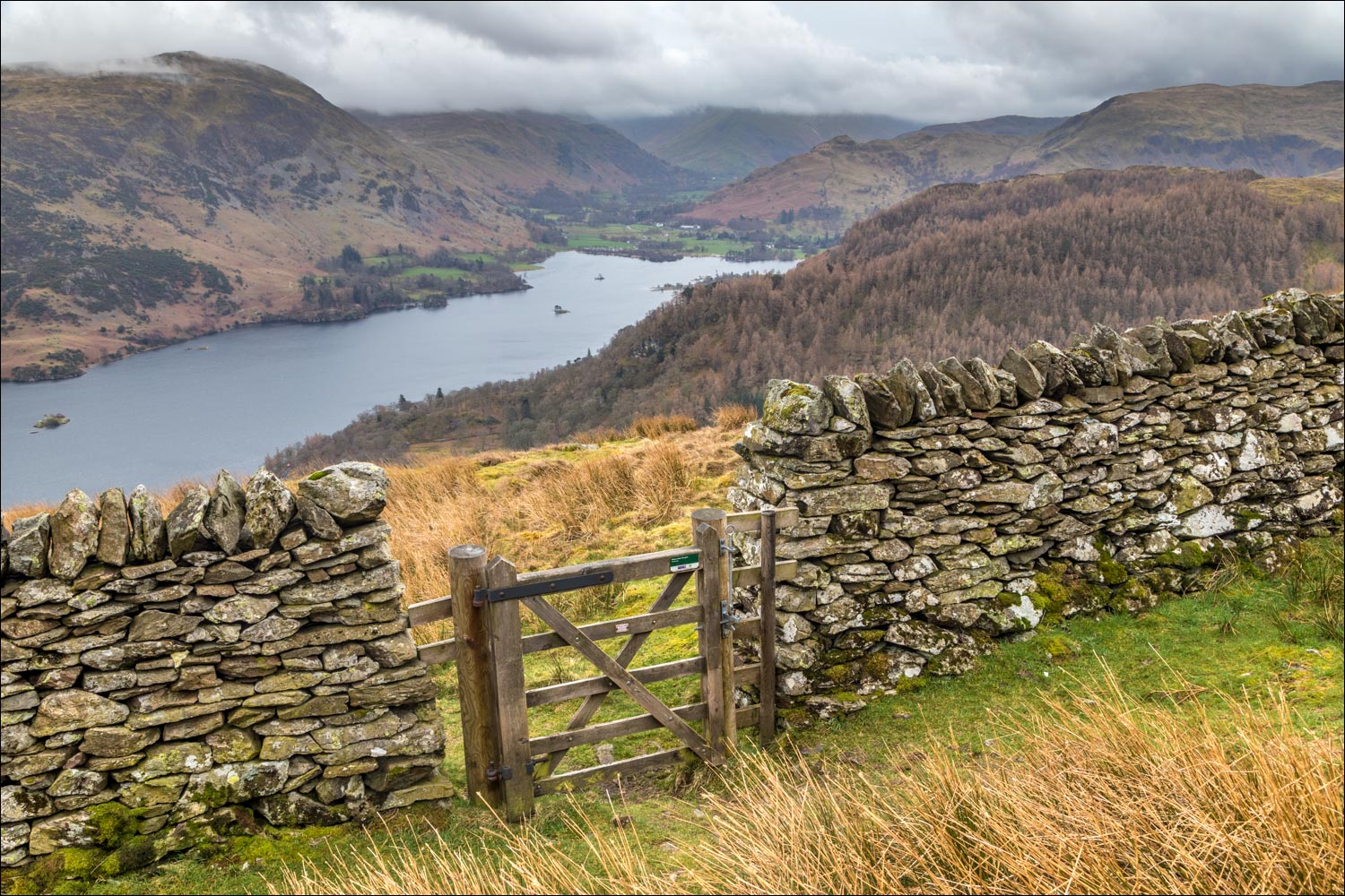
Eventually I arrived at a dry stone wall and a gate, which marked a change of direction. I followed the dry stone wall below Swineside Knott for a short distance, and just before a depression turned left to follow a short pathless course to the top of the fell, where the summit is marked by a small pile of stones
I then headed along the ridge to Watermillock Common and Common Fell, both of which are slightly lower than Swinside Knott. By now the weather had closed in – the views were restricted, and showers of snow and sleet were driving in, borne by a strong cold wind. It was a bleak and uninspiring section of the walk, sometimes pathless, and I was glad to arrive in the small village of Dockray
I crossed the road bridge over Aira Beck and immediately turned right to follow a signposted path to Aira Force. I followed the path beside the beck, where the upper falls were on good form. It was raining quite heavily by now, and each time I replaced the lens cap on the camera, the lens steamed up – and so did I. As a result there aren’t many photos of the falls and the woodland, nor did I bother to visit Aira Force itself, having been here many times before. Just before the main falls I crossed Aira Beck via a small bridge and, after following the beck for a short distance, made my way back up to the car park
I’d like to repeat this walk in better weather, as the photos which follow don’t really do it justice
For other walks here, visit my Find Walks page and enter the name in the ‘Search site’ box
Click on the icon below for the route map (subscribers to OS Maps can view detailed maps of the route, visualise it in aerial 3D, and download the GPX file. Non-subscribers will see a base map)

Scroll down – or click on any photo to enlarge it and you can then view as a slideshow

The start of the walk from Park Brow near Aira Force

Time to lace up a new pair of walking boots, bought from award winning Keswick Boot Co - I wonder where they'll take me this year?

After crossing the road I follow the sign for Glencoyne Head

Sheffield Pike and Birkhouse Moor in the distance

Glencoyne Park below, and the first of many wonderful views to the head of Ullswater - I was hoping for some better light, but it never came

Swineside Knott ahead, right of picture

A wooded area in Groove Gill

Looking towards the foot of Ullswater

Herdies above Ullswater

Looking back along the path, with Gowbarrow Fell in the mid distance

Head of Ullswater...

...and now looking back to the foot of the lake

I pass through a small copse of ancient beech trees

Ullswater again

One of the Ullswater Steamers plying its trade below

Glencoyne Park

Sheffield Pike and Birkhouse Moor

More views of Ullswater as I continue to gain height...


Sheffield Pike again

The start of the return leg, having passed through this gate just below Swineside Knott...


Looking back along the path before I turn off and make the pathless climb up to Swineside Knott

Head of Ullswater from Swineside Knott

A bleak scene looking towards the Helvellyn fells

The summit of Swineside Knott, looking towards the foot of Ullswater

Snow and sleet sweep in, so I don't linger here

I follow a sometimes pathless route across Watermillock Common towards Common Fell

Summit cairn on Common Fell, just a few feet lower than Swineside Knott

An erratic boulder - transported here by glacier movement and so called because if differs from the local geology

I continue down the featureless slopes of Watermillock Common, with Little Mell Fell in the distance

Looking across to Dowthwaite

Dockray below - a welcome sight as the snow and sleet have turned into rain lower down

I fork left for Dockray...


I follow this track to the road, then turn left and cross the road bridge over Aira Beck

Beyond the bridge I follow the sign for Aira Force

Place Fell and a glimpse of Ullswater as I enter the woodland beside Aira Beck

Some of the waterfalls as I descended beside the beck...


It was pouring with rain by now, and the camera had to be put away

A final photo back down the path before I arrive back at Park Brow
