
Route: Rabacal Valley via the Levada da Ribiera da Janela
Area: Madeira
Date of walk: 27th April 2022
Walkers: Andrew and Gilly
Distance: 6.4 miles
Ascent: negligible
Weather: Sunny
Today’s walk took advantage of the ancient levada system of water channels in Madeira, created hundreds of years ago in order to divert water from the lush laurisilva rainforest to the drier agricultural areas lower down. These channels are remarkable feats of engineering and required enormous effort and ingenuity. The terrain is remote and dangerous and the original builders somehow created these channels out of bare rock, with huge drops below, maintaining a steady gradient all the while. Taking today’s walk as an example, we walked 6.4 miles (there and back), yet only ascended a few feet. Although we were walking at high altitude, some 4,500 feet, the gradient of this walk was almost level. On the outward leg of the walk we could only tell that we were ascending because the water was gently flowing the other way
We started the walk from a picnic area beneath Lamaceiros, where there is ample parking. A sign warned us that the first tunnel, some 3 miles into the walk, was closed but this was of no concern as we could simply retrace our steps on reaching it. This is a ‘there and back’ walk no matter how far you go
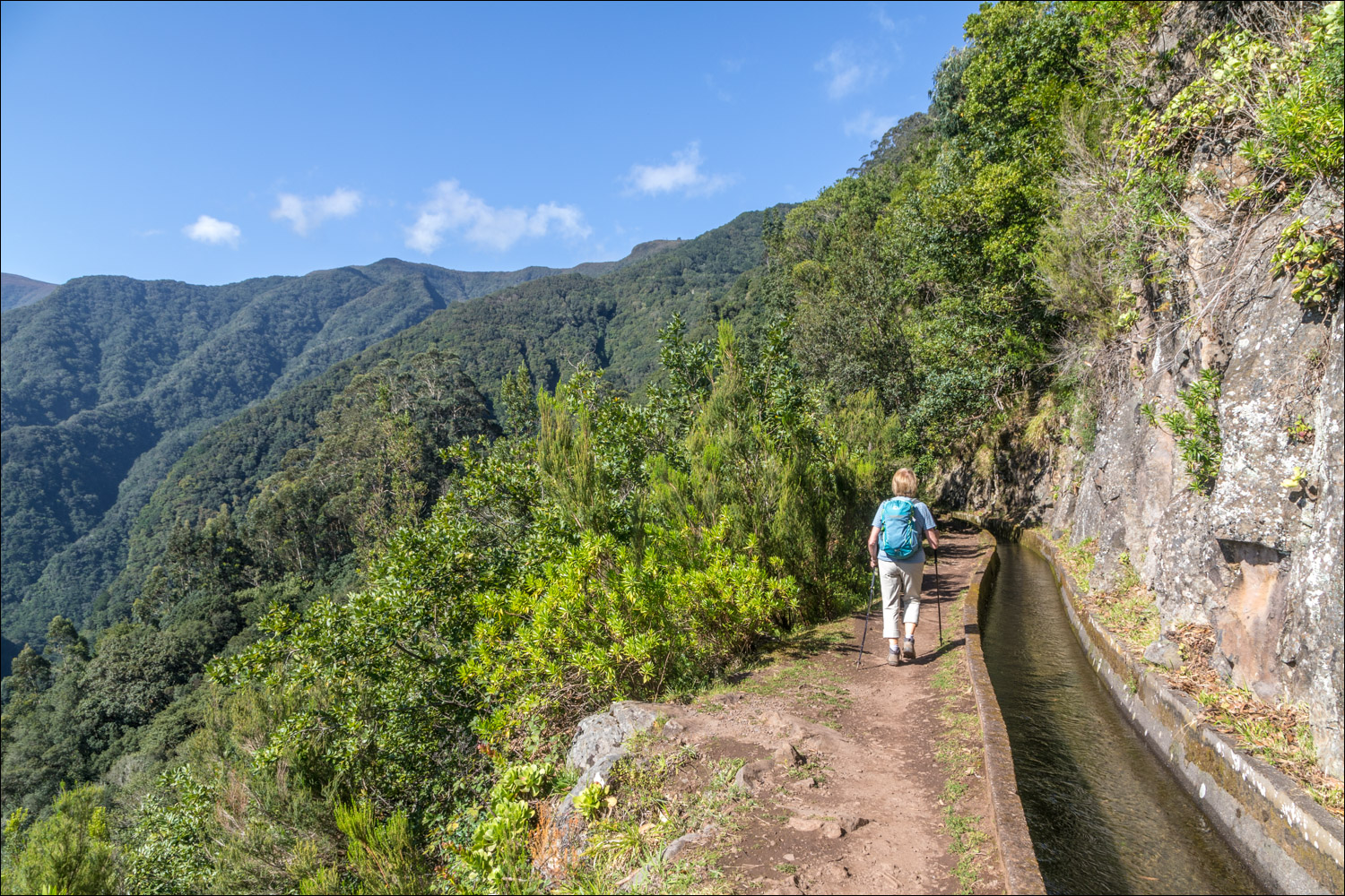
From the car park we joined the Levada da Ribeira da Janela almost immediately. From here no navigation skills are needed – just follow the course of the levada as it weaves its way around the gorge and deeper into the remote Rabacal valley. It’s impossible to get lost. The path is narrow, with the levada (about 3 feet wide and deep) on one side and huge drops on the other for much of the way. While there is some sense of exposure, the path is well protected by a fence for much of the way and there are no real dangers
As we walked further into the valley, the terrain became more dramatic, resembling a jungle at times. After about 3 miles we arrived at the tunnel. This is normally part of the itinerary, and we’d brought head torches in case it was open, but in view of the closure signs at the start, and at the entrance to the tunnel, we were quite content to end the walk here and retrace our steps (despite a group of walkers advising us that the tunnel was in fact open and that they were intending to walk through it)
It had been a memorable walk in unique surroundings
Click on the icon below for the route map
![]()
Scroll down – or click on any photo to enlarge it and you can then view as a slideshow

The start of today's walk as we pass by this information board near our parking space

This sign warns us the the levada is closed further ahead, due to tunnel repairs. We'd anticipated this so it wasn't an issue, we'd still have a six mile there and back walk

The Levada da Ribeira da Janela, which we'll follow for the entire journey

Looking across the Rabacal Valley to Ribeira da Janela

The Levada da Ribeira da Janela is wider and deeper than most

Views across the Rabacal Valley through the eucalyptus trees


Further along the levada...


Big drops into the Rabacal Valley on our left

Ferns and mosses on the rockface by the levada

It's a thrilling walk, with many enticing corners

The Rabacal Valley in all its glory - the laurisilva forest is a UNESCO world heritage site.

After 5km the levada disappears into a rock face and we realise that the first tunnel is just ahead


The first rock tunnel. The sign reads 'Perigo' which means 'Danger'. Earlier signs had advised us that the levada is closed beyond this point so we were content to retrace our steps. This is a 'there and back' walk even when the tunnel is open

We can enjoy the wonderful scenery for a second time...


Eucalyptus trees

Ribeira da Janela comes into view again....


Agapanthus lining the Levada da Ribeira da Janela as we reach the end of the walk
Follow the link for more walks in Madeira (17)
