
Route: North Cliffe Wood
Area: East Yorkshire
Date of walk: 4th May 2022
Walkers: Andrew and Gilly
Distance: 2.5 miles
Ascent: none
Weather: Bright, with a couple of showers
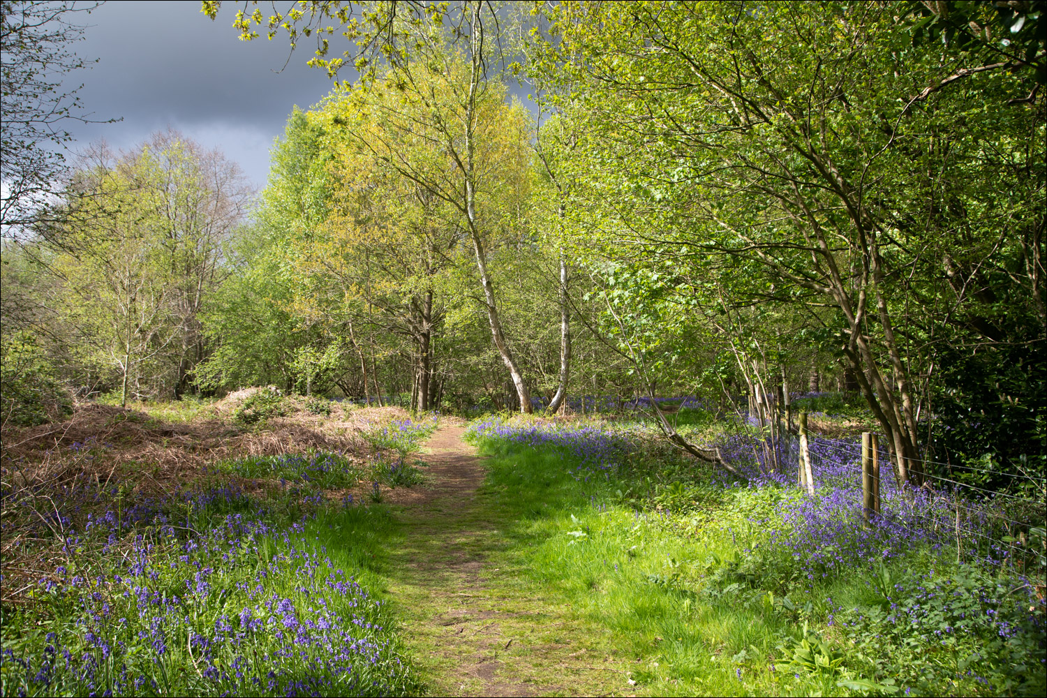
North Cliffe Wood Nature Reserve is managed by the Yorkshire Wildlife Trust and is well worth a visit at any time of year, but especially so in late April/early May when there are carpets of bluebells throughout the woods
There are a few roadside parking spaces along Sand Lane by the two entrances to the wood and we parked in one of these. On entering the wood we followed the track along its eastern edge. Within a couple of minutes we were greeted by the wonderful sight – and scent – of countless bluebells. The sight was enhanced by occasional patches of stitchwort and primrose, and a host of warblers provided background musical accompaniment
We walked around the perimeter of the wood, and also a small area of heathland where grass snakes may regularly be seen basking in the summer months
We then re-entered the wood, following a path around the edge until we arrived back at the start
The route on the Maps Page is taken from a previous visit. I took a slightly longer route today, but a route map isn’t really needed in this place – it’s best to wander around the waymarked paths as your fancy takes you
There seems to be an increasing issue these days with visitors to bluebell woods leaving the main paths and walking over the plants, perhaps in order to get a better photo. Once the plants are damaged by trampling they can’t photosynthesise enough energy and it can take them years to recover. Could I please ask anyone following this walk (or indeed any walk through a bluebell wood) to keep to the main paths and avoid contact with the plants. I hasten to add that no bluebells were harmed while taking the photos which follow…
For other walks here, visit my Find Walks page and enter the name in the ‘Search site’ box
Click on the icon below for the route map (subscribers to OS Maps can view detailed maps of the route, visualise it in aerial 3D, and download the GPX file. Non-subscribers will see a base map)

Scroll down – or click on any photo to enlarge it and you can then view as a slideshow

The entrance to North Cliffe Wood. We're in luck and our timing is right...

The bluebells are in full flower and the light is good

Captions aren't necessary, this is an easy walk with no risk of getting lost


A stately oak tree

The woodland is predominantly birch


A short heathland section

Back in the woods


Th end of another visit to this special place
Follow the link for more walks in East Yorkshire (117)
