
Route: Nether Wasdale
Area: Southern Lake District
Date of walk: 10th May 2019
Walkers: Andrew
Distance: 6.6 miles
Ascent: 500 feet
Weather: A few bright patches, gradually clouding. Some light rain from time to time
It’s been over a year since my previous walk in Nether Wasdale which is a year too long, as some of the country’s finest landscape is to be found in these parts. I parked in a small car park by Cinderdale Bridge, at a triangle of roads just beyond the village of Nether Wasdale. After turning right out of the car park I crossed the River Irt, and then joined the delightful track leading to Easthwaite, located in a dramatic position below The Screes. After passing around the farm I headed towards the foot of Wastwater. Before entering Low Wood I made a short there and back diversion to the foot of the lake to admire the wonderful view
After retracing my steps I crossed Lund Bridge and entered into Low Wood. The wood is renowned for its wonderful display of bluebells and I was looking forward to this section of the walk. Last time I was here, in late April, the bulbs weren’t in flower. Today the flowering was over. I was about a week too late – let’s hope it’s 3rd time lucky next year
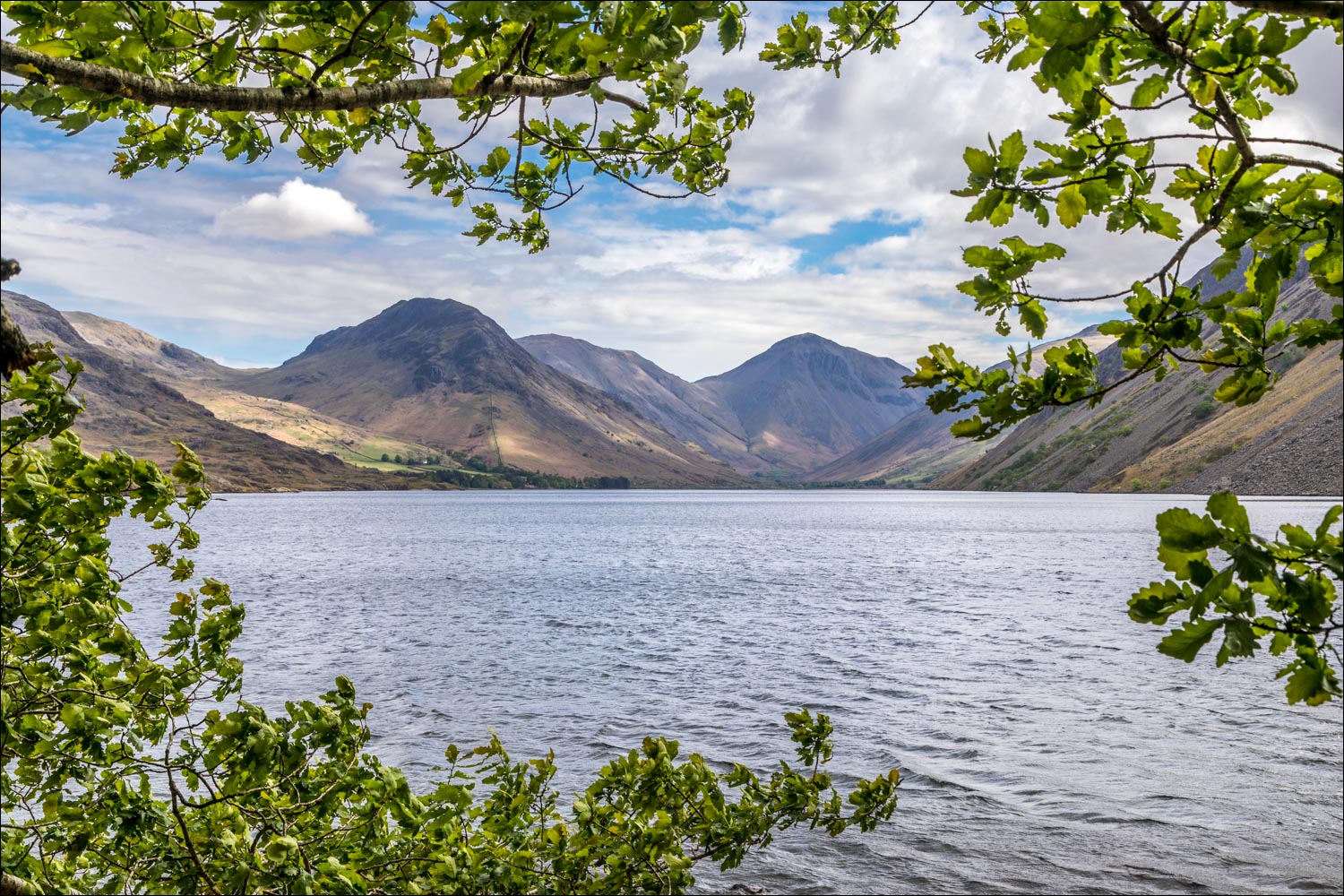
I wasn’t too disappointed though as I knew that there would be other sights to enjoy. I followed the path along the shore of Wast Water, with an ever improving view to Wasdale Head, one which has been voted as the UK’s favourite view in previous years. I continued along the shore as far as the Landing Stage shown on the OS map and then joined the quiet road leading to Greendale. Just beyond Greendale I turned off the road and joined a path through Roan Wood, which took me out onto open countryside
Beyond Ashness How there are 3 possible routes back to the start, one of which – via Scale Bridge and Mill Place – avoids the road entirely. However I’ve not seen Woodhow Tarn before and wanted to visit it, so I took the path to Woodhow instead. The tarn is a pleasant little spot but there’s no public access, and the small detour wasn’t really worth the bother. At Woodhow I joined the quiet lane leading back to the start of a wonderful walk, during the course of which I’d not seen a single walker
For other walks here, visit my Find Walks page and enter the name in the ‘Search site’ box
Click on the icon below for the route map (subscribers to OS Maps can view detailed maps of the route, visualise it in aerial 3D, and download the GPX file. Non-subscribers will see a base map)

Scroll down – or click on any photo to enlarge it and you can then view as a slideshow

The start of the walk from Cinderdale Bridge - I cross the bridge over the River Irt

Immediately beyond the bridge I turn left along the track to Easthwaite Farm

The Wast Water Screes ahead

Great Gable and Lingmell at the head of Wast Water, as yet unseen from here

Easthwaite Farm ahead - when I was here last year the path took me through the farm, but it's now been diverted along a track to its left

A jacob sheep with its four horns

Great Gable

Looking across to Yewbarrow, with Great Gable on the right, as I follow the track around Easthwaite Farm

Jacob sheep enhancing the scenery...


I continue along the track to the foot of Wast Water

The Screes ahead

I make a there and back visit to the foot of Wast Water, at the point where it flows into the River Irt

Yewbarrow on the right...

...and now on the left

A glorious scene, but time to getting on with the walk and I retrace my steps for a short distance

I follow the path beside the River Irt into Low Wood, where I'm hoping to see bluebells

Encouraging signs on the riverbank

I cross Lund Bridge

Wild garlic, which usually comes into flower just after bluebells

A week ago this would have been a sea of blue - I'm too late, but on a walk such as this there's plenty more to see....

....such as this - the boathouse beneath The Screes at the foot of Wast Water

A short walk in heaven and I'll let the photos speak for themselves as I follow the shoreline path around the foot of Wast Water...


I pass by Wasdale Hall

Looking across to The Screes

Bench with a view

The path continues around the shore of Wast Water


I emerge onto the road to the head of the lake, and follow it as far as the Greendale junction

A last lingering look to the head of Wast Water as the clouds roll in and it starts to rain

A view back to The Screes

Buckbarrow, which towers over Greendale

Looking back to Wasdale Head

Greendale...

...and some of its residents

Just beyond Greendale I leave the road and follow a path into Roan Wood

Bluebells still in bloom here...

...and wild garlic

I leave the wood and enter into open countryside

Herdies...


It would be quicker to continue along this track but I make a short detour to visit Woodhow Tarn, having noticed it on the OS map

The path takes me back in the direction of The Screes for a short distance

Woodhow Tarn - the photo omits the fence in front of me, and the tarn is private

Cattle near Woodhow

I arrive at the lane leading to Nether Wasdale

Galesyke - the garden looks superb and I discovered afterwards that it's open under the National Garden Scheme at certain times of the year

Back to Cinderdale Bridge and the end of a wonderful walk
