
Route: Mull of Oa and the American Monument
Area: Southern Islay
Date of walk: 20th March 2022
Walkers: Andrew and Gilly
Distance: 2.2 miles
Ascent: 200 feet
Weather: Sunny, gale force wind
On the first day of a short walking holiday on Islay, we decided to drive to the Mull of Oa, a short distance from our base near Port Ellen. The Oa is the name of the rocky peninsula in the southwest of the island. We parked in the free RSPB reserve car park at the end of the public road on the Oa. The reserve is particularly important for rare birds such as the chough and golden eagle. Fulmars, kittiwakes and razorbills nest on the steep cliff-faces during the summer, and otters can often be seen along the tide line
We set off along the track and followed the waymarked path to the American Monument, perched on the cliff top. The monument commemorates the loss of two troop ships in 1918, the Tuscania and the Otranto, and the location overlooks the very spot where the Tuscania sank
From the monument we’d planned a there and back detour along the cliff tops to Beinn Mhor, the highest point on the Oa peninsula. Unfortunately it was blowing a gale. We had difficulty in standing up and on a couple of occasions were almost blown off our feet. With precipitous cliffs nearby, and progress being very arduous, we decided to content ourselves with the shorter circular route shown here
The paths and tracks were all well waymarked, and there were no difficulties in navigation despite the wild and remote terrain. It was a short but superb walk and a good introduction to Islay. As an added bonus, the shortened walk left time for another walk later in the day
Click on the icon below for the route map (subscribers to OS Maps can view detailed maps of the route, visualise it in aerial 3D, and download the GPX file. Non-subscribers will see a base map)

Scroll down – or click on any photo to enlarge it and you can then view as a slideshow

The day before the walk, we take the Calmac Ferry from Kennacraig to Port Ellen on Islay

The start of our first walk on Islay from the RSPB car park near Upper Killeyan

We follow the easy track towards the sea

We pass through a kissing gate and follow the path uphill

Looking back - it was blowing a gale and despite appearances progress was quite arduous

Looking across to Lower Killeyan

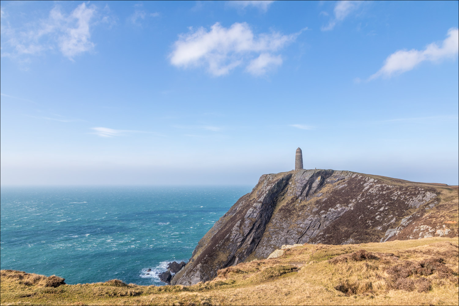
The American Monument comes into view

The Rhinns of Islay in the distance, another peninsula on the same island

The monument commemorates two separate tragedies and the loss of over 600 lives. The SS Tuscania was torpedoed by a German U-boat, and just 8 months later the HMS Otranto collided with another troop ship in bad weather

OS trig point beside the monument

The American Monument

A view along the west coast of the Oa Peninsula

Looking back to the American Monument as we follow the cliff top path

Our original plan had been to walk up Beinn Mohr, seen in the distance. This is the highest point on the peninsula but the gale force winds were making progress difficult and possibly dangerous, as much of the route is above the cliffs

In front of Beinn Mohr is Dun Athad, once home to an Iron Age fort

We turn left at this marker post

Bench with a view

We head back inland towards the white farmhouse at Upper Killeyan

Greylag geese in the fields, part of a large flock

We pass to the right of Upper Killeyan and follow a track back to the nearby car park
Follow the link for more walks in Scotland (44)
