
Route: Mont de Grange nature reserve
Area: Chablais Alps, France
Date of walk: 18th August 2018
Walkers: Andrew and Gilly
Distance: 10.5 miles
Ascent: 2,100 feet
Weather: Mostly sunny
We arrived at the Hotel Les Gentianettes yesterday afternoon after walking there from Abondance. Today’s circular walk started from the door of the hotel and took us into the northern part of the Mont de Grange nature reserve. After last night’s superb but highly calorific dinner we were in need of some exercise
We walked out of La Chapelle d’Abondance to join a path beside the River Dranse, which runs along the Abondance valley. After about 1.5 miles we crossed the river and following a short road section we began the long and quite steep climb up through the forest, passing by a lovely waterfall as we did so. There were innumerable hairpin bends along the narrow path, and these helped to take the sting out of the gradient
We eventually reached some meadows and followed a track around the mountainside, enjoying some wonderful views as we went along. On arriving at a junction known as La Pare du Midi we had a decision to make. At this point there is an optional there and back detour to the Refuge de Trebentaz, which involves an additional 1,000 feet of ascent (and descent), and would add 1.5 hours to the route. We debated the pros and cons for a while and in the end reluctantly decided to give it a miss, as clouds were coming in and rain was forecast for the afternoon
We started the long descent, initially through meadows, with more views ahead of us looking towards Mont Chauffé and Les Cornettes de Bise. There were several alpine cattle mooching around on the path in various places, but we passed by them without incident – they are good natured animals, despite their intimidating horns. These were the only beasts we saw in the nature reserve – we’d been hoping for a sighting of a chamois or perhaps a marmot but were out of luck today
The descent was easy, apart from a quite steep and slippery section near the end. On reaching the valley floor we crossed to the far side of the valley and retraced our steps back to the hotel to complete a hat trick of wonderful Alpine walks
Click on the icon below for the route map
![]()
Scroll down – or click on any photo to enlarge it and you can then view as a slideshow

Another glorious morning as we walk out of our hotel

We follow a track across the floor of the valley in the direction of Mont de Grange, partially obscured by the hills ahead

Looking back to Les Cornettes de Bise towering above La Chapelle

We arrive at the River Dranse and follow a path along its banks...


Les Cornettes de Bise again

Looking across the River Dranse


Having crossed the river via the Pont du Moulin we follow a quiet road uphill for a short distance...


Looking back


We pass by a waterfall

After a steep climb we reach a meadow and look back to La Chapelle d'Abondance

Les Cornettes de Bise again

The path enters into the forest...


A gap in the trees reveals this view across the valley

We emerge from the forest

Chalet Les Crottes

Beyond the chalet we follow a dirt track across the hillside with good views of the surrounding mountains...


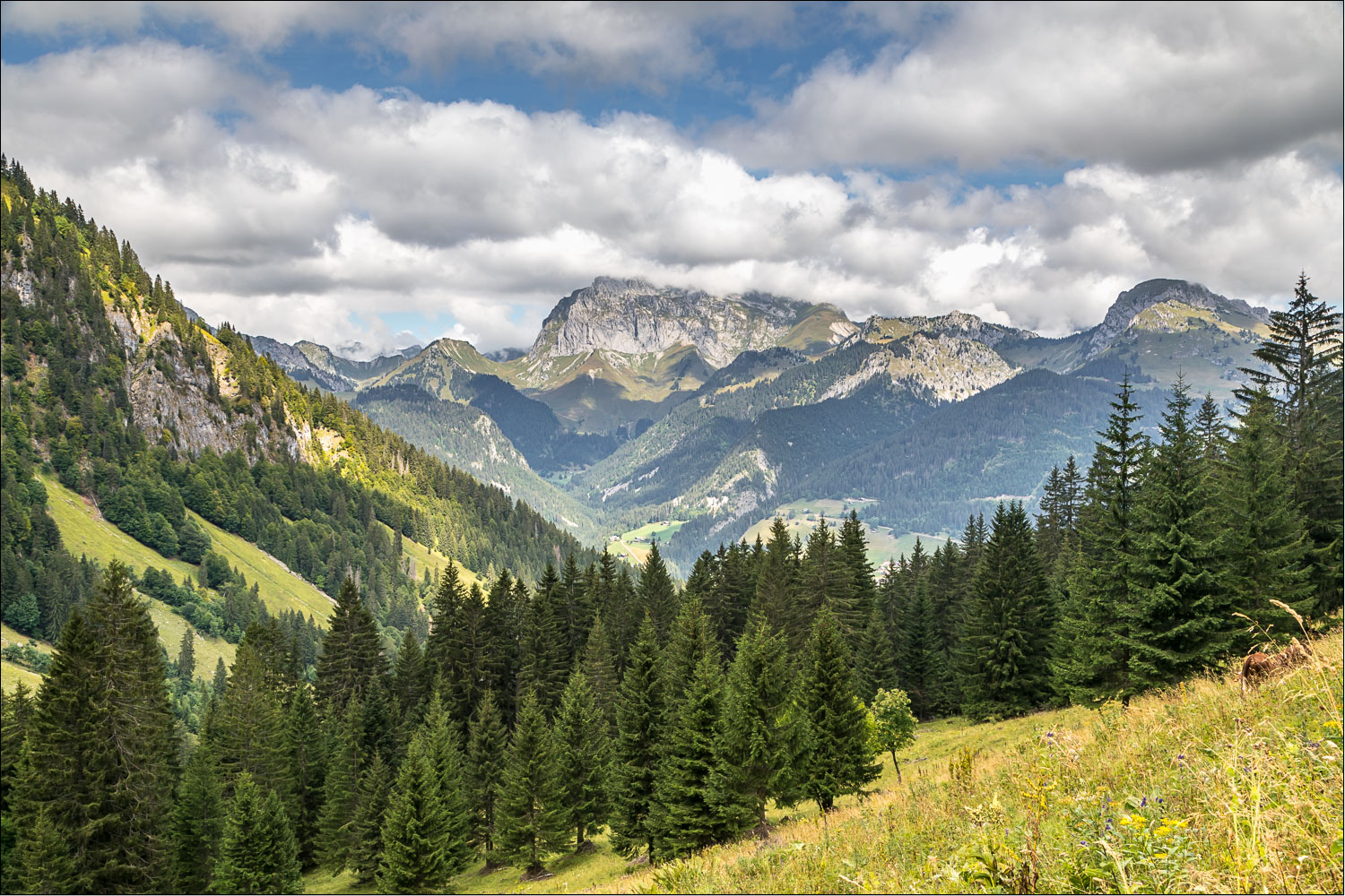
Mont de Grange, with the Refuge de Trébentaz just above the cliffs

Les Cornettes de Bise again, with La Chapelle d'Abondance below

La Pare du Midi at 1,550 metres or 5,085 feet - this is where the diversion to the refuge could be made

We begin the descent back towards La Chapelle...


Zooming in on the base of Les Cornettes de Bise

We follow a stony path through the meadow

A fritillary butterfly, possibly High Brown, but I stand to be corrected

We join a forest track

Le Petit-Châtel further along the valley - we'll be heading in that direction tomorrow


Plan des Feux above La Chapelle d'Abondance

We descend through the woods

We cross the bridge over the River Dranse

Heading back into La Chapelle...


The end of another superb walk in the Chablais Alps
Follow the link for more walks in France (11)
