
Route: Marloes Peninsula
Area: Wales, Pembrokeshire
Date of walk: 8th September 2019
Walkers: Andrew and Gilly
Distance: 7.6 miles
Ascent: 900 feet
Weather: Sunny
The Marloes Peninsula is a rugged promontory in South Pembrokshire. A peninsula is a good place for a circular coastal walk, as it means that the the coastline can be followed for most of the way, with only a short inland section. Today’s route would follow the Wales Coast Path for much of the way
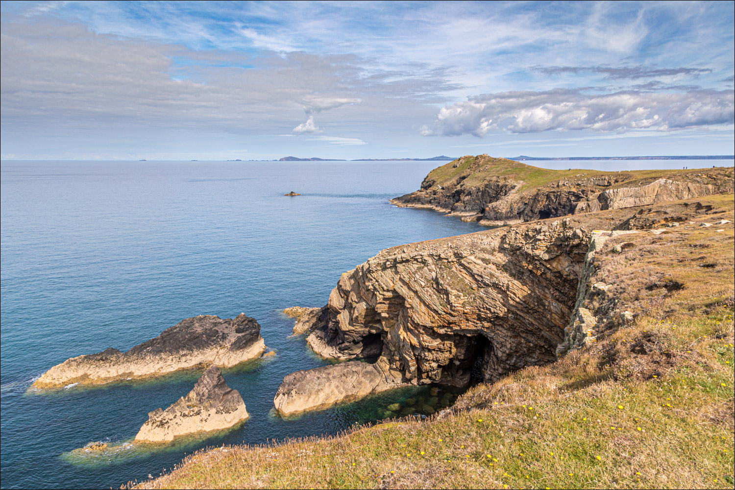
We parked in the National Trust car park near Marloes Mere, a grazing marsh which attracts waders, wildfowl and birds of prey. After following the lane out of the car park we joined a track which took us down to Marloes Sands, a beautiful beach with dramatic sawtoothed rocks pointing out to sea. We’d made an early start and had the place to ourselves. We could have lingered here all day, but it was only the start of the walk. We climbed some steps to rejoin the coast path, and followed the undulating route along the cliff tops, with wonderful views of the dramatic limestone rock formations
Every so often we peered down into the coves hoping to see grey seals, and it wasn’t long before we spotted several, along with their pups. It would be the first of numerous sightings along the way. When we reached Wooltack Point we could have taken a shortcut across the narrow headland, but decided to walk around its circumference. The views from here were magnificent, especially towards nearby Skomer Island, famed for its puffins
Wooltack Point was the western extremity of the walk, and its approximate half way point. From here we headed east along the other side of the Marloes Peninsula. The cliff scenery is not as dramatic as the southern coast, but it was a wonderful section nevertheless, with particularly fine views of Musselwick Sands
A path leads down to the sands, but we resisted the temptation of this diversion and headed away from the sea to complete the short inland section which leads back to the start. It was a memorable walk, one of the best
Click on the icon below for the route map (subscribers to OS Maps can view detailed maps of the route, visualise it in aerial 3D, and download the GPX file. Non-subscribers will see a base map)

Scroll down – or click on any photo to enlarge it and you can then view as a slideshow

The start of the walk as we leave the National Trust car park at Marloes Mere

We pass by Green Mire Cottage, set in a wonderful position

We arrive at the Wales Coast Path which runs all the way around the Marloes Peninsula

The path continues ahead, but we make a detour onto Marloes Sands

Gateholm Island

Raggle Rocks


Gazing out to sea - we have the beach to ourselves

We rejoin the Wales Coast Path and pass above Gateholm Island. Skokholm Island lies beyond it

Looking back over Marloes Sands...

...and now down to Marloes Sands

Gateholm Island and Skokholm Island

Albion Sands - we can just make out a protruding pipe in the sea, all that remains of of the paddle steamer Albion which was wrecked here in 1837

Skokholm Island again, which is an internationally important seabird haven

We had some good wildlife sightings at this point - a kestrel...

...wheatear

Grey seal (the seal was some distance below us - the photo was taken with a long lens and then cropped)

Grey seal pup

Skomer Island, a world renowned wildlife paradise which is famous for its puffins

Looking across the Marloes Peninsula

Skomer Island again

We continue around the peninsula...


Looking down to another grey seal pup, being suckled by its mother


Skokholm Island again

At the narrowest point of the peninsula we pass by a lone house above Martin's Haven

We enter the Deer Park at the end of the peninsula - it's a misnomer as it has never held any deer. The area was enclosed in the 19th century

Skomer

We head for Wooltack Point, the far extremity of the Marloes Peninsula

More grey seal sightings at the foot of the cliffs...


The half way point of the walk as arrive at Wooltack Point, here looking across St Brides Bay towards St Davids

We now head towards the white building on the high point of the headland...

...which is a small hut, originally a Coastguard lookout, but now manned by volunteers of the National Coastwatch Institution

A view back along our path, with Skomer Island beyond

We now turn our sights on the northern section of the peninsula, which is gentler in character than the southern side

We descend to Martin's Haven and follow the sign on the right, which takes us back onto the cliff

We follow the gently undulating cliff top path...


Musselwick Sands comes into view, marking the end of the Marloes Peninsula


We descend towards Musselwick Sands, ignoring the temptation to divert to the beach

A view back as we leave the Wales Coast Path and make the short inland journey back to the start

A final glance across St Brides Bay as we follow a quiet lane to the car park at Marloes Mere to end a wonderful walk
Follow the link for more walks in Wales (17)
