
Route: Loweswater and Holme Wood
Area : Western Lake District
Date of walk: 11th August 2022
Walkers: Andrew
Distance: 5.7 miles
Ascent: 1,000 feet
Weather: Sunny, cloudless and hot
This is one of my favourite local walks which, in the space of 6 miles, manages to cram in a huge variety of scenery including farmland, ancient woodland, a lake, a tarn, open moorland and a lonely valley. Along the way there are wonderful views over the Solway Plain looking north (including Scotland in clear weather) and to the high lakeland fells looking south
The country is in the middle of a drought and a heatwave, and in these temperatures a fell walk would have been unpleasant. I made an early start and parked as usual at Maggie’s Bridge where there is space for 8-10 cars (and during the school holidays it’s necessary to arrive early in order to be sure of a space). Instead of heading directly to Loweswater I followed the track to High Nook Farm, where Alfred Wainwright used to stay when he was researching his Guide to the Western Fells. After passing through the farm I carried on to the head of the valley before joining the wonderful terraced path above Holme Wood, known as the old coffin road from Loweswater to St Bees (the description may be fanciful but the name has stuck). The views from here are superb
The path contours around the sides of Carling Knott and Burnbank Fell and reaches a height of over 1,000 feet – higher than one or two lakeland fells. However the climbing is so gentle that it’s hardly noticed. I carried on towards Fangs Brow, on the very edge of the Lake District, before turning back at Iredale Place and following the path past Jenkinson Place and Hudson Place
I then descended into Holme Wood, and along the shore of Loweswater, passing by the bothy as I did so
The last section was an easy stroll along the track between Watergate Farm and Maggie’s Bridge. I’ve followed this route on numerous occasions at every time of the year and never tire of it
For other walks here, visit my Find Walks page and enter the name in the ‘Search site’ box
Click on the icon below for the route map (subscribers to OS Maps can view detailed maps of the route, visualise it in aerial 3D, and download the GPX file. Non-subscribers will see a base map)

Scroll down – or click on any photo to enlarge it and you can then view as a slideshow

The start of the walk as I leave Maggie's Bridge and follow the track towards Carling Knott

The track passes through High Nook Farm, just beyond the trees

Having passed through the farm, I head up a valley between Gavel Fell and Blake Fell

Looking back to Low Fell and Lorton Vale

Heather clad Black Crag on Gavel Fell

Just beyond this point l cross High Nook Beck and turn sharp right

The Old Coffin Road below Carling Knott - it's believed that the name is fanciful as the route is not very practical for such a purpose

Lorton Vale on the right

Looking back to Black Crag

Holme Wood ahead - the path passes above the top of the wood...

A glimpse of the Solway Firth and Scotland in the distance

The path continues to contour around the fellside, with ever improving views

The foot of Loweswater - the lake is unusual in that it drains into lakeland

View across the lake

A well placed bench...


Scotland in the distance

Looking back to Grasmoor and Mellbreak

The path continues towards Fangs Brow on the edge of the Lake District

Just before Fangs Brow I leave the path and turn right to cross this ladder stile

The path heads towards Mosser Fell for a short distance

I follow the track above Iredale Place...


Jenkinson Place above Loweswater

I walk across the field and around Hudson Place

Beyond Hudson Place I join a path which descends to Loweswater

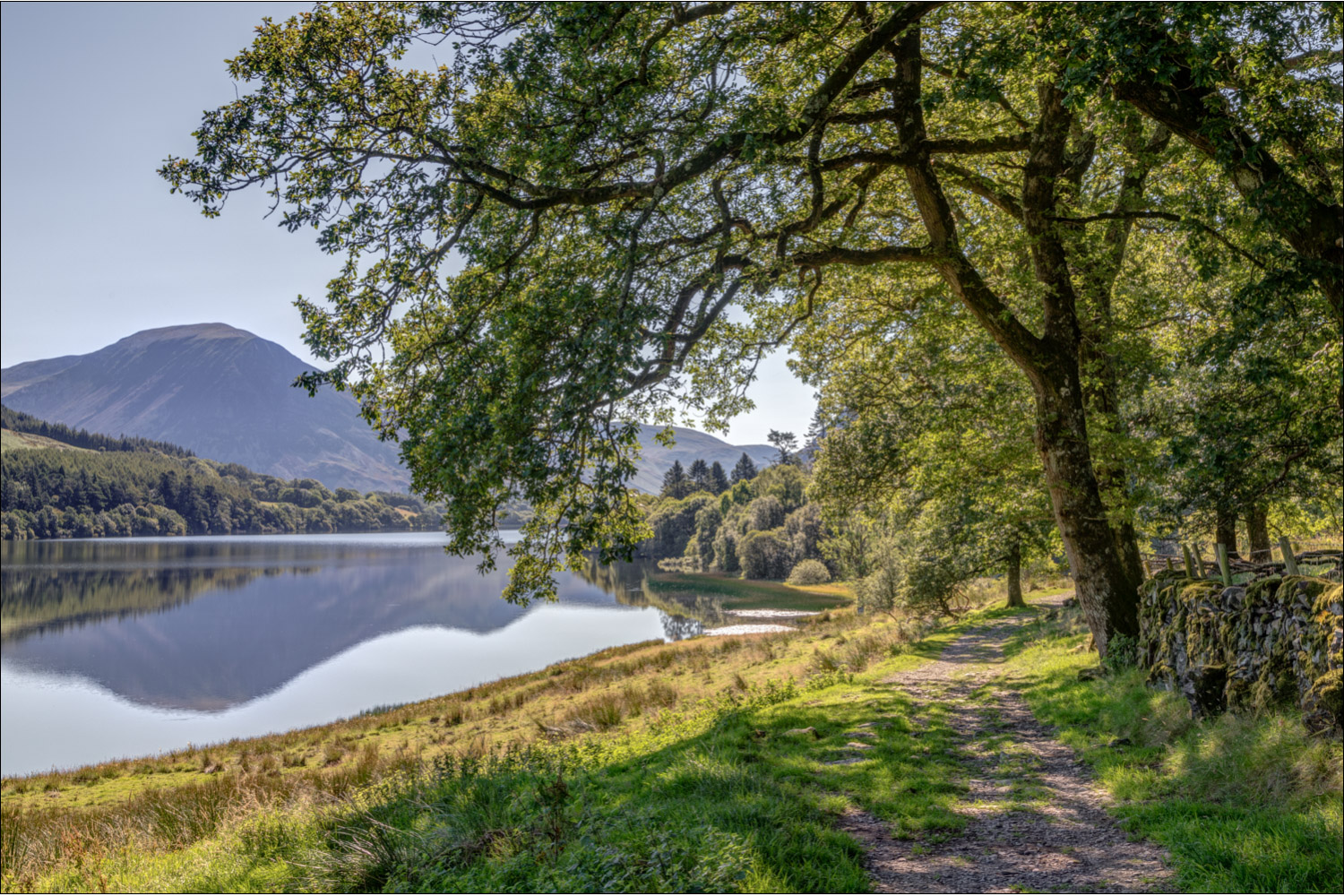
Views from the delightful shoreline path beside Loweswater...


I enter Holme Wood. There's a choice of paths here - the left fork runs closer to the lake and the other goes straight through the wood

I pass by the Loweswater Bothy

More views across Loweswater as I continue through Holme Wood...


Beyond the lake I follow the track back to the start

Mellbreak ahead, and the end of another visit to my favourite bench...
