
Route: Loughrigg Fell
Area: Central Lake District
Date of walk: 5th November 2013
Walkers: Andrew
Distance: 7.9 miles
Ascent: 1,400 feet
I parked by St Mary’s Church Rydal and crossed the road, and the River Rothay, to join the path alongside the shore of Rydal Water. At the far end of Rydal Water I joined Loughrigg Terrace, a beautiful path with views over Grasmere
At the end of the terrace I turned uphill to climb to the summit of Loughrigg Fell at a height of 1,101 feet. Despite its small stature, it punches well above its weight, commanding great views in all directions and being set in the middle of a rugged landscape
On the way down the weather cleared for a time, giving some lovely views towards Langdale and also over Windermere and Ambleside
After wandering round Ambleside for a short time, I returned to the start via Rydal Park and Rydal Hall, a great ending to a great walk
For other walks here, visit my Find Walks page and enter the name in the ‘Search site’ box
Click on the icon below for the route map (subscribers to OS Maps can view detailed maps of the route, visualise it in aerial 3D, and download the GPX file. Non-subscribers will see a base map)

Scroll down – or click on any photo to enlarge it and you can then view as a slideshow

I parked opposite St Mary’s Church Rydal and put £4 in the honesty box, so as to avoid being struck by a bolt of lightning

On the footbridge over the River Rothay, which flows out of Rydal Water

Rydal Water


One of the Rydal Caves

Loughrigg Terrace

Grasmere comes into view


Grasmere

The summit of Loughrigg Fell is ahead

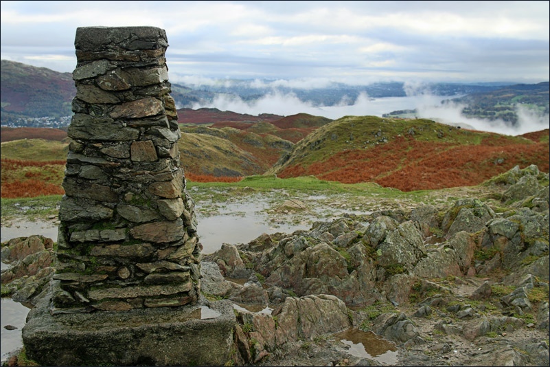
Summit of Loughrigg Fell, looking over Windermere

Elterwater

It suddenly misted up for 15 minutes or so

Out of the mist now, and looking over Windermere

Some blue skies at last

A small pool near Lily Tarn, looking towards the eastern fells

Lily Tarn

Ambleside

Crossing back over the River Rothay via Miller Bridge

The Bridge House Ambleside

After leaving Ambleside, I enter Rydal Park

Rydal Park


The Grot - see below

Rydal Hall, just before arriving back to the start
