
Route: Ling Fell
Area: North Western Lake District
Date of walk: 22nd February 2018
Walkers: Andrew
Distance: 3.0 miles
Ascent: 800 feet
Weather: Mostly sunny, rather hazy
There was only time for a short afternoon walk, and my thoughts turned to my last walk when I’d enjoyed a wonderful visit to the quiet and relatively unknown Wythop Valley. On that occasion I’d climbed Sale Fell and so it seemed appropriate today to pay my respects to its next door neighbour – Ling Fell
I parked in one of the few roadside spaces in the lane by the Old School, just outside Wythop Mill. I continued along the lane for 10 minutes or so and then left it to join the old Corpse Road, a path which I assume was used to transport coffins in the past, though it’s hard to tell from the OS map how the path could have been used for this purpose. I ignored a path to the left which takes a more direct approach to the summit and continued along the Corpse Road, climbing gently all the while
After rounding a corner I left the track to turn up an obvious grassy path which leads to the summit of Ling Fell. The path isn’t shown on the OS map but the way is obvious and I’d be surprised if the services of Mountain Rescue have ever been required on this fell. Even the clumsiest and most ill equipped walker is unlikely to have a mishap here
I was soon at the summit of the fell (marked by an impressive OS trig point) and admiring the views towards Skiddaw. According to Wainwright this is the best fell from which to view Cockermouth – this was not the case today, as I could barely make out the town thanks to the rather hazy conditions. I descended along another path not shown on the OS map, but again perfectly obvious, before joining a wider track around the fellside. This brought me back to the Corpse Road, and from here I retraced my steps back to the start of another short but very sweet walk in the lovely Wythop Valley
For other walks here, visit my Find Walks page and enter the name in the ‘Search site’ box
Click on the icon below for the route map (subscribers to OS Maps can view detailed maps of the route, visualise it in aerial 3D, and download the GPX file. Non-subscribers will see a base map)

Scroll down – or click on any photo to enlarge it and you can then view as a slideshow

Looking across the Wythop Valley towards Embleton from the parking space at the start of today's walk

I follow the lane below the flanks of Ling Fell on my right...


Looking across to Sale Fell, where I'd walked last week

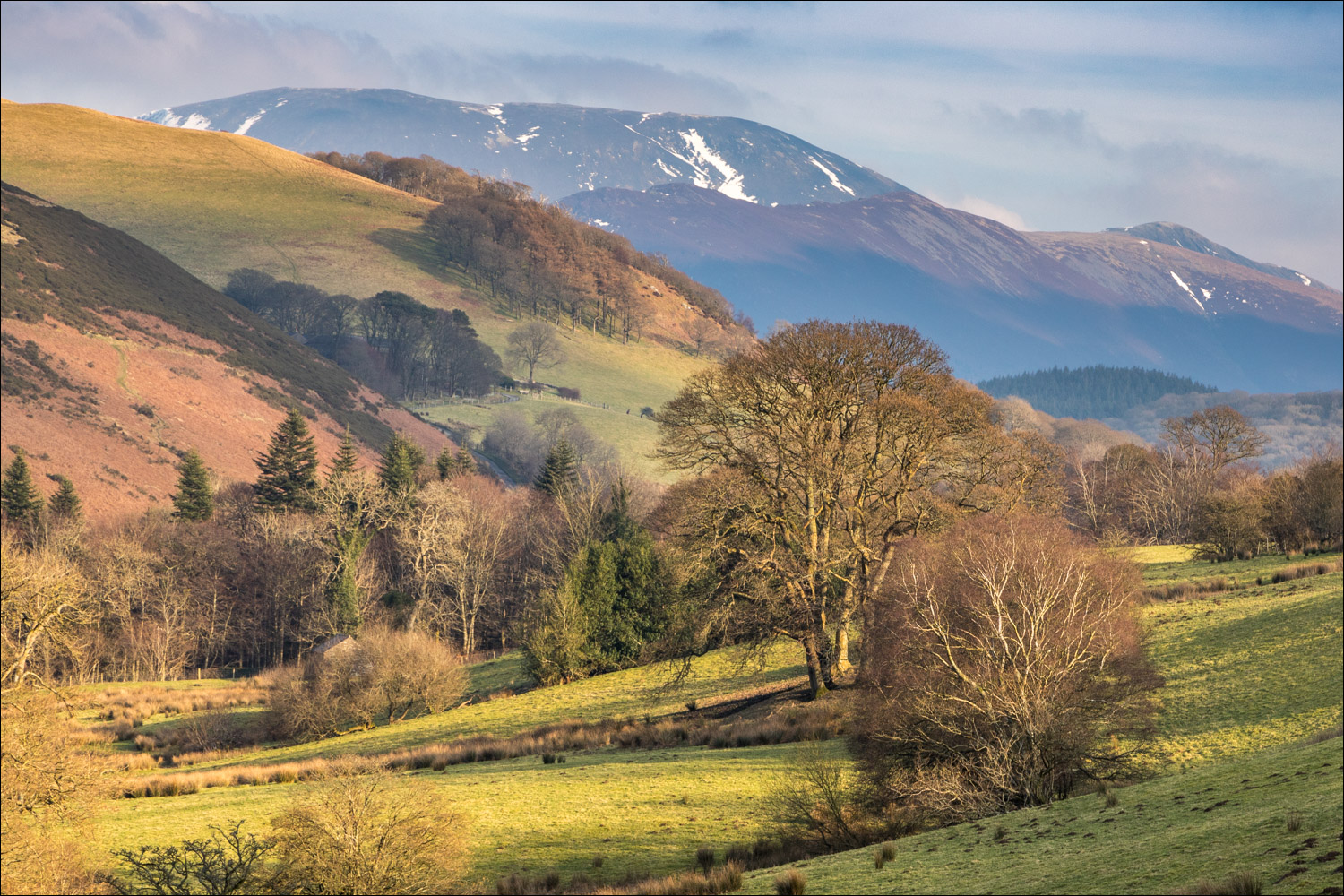
Skiddaw in the distance

Near the crest of the hill I'll leave the lane to join the Corpse Road

Bonnie at the start of the Corpse Road

Views back towards Skiddaw as I follow the easy path uphill...


Looking across the Wythop Valley

...and now looking back to Sale Fell

I round a corner onto open fellside

Looking back

Continuing up the fellside - it's very easy going all the way

We keep to the higher ground and fork off right here

Looking back

Wythop Mill below

The OS trig point at the summit of Ling Fell comes into view

Looking towards Grisedale Pike and Hopegill Head

Skiddaw, and Sale Fell to the left

I start the easy descent in the direction of Skiddaw...


Broom Fell

Bassenthwaite Lake is unseen from here, but lies beneath the hills ahead

I continue downhill, with Sale Fell ahead

Skiddaw again in the distance

Looking south along lonely Wythop Moss as I reach the foot of the fell

I walk north, following the track back above Burthwaite...


Back to the Corpse Road, where I'd started the ascent of Ling Fell an hour ago

I retrace my steps back to the start of a great little walk
