
Route: Horse Dale
Area: East Yorkshire
Date of walk: 11th February 2022
Walkers: Andrew and Gilly
Distance: 5.9 miles
Ascent: 600 feet
Weather: Sunny and cold
The starting point for today’s walk was the village of Huggate, which lies in a hollow, but is nevertheless the highest village on the Yorkshire Wolds at around 558 feet above sea level. Several paths radiate out of the village including two long distance paths which have featured here on previous occasions – the Yorkshire Wolds Way and the Chalkland Way
We parked on the roadside near the Wolds Inn, a perfect place for thirsty and hungry walkers to return to at the end of the walk. We followed the ‘no through road’ into the village, and left it via a path on the left, just beyond grade I listed St Mary’s Church. We walked along the path, part of the Yorkshire Wolds Way, past Glebe Farm as far as the upper edge of Horse Dale. This is one of the classic dry chalk valleys in the area which were shaped by glaciers. We ignored a higher path and passed through a gate to join a wide grassy path which runs along the upper rim of the valley. Near a junction of Horse Dale, Harper Dale and Holm Dale we passed by the Huggate Bench, one of the wonderful carved poetry benches which feature along the Wolds Way
We descended into Horse Dale and entered briefly into Harper Dale before climbing up and walking across North Field at the top of the wold. An easy descent took us down into another dry valley, Rabbit Dale, followed by the final valley of the route, Cow Dale. We followed the Chalkland Way along the valley and as it petered out we climbed up to join the lane back into Huggate to end our walk
Click on the icon below for the route map (subscribers to OS Maps can view detailed maps of the route, visualise it in aerial 3D, and download the GPX file. Non-subscribers will see a base map)

Scroll down – or click on any photo to enlarge it and you can then view as a slideshow

Earlier in the week, a sure sign that spring is on the way - naturalised crocus in the lawn

The start of the walk from one of the roadside spaces near the Wolds Inn Huggate

As we walk through the village we make a short detour to St Mary's Church

Back on the route, passing by the church again, behind Rectory Cottage

Just beyond the church we leave the lane to join the Yorkshire Wolds Way

We aim for Glebe Farm to the right of the picture

We follow the track past Glebe Farm

Looking back along the track

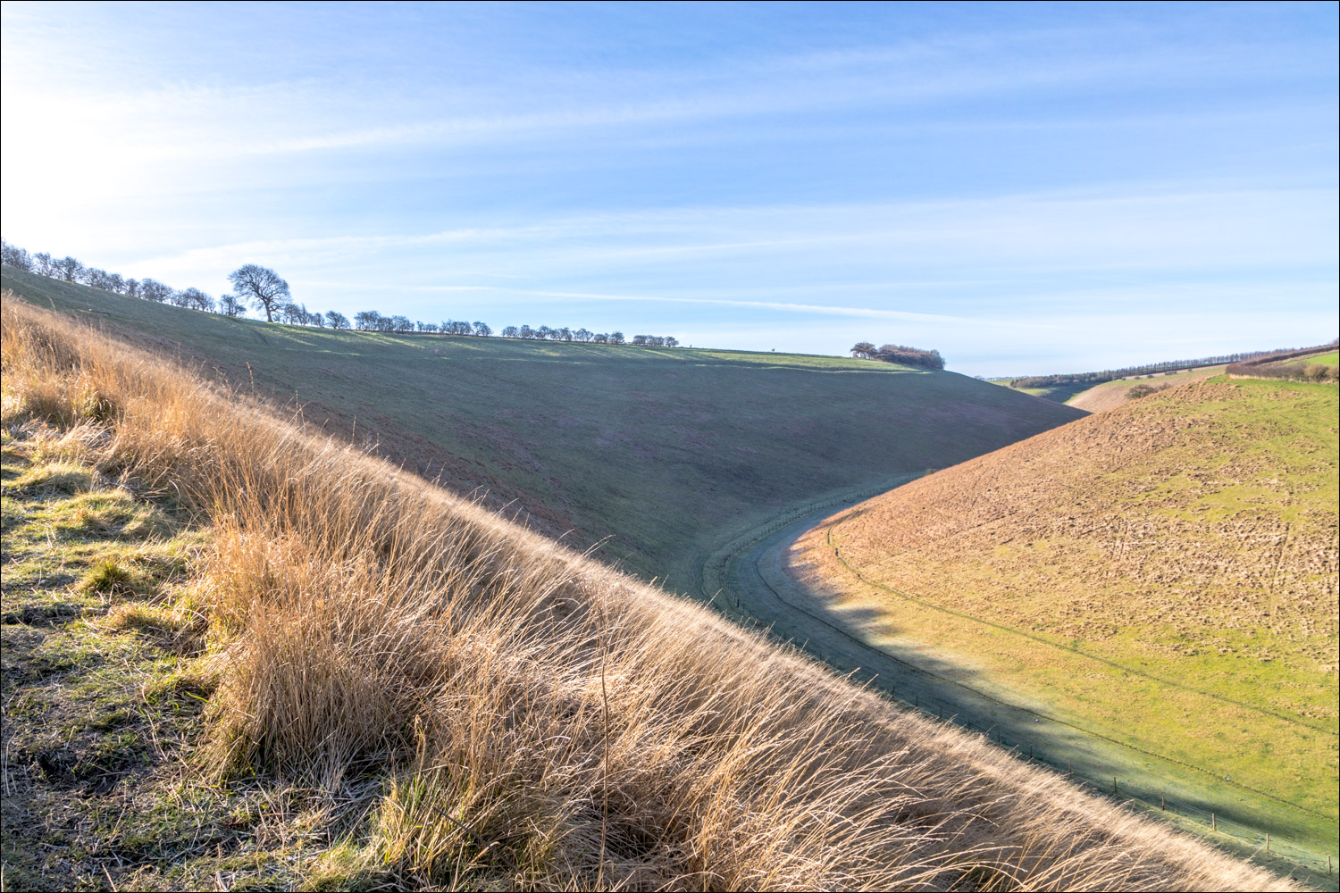
A short distance beyond the farm we arrive at the rim of Horse Dale. We pass through the gate to take the lower of two paths above the valley

We follow the grassy path with Horse Dale below on our left

Looking back

At this junction we keep to the lower path. Horsedale Plantation is ahead


The Huggate Bench, one of the carved Poetry Benches which adorn the Wolds Way

A wonderful place to contemplate the views in both directions along Horse Dale

The benches were designed by artist Angus Ross and the poems were written by John Clark. "We have rippled the earth with our desire to be here not there. We have driven the dale’s wedge of hush home between us. But you move, as we moved, in the ghost of water. A hare rips away from the dead, Thuds down the dyke and out into everywhere the grasses foam".

We descend gently into Horse Dale

Looking back along the valley...


At some point Horse Dale ends and Harper Dale begins. I assume that the boundary is the fence and gate ahead

A view back into Horse Dale

We walk along the valley floor of Harper Dale....


The path curves around to the right as we climb out of Harper Dale

We join a track leading uphill onto the wold

On top of the wold now as we walk across North Field

We follow the sign here and walk downhill into the next valley

Rabbit Dale, where we turn right


Rabbit Hill on our right


At the end of Rabbit Dale we turn right into the final valley of our walk...

...Cow Dale


Looking back...


The valley peters out and we turn right here

We pass through this stile, which leads on to the quiet lane into Huggate. From here it's a short stroll back to the end of a wonderful walk on the Wolds
Follow the link for more walks in East Yorkshire (117)
