
Route: Holyhead Mountain/Mynydd Twr
Area: Holy Island, Anglesey, North Wales
Date of walk: 21st September 2021
Walkers: Andrew and Gilly
Distance: 5.6 miles
Ascent: 1,300 feet
Weather: Weak sun and mostly grey skies
Holy Island, or Holyhead Island, is situated on the western side of the larger Isle of Anglesey and is home to the highest sea cliffs in North Wales
We started today’s walk from the lower of the two RSPB car parks near South Stack (free to members, otherwise £5 cash at today’s prices). From the car park we followed the waymarked path to Ellin’s Tower, built in 1867 as a retreat for Ellin, the wife of William Stanley, a local MP. We then joined the long distance Wales Coast Path. The ensuing cliff top path is well waymarked, and this proved to be useful as there are numerous paths around here and it would be easy to follow the wrong one. We walked above South Stack/Ynys Lawd, enjoying good views of its lighthouse, and headed towards the north face of Holyhead Mountain. A direct ascent of the mountain from this side is not possible for ordinary walkers, although it’s a popular place for climbers
Our route took us to the left of the mountain and towards North Stack/Ynys Arw. We continued along the Wales Coast Path and descended to the lighthouse above North Stack, taking care not to stray too close to the vertical cliffs plunging into the sea. From here we retraced our steps for a short distance and then branched off to the left. We followed a path which gave us good views to the port of Holyhead and its long snaking breakwater. It’s necessary to keep a sharp lookout for a path on the right which is the key to the ascent of Holyhead Mountain. We duly located this and started the rocky but easy ascent to the summit. The views from here were huge, although the light wasn’t inspiring and it was rather hazy
Care always needs to be taken when descending from a summit and Holyhead Mountain is no exception. It would be a mistake to descend in the obvious direction of South Stack, clearly visible from the summit. This would lead to the cliffs of the north face which would provide a quick but possibly fatal way down. Instead it’s necessary to head west and locate a path which avoids the crags and provides a rocky but relatively easy way back down to the Wales Coast Way
After retracing our steps along the path for a short distance we branched off to the left at the radio stations to join a path which brought us down to RSPB South Stack (where there are toilets and a cafe). From here it was a short stroll back down the road to the lower RSPB car park and the end of the walk
Click on the icon below for the route map (subscribers to OS Maps can view detailed maps of the route, visualise it in aerial 3D, and download the GPX file. Non-subscribers will see a base map)

Scroll down – or click on any photo to enlarge it and you can then view as a slideshow

The start of the walk from the lower RSPB car park at South Stack/Ynys Lawd

We pass by Ellin's Tower, bought by the RSPB in 1980 and now an information centre and bird hide

We pass above South Stack and its lighthouse


We follow the Wales Coast Path (well waymarked) above South Stack

Looking back to Ellin's Tower

We pass by an old lookout buidling

Looking back down to South Stack Lighthouse

Our next objective is North Stack, at the tip of the promontory

Holyhead Mountain - the crags are a popular spot for climbers, but walkers must deviate to the left

Looking down to Parliament House, the redundant fog warning station on North Stack

Holyhead Harbour

Looking back to South Stack Lighthouse

Start of the descent to North Stack

We'll have to retrace our steps back uphill shortly

Parliament House and North Stack below

The fog warning station is redundant and is now a bird watching station

A view from North Stack back to South Stack

Looking down to North Stack

Holyhead Harbour seen as we retrace our steps uphill to start the ascent of Holyhead Mountain...


The breakwater at the harbour's edge

Holyhead Mountain ahead - it's an easy climb

Looking back to Holyhead Harbour

From just below the summit a view along the coast of Holyhead

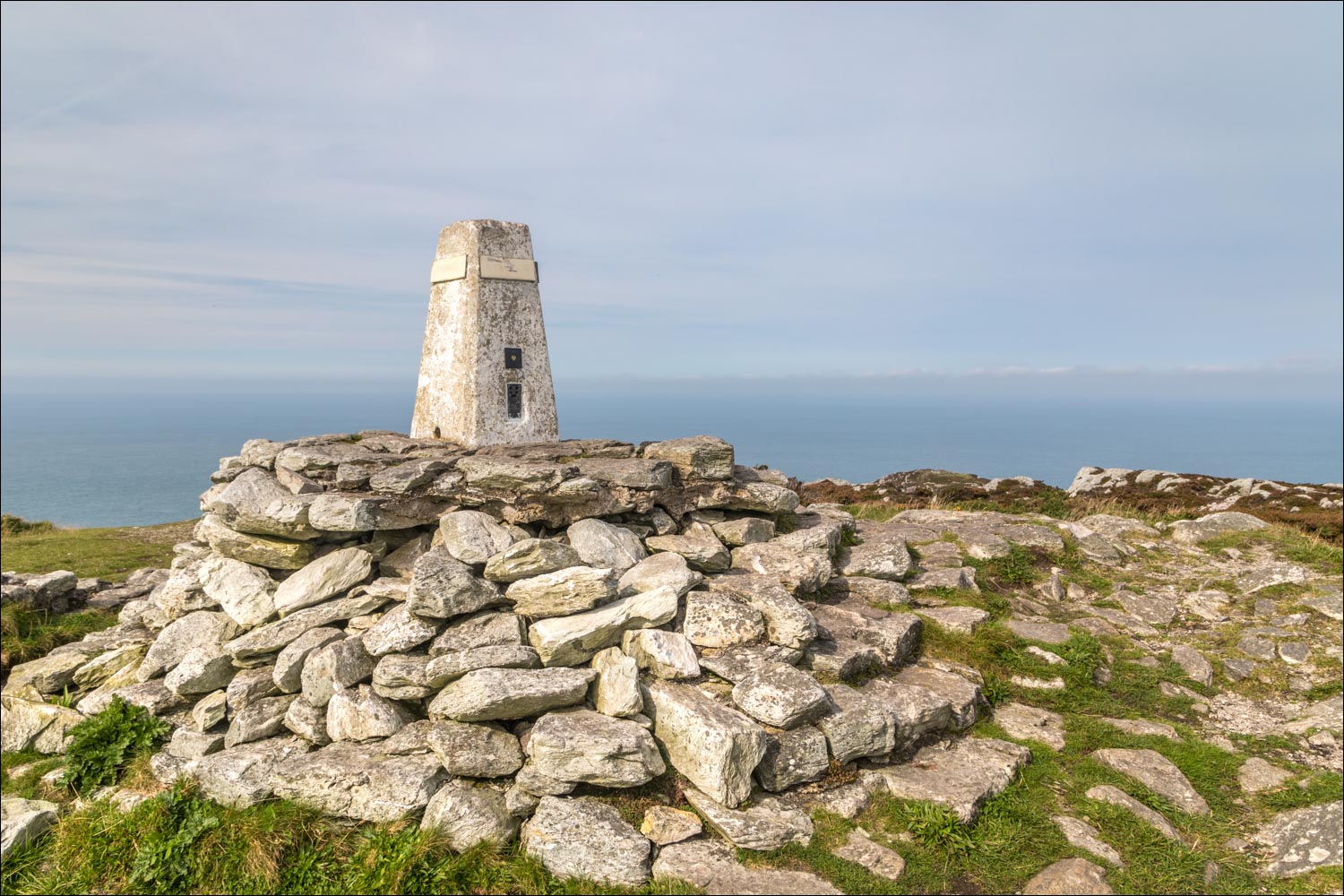
Trig point at the summit of Holyhead Mountain

The west coast of Holyhead ...


Time to descend - we're aiming for the various criss crossing paths below, but can't make a beeline for them in view of the cliffs below, unseen from here

We head towards the sea initially before descending back to the Wales Coast Path, which we'd followed earlier

Having bypassed the crags, it can be seen why a direct descent is out of bounds to ordinary walkers

From here we walk back to the start - the skies had been grey and uninspiring but it had been an enjoyable walk nonetheless
Follow the link for more walks in Wales (17)
