
Route: High Rigg
Area: Central Lake District
Date of walk: 2nd December 2021
Walkers: Andrew and Gilly
Distance: 5.8 miles
Ascent: 1,300 feet
Weather: Mostly sunny, very cold
This is a walk we’ve followed often (today would make it the seventeenth occasion) and is one of our favourites. We parked in the car park at Legburthwaite, although there is alternative parking for about 15 cars on the wide verge of the A591. (UPDATE: following a visit in 2024 I found the access road to the car park to be very badly eroded, with huge potholes. I recommend parking on the roadside verge). After crossing the ladder stile beside the road we made our way up Wren Crag towards the ridge. The flanks of the crag are adorned by some fine old pine trees, but it’s a shame that a number of these – perhaps 20 or 30 – fell victim to gales four years ago. The so-called ‘Beast from the East’, which was followed by a couple of other gales from the same direction, was the obvious culprit, since the trees are all lying on an east/west axis. This wind direction is highly unusual for the Lake District, and so the root systems of the trees had not grown to cope with it
When we reached the knobbly summit ridge above Wren Cra we followed the undulating path up and down and after about 1.5 miles arrived at the summit of High Rigg. There are lovely views from here, particularly those looking towards Blencathra
We then descended in the same direction as the ridge to reach the hause between High Rigg and Low Rigg. From here we followed a narrow lane for a few yards, passing by tiny St John’s Church, before joining a path which hugs the lower flanks of High Rigg. Another named storm, Storm Arwen, had blown over a couple of large trees which obstructed the path, and we had to clamber up a steep bank to get round them. We continued along the elevated valley path from which there are good views across St John’s in the Vale
Near the end of the vale we passed by Low Bridge End Farm (where tea and cakes are available in season) and continued along the path, which rises steeply above St John’s Beck. The path rounded the foot of the fell and brought us back to the A591 to end a walk which never fails to please
For other walks here, visit my Find Walks page and enter the name in the ‘Search site’ box
Click on the icon below for the route map (subscribers to OS Maps can view detailed maps of the route, visualise it in aerial 3D, and download the GPX file. Non-subscribers will see a base map)

Scroll down – or click on any photo to enlarge it and you can then view as a slideshow

Earlier in the week the ghost of a bird, probably a wood pigeon. The white imprint is 'powder down', a deposit left after a collision with a window

The morning of the walk, and a red squirrel visiting for breakfast

Later in the morning, the start of the walk as we cross this ladder stile beside the A591

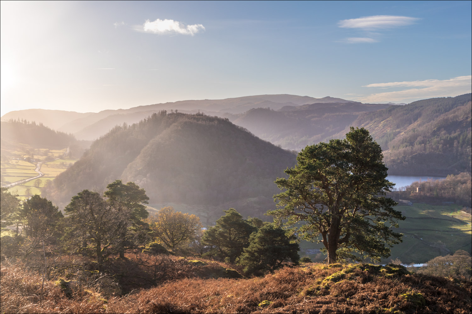
Wren Crag ahead, which signifies the start of the long ridge leading to High Rigg

We follow a path through some old pine trees

Looking back


Castle Rock below the spine of the eastern fells, culminating in Helvellyn

More pine trees, the numbers sadly depleted by the storm known as the 'Beast from the East'

Looking back to Great How and Thirlmere

Looking back along our path, with Castle Rock in the background

Looking back as we end the climb up Wren Crag, and set out along the undulating ridge of High Rigg, known as Long Band

Blencathra in the distance and Clough Head on our right

Some remaining snow at the top of Skiddaw

St John's in the Vale below, which will be our return route

Further along the ridge

We pass by a small tarn

Another down and an up as we descend to the dry stone wall, and will follow the path beside it

We cross this ladder stile, very gingerly as each step was as slippery as a block of ice

We continue beside the dry stone wall

We pass by another unnamed tarn

Clough Head


Summit cairn on High Rigg, looking towards the eastern fells


We descend to the Youth Centre on the hause between High Rigg and Low Rigg, with Skiddaw in the distance

We pass by tiny St John's Church and just beyond it turn off the lane to follow a path leading into St John's in the Vale

The halfway point of the walk as we follow the path around the foot of High Rigg

We pass by an atmospheric ruined building at Rake How


We continue along the path through St John's in the Vale...


A final look back along St John's in the Vale to Blencathra

We follow a narrow path with St John's in the Beck below - this will bring us back to the start of the walk

The track leading back to Legburthwaite car park, and the end of one of our favourite walks
