
Route: Caldbeck and Hesket Newmarket
Area: Northern Lake District
Date of walk: 20th April 2024
Walkers: Andrew and Gilly
Distance: 4.5 miles
Ascent: 500 feet
Weather: Mostly sunny
The vast area to the north of Skiddaw is unfrequented. It’s easy to assume that the Lake District ends at Skiddaw, but beyond it lie miles of rolling hills dotted with old villages which have hardly changed for centuries. Today’s walk would link two of those traditional fell villages – Caldbeck, which we visited last year, and Hesket Newmarket. Today’s walk started from the public car park in Caldbeck. We left the village via a path beside Cald Beck which passed by the village church. After a short while we entered into Parson’s Park, an area of woodland managed by Forestry England. We followed a path through the woodland, part of the long distance Cumbria Way. Bluebells lined the path for much of the way but we were a few days too early to see them at their peak. Beyond a gate at the edge of the wood we descended to Watersmeet, a lovely wooded area where the rivers of Cald Beck and the River Caldew meet and form a narrow neck of land which is almost an island. Although the walk could be shortened here, we decided to extend it by walking around the ‘island’, a short but very worthwhile diversion. The woodland was covered with wood anemone, celandine, wild garlic and bluebells. The spectacle was not yet at its peak, but it was a lovely section of the walk nevertheless
At the end of the circuit of the ‘island’ we headed south, following a path above the River Caldew. This brought us to the unspoilt village of Hesket Newmarket, where there is a pub and a post office. We left Hesket Newmarket via a quiet country lane with good views across the rolling fields. After half a mile or so we left the lane and joined a path through the fields which descended gently to Matthew Rudding (not a person, but a small settlement). From here we followed a track to Townhead on the edge of Caldbeck and then strolled back to the start. It had been an enjoyable walk and during the course of nearly five miles we’d hardly seen another soul
Click on the icon below for the route map (subscribers to OS Maps can view detailed maps of the route, visualise it in aerial 3D, and download the GPX file. Non-subscribers will see a base map)

Scroll down – or click on any photo to enlarge it and you can then view as a slideshow

The day before the walk, a barn owl hunting in the fields near our house...


The start of today's walk as we leave the public car park in Caldbeck and follow the sign pointing along Friar Row to Hesket Newmarket

We follow a lane between the cottages, with Cald Beck on our right

We enter into Parson's Park, managed by Forestry England. The path follows a section of the long distance Cumbria Way

We keep to the higher ground as the path takes us through the woods

Peacock butterfly on a bluebell

We pass through this gate

The planting has been extended in recent years

We leave the Cumbria Way and turn right at this junction to descend to Cald Beck

Celandine lining the path...

...and bluebells, not yet at their peak

We cross the footbridge over Cald Beck. We make a detour here at Watersmeet to walk around an 'island' between Cald Beck and the River Caldew

Cald Beck from the bridge

Bluebells in Watersmeet

The River Caldew on the other side of the 'island'

We pass by the footbridge again at the end of the short detour

We follow the path out of the wood, with the River Caldew on our left

Looking back

The River Caldew is below on our left as we enter another wooded area

Heading south towards Hesket Newmarket...


Approaching Hesket Newmarket

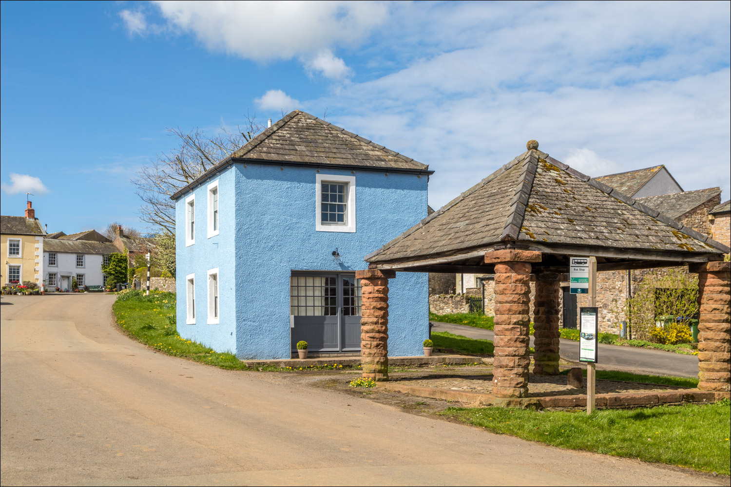
Hesket Newmarket, which is a collection of 18th century cottages surrounding a village green

Hesket Newmarket Free Church

We walk through the quiet village, where there is a pub and a village shop

We leave Hesket Newmarket and follow a country lane to the left of the white cottage

After walking along the lane for 15 minutes or so we leave it here to follow a sign for Matthew Rudding, a farm with an attractive cottage

After passing through Matthew Rudding we continue along the access track towards Caldbeck

We approach Townhead on the edge of Caldbeck

We turn right to pass above Townhead before descending into Caldbeck

We arrive back in Caldbeck to end a lovely walk. For anyone looking to escape from the tourist hot spots of the Lake District, this is an ideal place to visit

Later that day, a red squirrel in the garden
