
Route: Great Carrs, Swirl How and Grey Friar
Area: Southern Lake District
Date of walk: 2nd October 2014
Walkers: Andrew
Distance: 6.3 miles
Weather: sun and blue skies
I parked near the Three Shire Stone at the top of the Wrynose Pass and was thankful to get a space as parking there is limited. It was a glorious morning and I set off up Wet Side Edge full of anticipation. The climb was easy and it’s a grand way to reach the summit of Great Carr. I visited the remains of the crashed Halifax bomber just below the summit – a poignant moment
I then made my way over to Swirl How, the highest point of the walk at 2,630 feet. After admiring more amazing views I left the summit and walked across easy grassy terrain to the final fell – Grey Friar
I did wonder about returning the way I’d come, along Wet Side Edge, so as to keep to the heights for as long as possible on such a lovely day, but in the end decided to stick to Plan A and descend towards Cockley Beck down a path clearly marked on the OS map. There was a slight problem as it soon became clear that the path doesn’t exist and the descent was pathless throughout. A descent to Cockley Beck would not be possible in any event, since about a third of the way down the so-called path meets a barbed wire fence. I followed the line of the fence across the fell and then down hill, which at least had the advantage of cutting a large corner off the planned route. Apart from the final section, which was quite steep and rocky, the descent was reasonably straightforward though I wouldn’t like to do it in mist
Having reached Wrynose Bottom, it was a simple matter of following the road back to the start – only hardy motorists dare to tackle Wrynose Pass, so I only saw a few cars along the way
It had been a privilege to be up on the fells on such a day as this
Click on the icon below for the route map (subscribers to OS Maps can view detailed maps of the route, visualise it in aerial 3D, and download the GPX file. Non-subscribers will see a base map)

Scroll down – or click on any photo to enlarge it and you can then view as a slideshow

On the way to the start, I stopped at Grasmere which was looking magical with a low early morning mist


The interesting journey to the start of the walk continues

I start the walk from the Three Shires Stone at the top of the Wrynose Pass

The path leading up to Wet Side Edge

Looking back down to the start

Looking down the Wrynose Pass towards Harter Fell

The cairn marking the ridge of Wet Side Edge, looking back to Little Langdale Tarn

Further along the ridge on the approach to Great Carrs

Great Carrs

Greenburn

Summit of Great Carrs

Looking north

Grey Friar, with Harter Fell and the Irish Sea beyond

Greenburn from the summit

Broad Slack, on the way to Swirl How

The remnants of the Halifax Bomber mentioned in the introduction

I stood here for a while in reflection


Summit cairn on Swirl How

Looking into the sun over Coniston Water and Morecambe Bay

Great Carrs in the foreground and Scafell Pike behind it

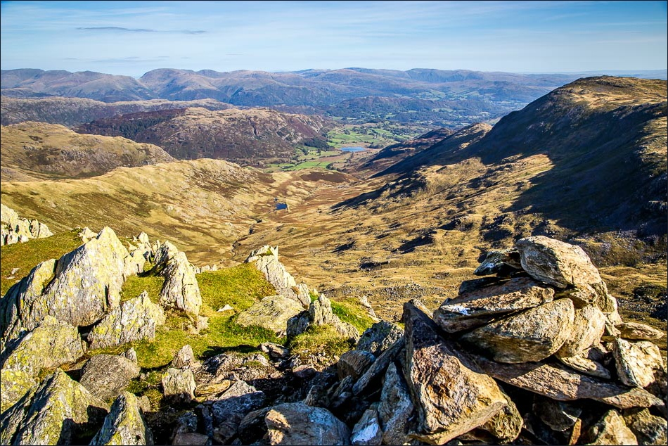
Summit cairn on Swirl How again

On the way to Grey Friar, the final fell of the round

Looking across to Great Carrs

The easy path to Grey Friar

The Scafell Range

Summit cairn of Grey Friar

The Scafells again

The pathless way down to Wrynose Bottom

The ‘path’ shown on the OS map goes left through the fence at this point. Rather than risking a painful injury, I follow the fence across the fell

I follow the line of the fence down to valley level

Gaitscale below

Almost back down to the Wrynose Pass - it just remains to walk back up it

Eller Dubs runs beside the road

Nearly at the top of the pass

Back to the Three Shire Stone
