
Route: Grasmoor and Whiteless Pike
Area: North Western Lake District
Date of walk: 12th January 2018
Walkers: Andrew
Distance: 6.5 miles
Ascent: 2,900 feet
Weather: Sunny at first, becoming cloudier, freezing on tops
The Mountain Weather Information Service had flagged up the tantalising prospect of a cloud inversion today, so I decided on a high level walk. I parked at Cinderdale Common, which I’d passed by on yesterday’s circuit of Crummock Water. The climbing starts immediately. I crossed Cinderdale Beck after a short distance – if the crossing is left too late it would be very hard to get across higher up. I followed the easy path up Lad Hows which seems to be a separate fell when seen from below, and it’s only once height has been gained that it becomes apparent that it’s a curving ridge jutting out of Grasmoor above
There was no sign of the promised cloud inversion, indeed there was no sign of any clouds at all – it was a beautiful sunny morning as I toiled on upwards. Beyond Lad Hows the path becomes steeper and rockier, though there are no difficulties. Eventually I arrived at the summit of Grasmoor. A fierce gale was blowing across the tops and it was bitterly cold up there. I took shelter in the large summit cairn where I added another layer of clothing – making 5 top layers in all
The summit of Grasmoor is a ‘there and back’ affair wherever the approach is from, so I retraced my steps back to the top of the ridge and then descended to the col at Wandope Moss. A 10 minute diversion would have taken me to the top of Wandope but I gave it a miss today and carried straight on along Whiteless Edge. This thrilling up and down ridge soon brought me to the summit of Whiteless Pike. There’s no summit cairn to mark the top of the fell, but there’s no doubting the highest point, and from here there were some tremendous views
I followed the path down Whiteless Breast, quite steep in a couple of places, and when I reached the head of Rannerdale I descended gently down the valley beside Squat Beck and made my way back to Cinderdale Common along a gentle grassy path. In 4 hours I’d only passed 2 other walkers. The promised cloud inversion didn’t materialise but there was some heavenly light showing the North Western Fells at their best and it had been a superb walk
For other walks here, visit my Find Walks page and enter the name in the ‘Search site’ box
Click on the icon below for the route map (subscribers to OS Maps can view detailed maps of the route, visualise it in aerial 3D, and download the GPX file. Non-subscribers will see a base map)

Scroll down – or click on any photo to enlarge it and you can then view as a slideshow

Sign by the small car park at Cinderdale Common

Off we go - Lad Hows is ahead, Grasmoor is out of sight to its left

Looking back to Mellbreak beyond Crummock Water

Waterfall in Cinderdale Beck

Crummock Water and a glimpse of Loweswater beyond

The route reveals itself higher up - the ridge snakes round to the left

A couple of herdies

Looking back - my return route will be along Rannerdale below

Loweswater in the distance and beyond it the Solway Firth and Scotland

Further along the Lad Hows ridge

Looking back along the path

Low Ling Crag jutting out of Crummock Water - I'd walked past it on yesterday's walk

The path becomes a little rockier nearer the top, but there are no difficulties

Looking across to Wandope, which will be my return route

A view back down the path

The eastern fells in the distance

Summit of Grasmoor ahead

Looking back down the path to Whiteless Pike, which I'll cross later

Crummock Water again, and I can just see my car right of picture

Whiteless Pike again

Summit cairn on Grasmoor at 2,791 feet and time to add another layer - it was freezing up here

Looking towards Grizedale Pike and Skiddaw

Crummock Water below

Grasmoor End

On a warmer day I'd have wandered around the summit area but it was too cold today and without ado I retraced my steps

A small cairn marking the short descent to the col at Wandope Moss

Grisedale Pike and Skiddaw

Path to Crag Hill, temptingly close but I turn right at the col below...


Looking back along the partially frozen path

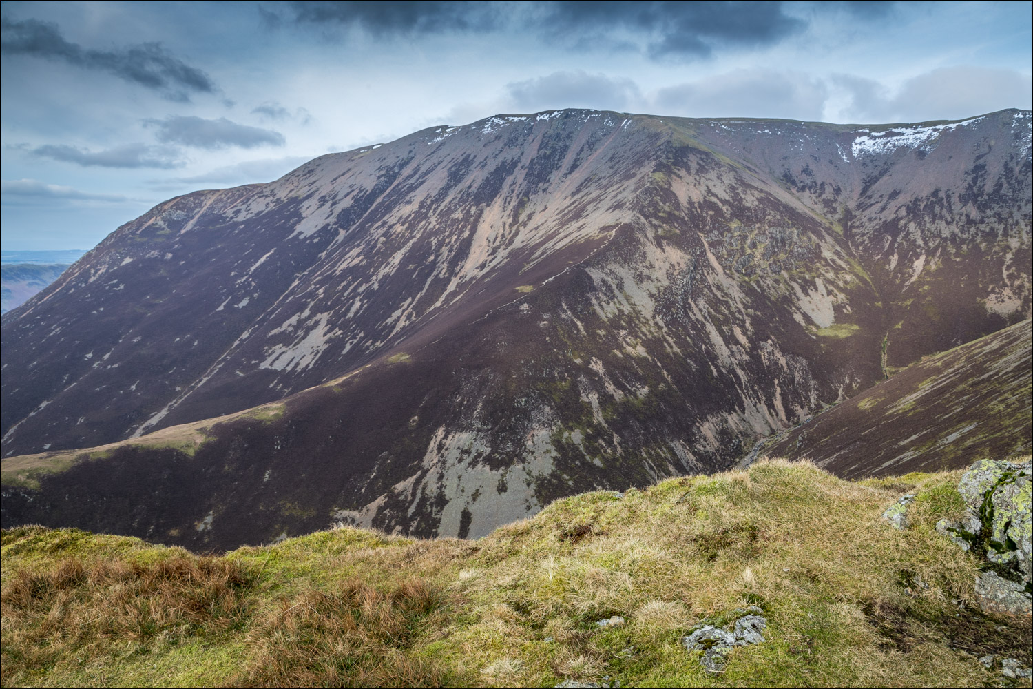
Grasmoor from the cairn at Thirdgill Head Man

View towards Buttermere, with Great Gable in the distance

The path to Whiteless Pike...


The Lad Hows ridge, which I'd walked up earlier

The Eastern Fells

Looking down Third Gill to Knott Rigg and Ard Crags

A view back along Whiteless Edge

The Knott Rigg to Ard Crags ridge again

Crummock Water and Loweswater from the summit of Whiteless Pike

The Lad Hows ridge and Grasmoor

I descend in the direction of Buttermere

Newlands Hause

Knott Rigg and Ard Crags

Descending towards Rannerdale

The knobbly outline of Causey Pike in the distance

Buttermere

Causey Pike and Knott Rigg again

Rannerdale - my route back to the start

Rannerdale Knotts - my path lies below it

Great Gable in the background

Buttermere village below, but I turn sharp right here

The path leading into Rannerdale

Further along Rannerdale

Looking across to Grasmoor

I cross the footbridge over Squat Beck

Path to Cinderdale Common

I arrive back at the start - what a wonderful walk it had been

Red squirrel having breakfast before I set off this morning
