
Route: Borrowdale
Area: Central Lake District
Date of walk: 24th September 2022
Walkers: Andrew and James
Distance: 2.2 miles
Ascent: 300 feet
Weather: Mostly sunny
The woodlands of Borrowdale are the last surviving fragments of an enormous ancient forest that once stretched all the way down the west coast of Britain and Ireland. They receive on average 11 feet of rainfall per year and qualify as temperate rainforest. The valley is one of the most important habitats in Europe for mosses, liverworts and lichens. As a result of their rarity and diversity, the Borrowdale rainforest is protected as a Site of Special Scientific Interest. It also gets international recognition as a Special Area of Conservation (SAC), the highest tier of protection given to habitats in Europe
Today’s short walk explored a small part of the area, Cummacatta Wood. This is one of my favourite woods in the district and I’ve often walked though it, but invariably on the way up to King’s How.
We started from the National Trust Bowderstone car park near the hamlet of Grange. At the northern end of the car park there’s an easily missed gate which leads into Cummacatta Wood. Most folk who park here will head in the opposite direction, towards the famous Bowderstone, so that anyone following this route is likely to enjoy the walk in solitude. After passing through the gate we followed a meandering and gently rising path through the woods, with good views back to Castle Crag. All too soon the woodland section ended near Troutdale Cottages and we joined the Borrowdale road and walked past the village of Grange. There’s a narrow footpath, and the opportunity to divert to the banks of the River Derwent at one point. Beyond Grange we re-entered into Cummacatta Wood and from here retraced our steps back to the start
For other walks here, visit my Find Walks page and enter the name in the ‘Search site’ box
Click on the icon below for the route map (subscribers to OS Maps can view detailed maps of the route, visualise it in aerial 3D, and download the GPX file. Non-subscribers will see a base map)

Scroll down – or click on any photo to enlarge it and you can then view as a slideshow

The entrance to Cummacatta Wood from the Bowderstone car park

We pass by a massive boulder


Looking across to Maiden Moor

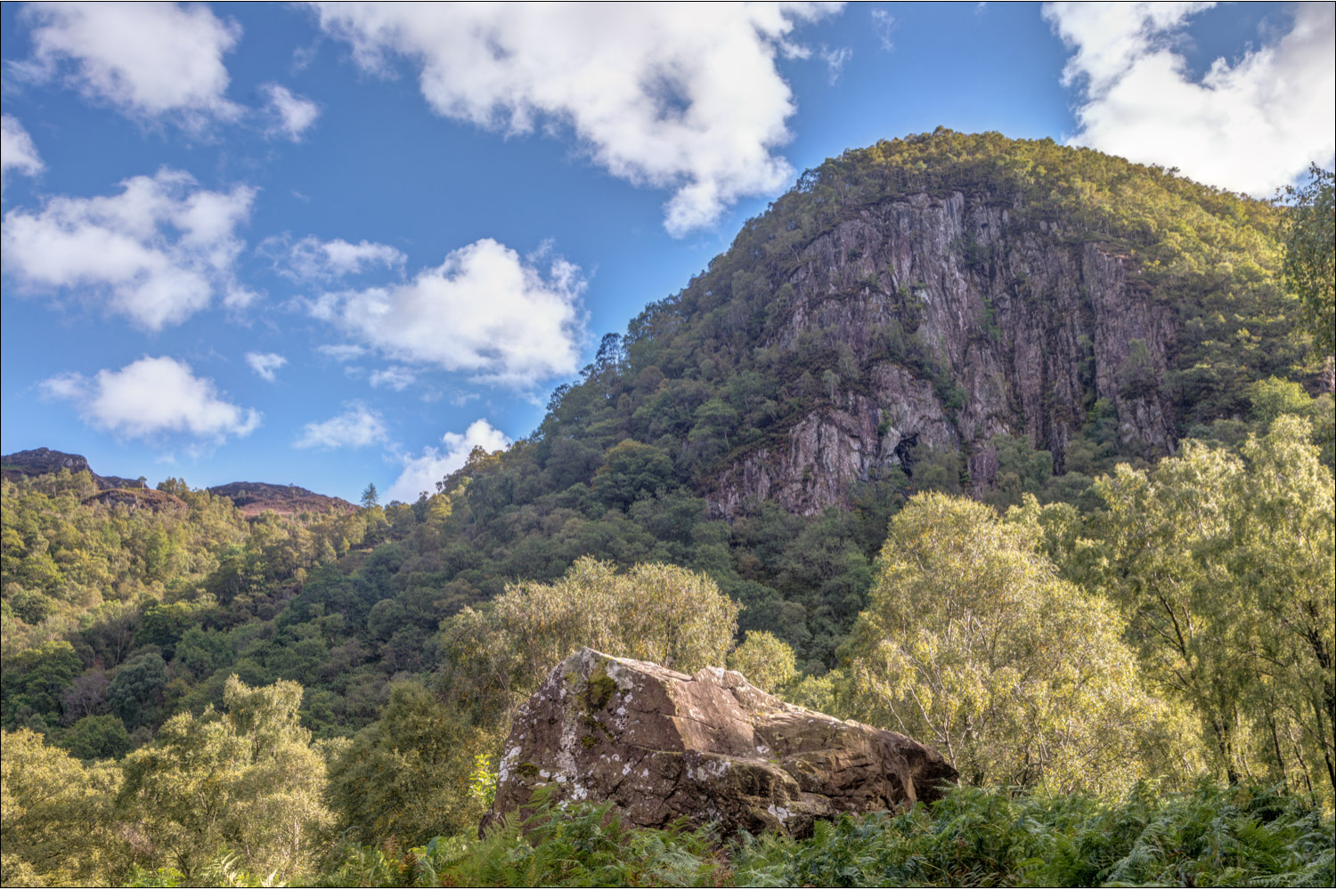
Greatend Crag

Looking back to Castle Crag

We pass below Greatend Crag

Black Crag - you may be able to pick out a couple of climbers

I normally turn right for King's How here, but James and I continue through the wall gap

Black Crag again

We reach the end of the wood, and a view of Skiddaw and Derwent Water opens up

Looking back along Comb Gill

We join a track leading to the Borrowdale road

We follow the path beside the Borrowdale road

We pass by the double arched bridge at Grange

A path next to this old memorial leads back into Cummacatta Wood...


Castle Crag ahead, and a couple of short drone videos from the same spot...
