
Route: Berneray
Area: Outer Hebrides, Berneray
Date of walk: 6th March 2024
Walkers: Andrew and Gilly
Distance: 9.2 miles
Ascent: 500 feet
Weather: Mostly sunny
The island of Berneray lies between North Uist, where we’ve been staying for the last two nights, and Harris, where we’ll be staying tomorrow for a few days. Berneray is more accessible than it once was, being linked to North Uist by a 900 metre-long causeway officially opened by Prince (now King) Charles on the eve of the millennium
Having driven across the causeway we parked at the Berneray Community Centre at the edge of Borve. We follow a sometimes pathless course, guided partly by some wooden marker posts to the Cladh Maolrithe Standing Stone at the top of the modest hill of Beinn a’ Chlaidh. From here we descended to a single track road which we followed around the edge of Loch A Bhaigh. We had some good sightings of common seals along the way. At Port Ludaig we made a short there and back diversion to admire some picturesque old cottages set at the edge of East beach
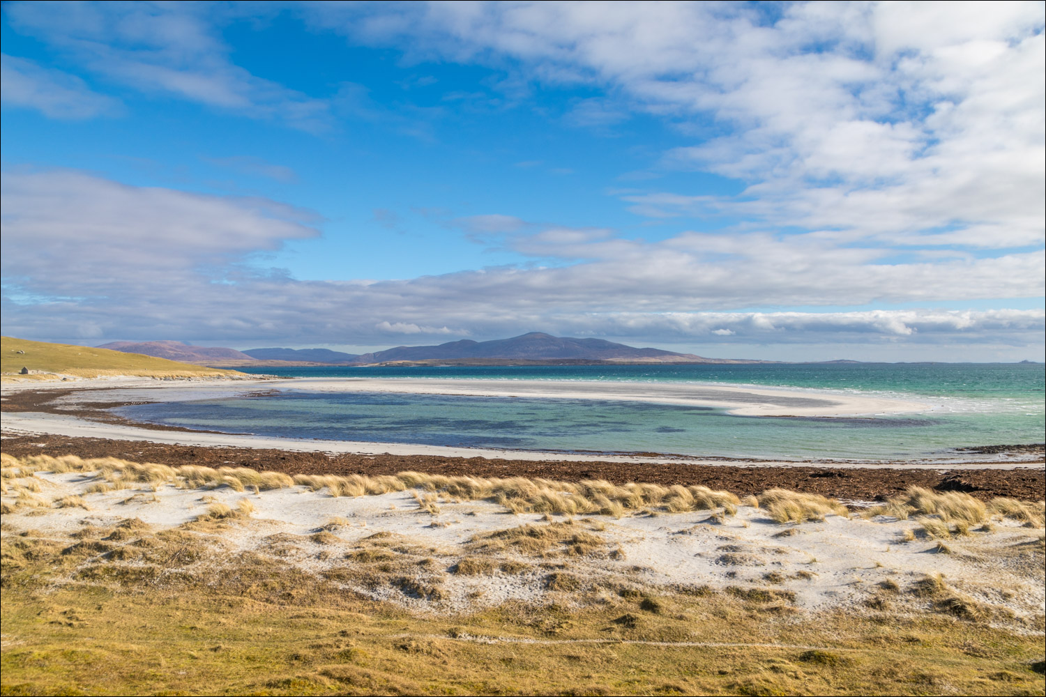
After that worthwhile diversion we returned to the road, passing above East Beach which looked idyllic set in a turquoise sea with the hills of Harris in the distance. We left the road to climb up through a field and past the cemetery. After an easy climb we reached the highest point on Berneray, Beinn Shleibhe. The views were wonderful, especially looking towards Harris and Pabbay
We made an easy descent, aiming for the northern end of West Beach. This is one of the finest beaches in the Hebrides, and is around 3 miles long. We had the place to ourselves as we walked along the perfect shell sand for an hour or so. This was a heavenly section of the walk. Eventually the time came to leave the beach, and this proved to be the only unsatisfactory part of an otherwise perfect walk. The beach is backed by high dunes, some 25 feet tall, and when we arrived at the point of departure there seemed to be no way up. We tried a few times, but it was a case of one step up two steps down. We continued along the beach until we reached an obvious breach in the dunes and here climbed up. We then had to walk back along the top of the dunes to regain our course. This added about 1.5 miles to the walk. Anyone following this route may wish to consider reversing the recommended direction of travel, as descending the dunes would be no issue.
Having got back on course we located the Community Centre, easily recognisable by its red roof, and followed a mostly pathless route towards it, dodging back and forth beween numerous small lochans. Despite the minor navigation issue, it had been a fantastic walk – one of the best
Click on the icon below for the route map (subscribers to OS Maps can view detailed maps of the route, visualise it in aerial 3D, and download the GPX file. Non-subscribers will see a base map)

Scroll down – or click on any photo to enlarge it and you can then view as a slideshow

The start of the walk as we leave the car park at the Berneray Community Centre at the edge of Borgh (Borve) and follow the course of a burn, which we cross via a bridge ahead

Looking back to the Berneray Community Centre as we climb up the easy slopes of Beinn a’ Claidh

The ancient standing stone at Cladh Maolrithe at the top of Beinn a’ Claidh (hill of the graveyard). The stone is buried eight feet into the ground and is said to date back to the Bronze Age, around 2000 BC

Waymarkers assist the descent through otherwise featureless terrain

We descend into Borgh (Borve) to start a lovely coastal section along a quiet road

We pass by the Coralbox at the heart of the scattered community of Borgh

We walk around the harbour of Loch a’Bhaigh, where common (harbour) seals can usually be seen lolling around

A hive of inactivity...


Curlew, one of several

And an oystercatcher, one of many

Traditional crofters' cottages in Borgh...


We continue along the coastal road

We make a short there and back diversion to a hostel run by the Gatliff Trust, which consists of two picturesque thatched and whitewashed cottages overlooking the east beach....


A redevelopment opportunity

East Beach

We return to the road, with views across to Harris.

We pass beside East Beach


At the end of the beach (and the road) we pass by Sandhill Farm and head for the grassy slopes of Beinn Ghainche....


We pass by the old cemetery, which was used as a burial site for countless generations

Looking back along our path as we climb up Beinn Shleibhe

OS trig point at the summit of Beinn Shleibhe, looking towards the island of Pabbay

The view towards Harris

We start the easy descent to the coast

Looking inland to Loch Bhrusda

We descend to West Beach

We arrive at Tràigh Iar (West Beach). The beach is around 3 miles long with perfect shell sand backed by high dunes, and looks out to Pabbay and the open Atlantic...


Somewhere around this point we knew we had to climb up the dunes to walk back to the start. Easier said than done as we failed to gain a foothold in the soft sand

Eventually we found a break in the dunes which made for an easy exit - but this added some distance to the walk

The Berneray Community Centre is easily recognisable by its red roof but it's not possible to cross the intervening terrain, so we had to walk along the top of the dunes for a while

Eventually we drew level with our target and walked across the machair (mostly pathless) until we arrived back at the start

Dawn the next day, and a short walk from our base at Langass Lodge North Uist to the Pobull Fhinn standing circle
Follow the link for more walks in Scotland (44)
