
Route: Aydon Castle
Area: Northumberland
Date of walk: 7th August 2019
Walkers: Andrew and Gilly
Distance: 6.1 miles
Ascent: 700 feet
Weather: Mostly sunny
Starting from our base in the ancient village of Corbridge, which dates back to Roman times and is worth a visit in its own right, we headed north through the attractive streets. Beyond the village we joined a path which is bissected by the busy A69, and in order to cross this it’s necessary to follow the path above the road, cross a footbridge, and then walk back along the other side – a 15 minute detour which advances progress along the route by a matter of a few yards
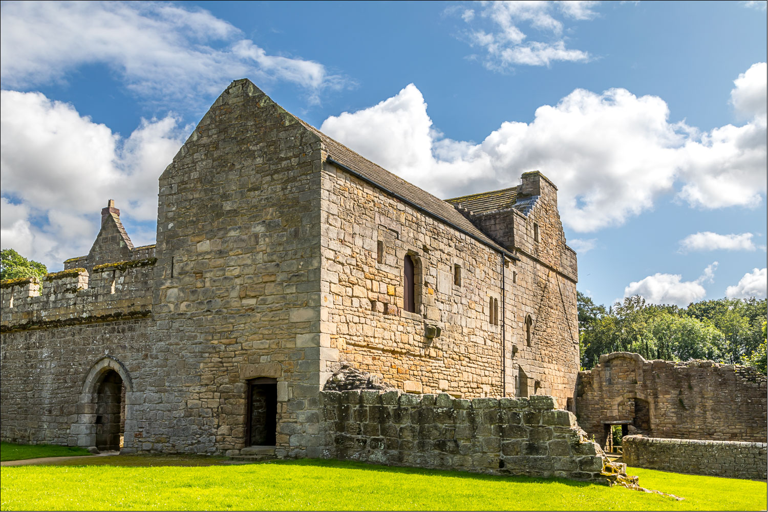
This minor irritation was soon forgotten as we followed a path across the fields and into some woodland. After crossing Cor Burn at the bottom of the woods we climbed up out of them to arrive at Aydon Castle. The castle is owned by English Heritage. It is almost completely intact, and is one of the finest and most unaltered examples of a 13th century English manor house. It has a long and chequered history. Originally built as an undefended residence, it was fortified on the outbreak of Anglo-Scottish warfare. It was then pillaged and burnt by the Scots in 1315, seized by English rebels two years later, and again occupied by Scots in 1346. The castle later became a farmhouse in the 17th century and was lived in up until 1966
After wandering around this atmospheric place for a while it was time to be on our way and we continued heading north, following a country lane in the direction of Halton. We made a 5 minute there and back diversion to see Grade I Listed Halton Castle, (which is privately owned and cannot be visited) and then started the return journey back to Corbridge. This was entirely along country lanes, but they were virtually traffic free and there were good views across the surrounding countryside along the way
Click on the icon below for the route map (subscribers to OS Maps can view detailed maps of the route, visualise it in aerial 3D, and download the GPX file. Non-subscribers will see a base map)

Scroll down – or click on any photo to enlarge it and you can then view as a slideshow

The day before the walk, a red squirrel in the Lake District

Next day, on the other side of the country, the start of today's walk from the centre of the unspoilt village of Corbridge. We first make a minor detour to the 17th century bridge...

Looking west along the River Tyne from the bridge...

...and now looking east

We walk back through Corbridge

We leave the village streets here to join Deadridge Lane...


Looking back over the Tyne Valley

In order to cross the busy A69, we have to walk along one side of it, cross a roadbridge further along, and then walk back along the other side to rejoin our path

We follow this path through open countryside

At first we mistook the castle in the distance for Aydon Castle, but in fact it's nearby Halton Castle

We approach some woodland near Aydon Castle

The path takes us through the woods

We cross the footbridge over Cor Burn

Entrance to Aydon Castle, which is sited next to the woodland

Aydon Castle

Fireplace in the kitchen, dating back to the 14th century

The courtyard

We leave the castle and continue heading north along a quiet country lane

On reaching the furthest point of the walk we make a short there and back detour to see Halton Castle, which is privately owned and cannot be visited

We turn back towards Corbridge

The remainder of the walk is along quiet country lanes

Views over the Tyne Valley as we progress...


We cross Cor Burn for the second time

At the edge of Corbridge we pass by the bottle shaped kilns of Walker's Pottery, which closed in 1914. These are now Scheduled Ancient Monuments...

The pottery opened in 1840 and produced pipes, roofing tiles, bricks and other building materials

We arrive back in Corbridge

The end of the walk as we pass by the Black Bull (which we can recommend)
Follow the link for more walks in Northumberland (29)
