
Route: Maenporth to Helford Passage
Area: Cornwall
Date of walk: 14th October 2025
Walkers: Andrew and Gilly
Distance: 5.2 miles
Ascent: 600 feet
Weather: Dull and overcast
For the third day in a row we plotted a route which would take us along another section of the long distance South West Coast Path. We parked in a public car park just a few feet from the beach at Maenporth and walked to the southern end of the beach. A narrow undulating path took us above the cliffs. Rosemullion Head soon appeared in the distance. We dropped down to Bream Cove before climbing up again and walking around the promontory of Rosemullion Head
We then continued beside the coast, making a brief detour to the ancient Church of St Mawnan, which is on the headland where the Helford River meets the sea. Situated high above mouth of the Helford River, the church is a navigational aid to vessels entering the river. Beyond Mawnan we continued beside the water, now the estuary of the River Helford and no longer the Atlantic Ocean. We arrived at the small hamlet of Durgan which has a small beach. At Durgan it’s necessary to detour briefly inland and follow a wide path up a gully and back down the other side. The OS map suggests that a riverside path exists from Durgan, but this is no longer the case. A visit to Glendurgan Garden can easily be made from here
On regaining the coastline we made our way to our destination, Helford Passage, in good time to enjoy the hospitality of the famous Ferry Boat Inn, which dates back 300 years and enjoys a lovely view across the Helford. This was a perfect end to a wonderful walk, despite the indifferent weather. It should be borne in mind that this is a linear walk and arrangements are needed in order to get back to the start. In our case we met friends Phil and Denise who took us back. Anyone else following this walk can either retrace their steps, use two cars, or call for a taxi
Click on the icon below for the route map (subscribers to OS Maps can view detailed maps of the route, visualise it in aerial 3D, and download the GPX file. Non-subscribers will see a base map)

Scroll down – or click on any photo to enlarge it and you can then view as a slideshow

Maenporth beach - the car park is just a few feet away from this spot

We walk across to the other side of the beach

At the far end of the beach we join the South West Coast Path and climb up to the top of the cliff

Looking across Falmouth Bay...


Rosemullion Head, which we'll walk around later

A short diversion to the beach at Bream Cove

We continue towards Rosemullion Head...


We walk to the far end of Rosemullion Head,...


We walk back along the other side of the headland

Our path will take us above the cliffs on the right...


We enter a small woodland known as Mawnan Glebe

We climb out of the woods and make a short there and back diversion to the church of St Mawnan

We return to Mawnan Grebe and follow the path through an atmospheric section of woodland


A seaside walk becomes a riverside walk as we arrive at the mouth of the Helford River

Looking along the Helford River

We descend to the stony beach at Porthallock

We pass around an old shed on the beach

We pass by Bosloe House

A short woodland section

We arrive at a quiet lane, which we follow into Durgan

The hamlet of Durgan

The small shingle beach at Durgan, looking across the Helford River

We climb up a gully out of Durgan, only to have to descend back down near its head. The OS map suggests that it's possible to continue beside the river, but that's no longer the case

The National Trust garden of Glendurgan can be accessed from the path, but we continued along the bank of the Helford River

Polgwidden Cove ahead


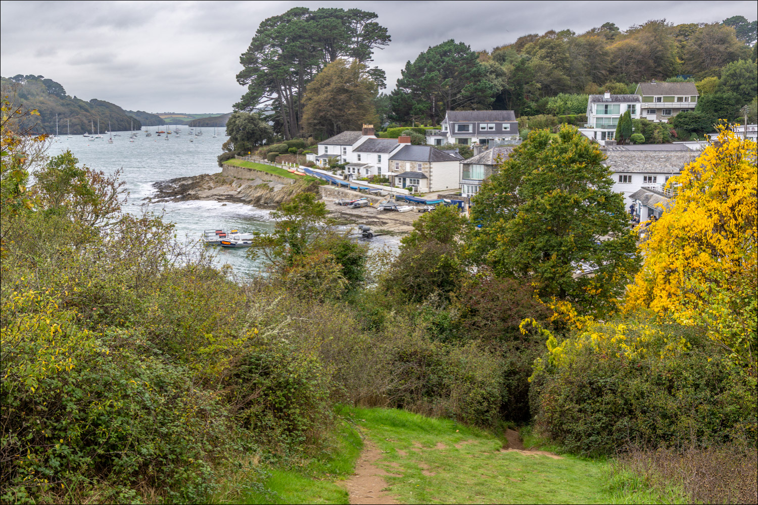
Beyond the cove we continue to Helford Passage


Our destination, Helford Passage, comes into view

We arrive at the famous Ferry Boat Inn where we meet up with friends Phil and Denise, who have taken a different route here

Phil and Denise will give us a lift back to the start - cheers you two

It had been a great walk despite the dull conditions. Later on, a lovely end to the day back at our base in Flushing
