
Route: Lelant to St Ives
Area: Cornwall
Date of walk: 15th October 2025
Walkers: Andrew and Gilly
Distance: 6.6 miles
Ascent: 400 feet
Weather: Cloudy
Having completed three walks on the south coast of Cornwall (St Anthony Head, Lizard Point and Helford Passage), we decided to explore further afield and visit the north coast of the county. We drove to the archetypal Cornish fishing village of St Ives and parked in the railway station car park (charges apply). There’s a regular service to St Erth which stops on request at Lelant, enabling a linear walk to be made from there. It’s a good idea to seek out the guard as the train will not stop at Lelant unless requested. It’s possible to start the walk from St Ives, but it’s far better to follow this walk in the direction described as it leaves time to explore St Ives at the end of the walk with no fear of missing the train back
The railway line was originally built in order to make markets more accessible to the local fishing industry, but this also opened up St Ives to the fast developing tourism of the late 19th century and the village is now one of the most visited places in Cornwall. We were here out of season, so crowds weren’t an issue
After an enjoyable 10 minute train journey we disembarked at the small station in Lelant and joined the South West Coast Path which took us above the Hayle Estuary, passing by the church of St Uny and St Anta. The path then headed over the dunes and above the vast expanse of Porth Kidney Sands. We detoured from the South West Coast Path here and walked down the dunes to follow the beach. The headland of Clarrack Gladden prevents further progress along the sands and we climbed back up the dunes to regain our original path
After walking around the headland we arrived at the sandy beach of Carbis Bay, overlooked by a very large hotel and numerous expensive looking houses. Beyond Carbis Bay our destination, St Ives, came into view. The walk could be ended at the railway station and shortened to about 4.5 miles. We preferred instead to explore St Ives and so continued beside its beaches and harbour as far as St Ives Head. We turned back here and returned to the start through narrow winding streets full of small independent shops and art galleries
Click on the icon below for the route map (subscribers to OS Maps can view detailed maps of the route, visualise it in aerial 3D, and download the GPX file. Non-subscribers will see a base map)

Scroll down – or click on any photo to enlarge it and you can then view as a slideshow

Porthminster Beach St Ives seen from the railway station as we await our trail to Lelant

A few minutes later we disembark at Lelant railway station to start our walk

From the station platform, looking across to Hayle on the far side of the Hayle Estuary

After a short walk hrough the outskirts of Lelant we visit the Church of St Uny

We head down to the sands, with Godrevy Island in the distance

We arrive on Porth Kidney Sands

The River Hayle flowing into St Ives Bay

The South West Coast Path crosses the dunes above Porth Kidney Sands...

The railway line which had brought us here is on our left

We prefer to walk along the beach and leave the official path, which continues along the top of the dunes

The headland of Carrack Gladden prevents further access along the beach, so we climb back up the dunes to regain the official path.

Views back along Porth Kidney Sands as we ascend...


Back on the South West Coast Path, as confirmed by the marker post

We walk over the headland of Carrick Gladden

Carbis Bay

Our destination, St Ives, appears in the distance beyond Carbis Bay

We descend to the beach...


We climb up and cross a bridge over the railway line

We walk above the beach and then through the village streets, which are suburban in character

After a while we arrive at Porthminster Beach and St Ives, looking towards its harbour. The railway station is nearby and the walk could be ended here, but we preferred to explore St Ives

A traditional Cornish lugger sails by

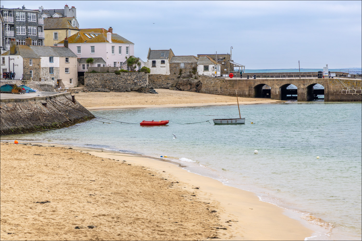
St Ives Harbour

We head towards the harbour


When in Rome. We overheard someone remarking that all the Cornish pasty shops in St Ives are 'award winning'. We can vouch for this one

The closest I've ever been to a turnstone, no doubt in search of pasty crumbs

We continue around the seafront...


Looking back across St Ives Bay...


We walk above Bamaluz Beach the then follow a path up to St Ives Head

St Nicholas Chapel, in a wonderful position at the end of the headland

We descend down the other side of the headland, with views of Porthmeor Beach

Lower down, a kestrel

Porthmeor Beach below

We pass by the beach and head back into the main part of the town

We wander through the narrow streets of St Ives and back to the railway station car park to end an enjoyable walk
