
Route: Howtown to Glenridding along the shore of Ullswater
Area: Eastern Lake District
Date of walk: 18th April 2018
Walkers: Andrew and Gilly
Distance: 7.2 miles
Ascent: 1,000 feet
Weather: cloudy at first, gradually clearing. Very warm
Nearly 30 years ago we first walked this route along the shore of Ullswater with our daughter, then aged 3, and carrying our baby son in a backpack. Since then we’ve followed the same route on numerous occasions – it’s a classic low level walk, even though numerous ups and downs along the way build up to a total of 1,000 feet of ascent. In Wainwright’s opinion the lakeside path is ‘the most beautiful and rewarding walk in Lakeland’. The linear route is made possible by the Ullswater Steamers, an award winning Lake District attraction which has been operating for over 150 years
We drove over to Glenridding in time to board the midday sailing of M.Y Raven, first launched in 1889. The boat trip is an adventure in itself, passing through some of the finest scenery in Lakeland. After 30 minutes or so we disembarked at Howtown to start today’s walk
Navigation is a simple affair and the maps page is hardly needed – just keep the lake on your right. We followed the waymarked Ullswater Way, passing around the foot of Hallin Fell and walking around Sandwick and its bay. Beyond Sandwick our progress was delayed by a new attraction on the the route – the Lowther Team Room, a perfect place to rest weary legs and enjoy a cup of tea and some guilt free cake
Suitably refreshed we continued along the undulating path until we reached Side Farm. We left the main path here to walk through the farm, following a track across the head of Ullswater to the outskirts of Patterdale. From here we followed the pavement back to the start of a wonderful walk which I’d happily repeat tomorrow
For other walks here, visit my Find Walks page and enter the name in the ‘Search site’ box
Click on the icon below for the route map (subscribers to OS Maps can view detailed maps of the route, visualise it in aerial 3D, and download the GPX file. Non-subscribers will see a base map)

Scroll down – or click on any photo to enlarge it and you can then view as a slideshow

A pair of red squirrels before we set off for the east of the district...


Aboard the M.Y Raven as we leave Glenridding Pier

The ship sails by the rugged coastline which we'll be walking along later

Another of the fleet passes by as we arrive at our destination, Howtown

The route follows the Ullswater Way, a wonderful long distance circuit of the lake which we completed last year


We walk round Geordie's Crag


Kailpot Crag

Looking back towards Arthur's Pike and Barton Fell

Sheffield Pike near the head of Ullswater


Our route will take us around Place Fell ahead

Looking back

A view across the lake to Gowbarrow Fell

Approaching Sandwick

We cross the footbridge over Sandwick Beck

Looking back to Hallin Fell

Foot of Ullswater and the Pennines beyond

We stop for refreshments here - the cafe, which is excellent, has no road access


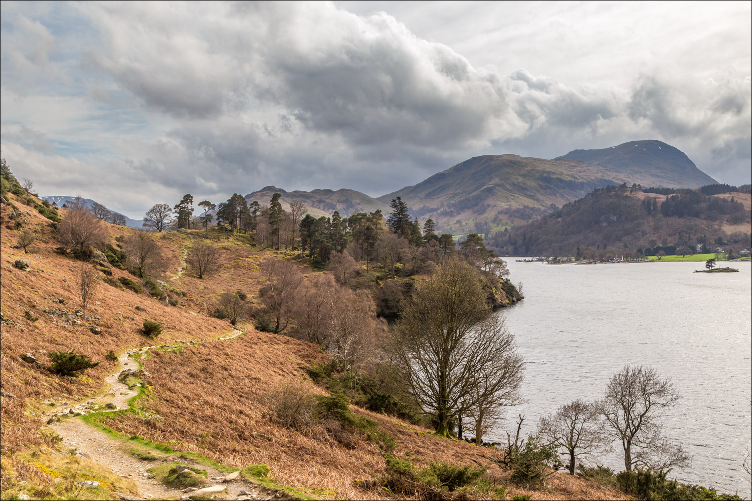
A view back along the lake


Gowbarrow Fell


Zooming in to two walkers on the path ahead

Glenridding Dodd

Arnison Crag

Woodland above Devil's Chimney

Glenridding comes into view


We pass by an old barn

We have to walk beyond the lake to the path which crosses its head

This is where we turn off - Side Farm

New born lambs

St Patrick's Church Glenridding...


Glenridding Pier ahead, and the end of a wonderful walk
