
Route: Tarn Hows
Area: Southern Lake District
Date of walk: 25th October 2013
Walkers: Andrew and David
Distance: 6.3 miles
Ascent: 800 feet
We parked in the National Trust car park at Tom Gill and walked up along the gill past some attractive waterfalls. This took us to Tarn Hows, which looked stunning in the autumn conditions
We walked round the tarn and then into woodland. At Boon Crag Farm we made a short diversion to see the head of Coniston Water, then retraced our steps back to the farm
The return leg via Yewdale and through Tarn Hows Wood was beautiful
The weather forecast had been for rain in the morning, with a 3-4 hour interval of clear weather, followed by more rain. We based our walk on this prediction and it was spot on – by the time we got back to the car it was pouring. Thanks to the weatherman we’d enjoyed a walk in stunning surroundings and managed to keep dry
For other walks here, visit my Find Walks page and enter the name in the ‘Search site’ box
Click on the icon below for the route map (subscribers to OS Maps can view detailed maps of the route, visualise it in aerial 3D, and download the GPX file. Non-subscribers will see a base map)

Scroll down – or click on any photo to enlarge it and you can then view as a slideshow

We followed the gill upstream


Winnie in paradise


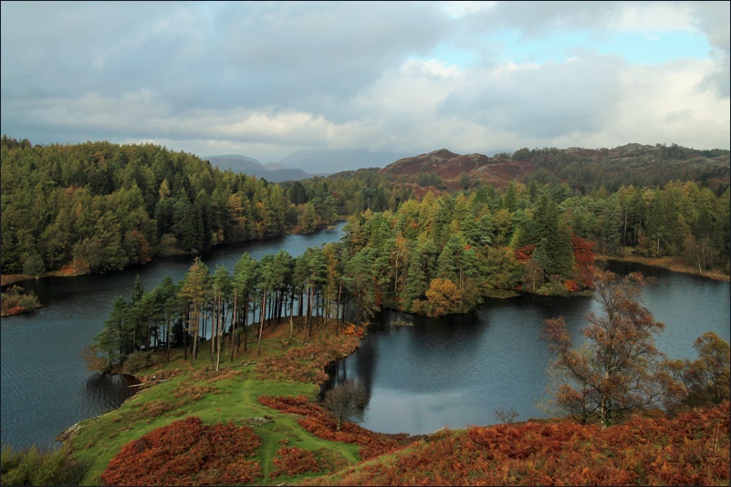
Tarn Hows

The path round Tarn Hows


Northern end of Tarn Hows


With reluctance we left the tarn, and walked through Hill Fell Plantation


Looking towards the Yewdale Fells

The head of Coniston Water


On the way to Tarn Hows Wood

Yewdale Beck

The car park at Tom Gill

Exactly as forecast the heavens opened, but we’d made it back just in time. It had been a wonderful afternoon
