
Route: Tarn Hows and Coniston
Area: South Western Lake District
Date of walk: 26th August 2015
Walkers: Andrew
Distance: 8.7 miles
Weather: Cloudy with bright spells, improving, strong winds
Tarn Hows and Coniston are two contrasting bodies of water – the former is a small reservoir and the latter is the 3rd largest lake in the district
I parked in the National Trust car park at Glen Mary and followed the path uphill beside Tom Gill
The waterfalls were in good form as a result of some torrential rain earlier in the day. At the top of the climb I emerged onto the footpath which encircles Tarn Hows – a popular place thanks to its beauty and accessibility
After walking round the tarn there followed a very short road section before I joined a path leading through woodland to Coniston Water. I walked round the head of the lake and then into the vlllage before joining the Cumbria Way, which took me through some beautiful countryside back to the start
It was a wonderful low level walk (though it involved about 1,200 feet of ascent) and I’d happily repeat it tomorrow
For other walks here, visit my Find Walks page and enter the name in the ‘Search site’ box
Click on the icon below for the route map (subscribers to OS Maps can view detailed maps of the route, visualise it in aerial 3D, and download the GPX file. Non-subscribers will see a base map)

Scroll down – or click on any photo to enlarge it and you can then view as a slideshow

There was heavy rain on the morning of the walk, so I took some photos of the local wildlife before setting off…


Nuthatch…

…with nut

Start of the walk from the National Trust Glen Mary car park

Climbing uphill beside Tom Gill waterfalls…


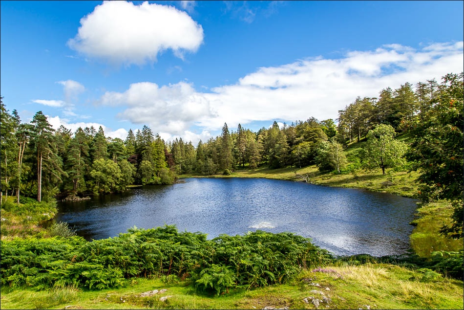
The path emerges by the shore of Tarn Hows and I follow the easy track around the lake


So money does grow on trees after all


The path gains height beyond this point, giving lovely views over Tarn Hows and the surrounding fells…


A last lingering look back over the tarn as I climb up to the quiet road, which I follow for a short distance

I follow the bridleway to Coniston

Hill Fell Plantation


Out of the woods now and approaching Coniston

Head of Coniston Water

I follow the lakeshore path to Water Head Pier


Walking through Coniston village

St Andrew’s Church

I leave the village and join the Cumbria Way back towards Tarn Hows

Looking back to Coniston Water from High Guards

An artfully constructed dry stone wall

Looking across to the Yewdale Fells


Idyllic countryside every step of the way - and I only saw two or three other folk on the return leg

Yewdale Beck

Tarn Hows Cottage in front of heather clad Holme Fell

Almost back to the start
