
Route: Swineside Knott
Area: Eastern Lake District
Date of walk: 27th March 2016
Walkers: Andrew Gilly and Tom
Distance: 6.0 miles
Ascent: 1,300 feet
Weather: Some bright spells but often appalling with gales, hailstorms, rain and sleet
On this Easter Sunday we decided to visit a quiet area in the eastern fells in order to avoid the bank holiday crowds. We parked near the Royal Hotel in the village of Dockray and walked out onto Watermillock Common, taking a faint path uphill to the col between Bracken How and Round How. Whilst following the wall along the flanks of Common Fell we had our first dose of bad weather – a hailstorm swept in, stinging our faces and causing us to take shelter behind the wall. We’d brought full winter gear and it was all needed, as the wind chill factor was considerable
The views of Ullswater from the path to Swineside Knott were superb, though were often lost in the weather. Eventually the path headed away from the lake in the direction of Glencoyne Head and we descended a very juicy path down Watermillock Common to the remote hamlet of Dowthwaitehead, where there was an improvement in the weather. From there we followed the valley path back to the start
The photos which follow don’t do this walk full justice as the camera had to be stowed away much of the time. I’d like to return here in better conditions as the scenery is beautiful throughout
For other walks here, visit my Find Walks page and enter the name in the ‘Search site’ box
Click on the icon below for the route map (subscribers to OS Maps can view detailed maps of the route, visualise it in aerial 3D, and download the GPX file. Non-subscribers will see a base map)

Scroll down – or click on any photo to enlarge it and you can then view as a slideshow

Before the walk, a cock pheasant spots the squirrel food..

…much to the consternation of this red squirrel


Later on, the path leading out onto Watermillock Common at the start of the walk

Looking back to Dockray

We arrive at the wall which will be our guide as far as Swinside Knott

Looking back along the wall to Gowbarrow Fell

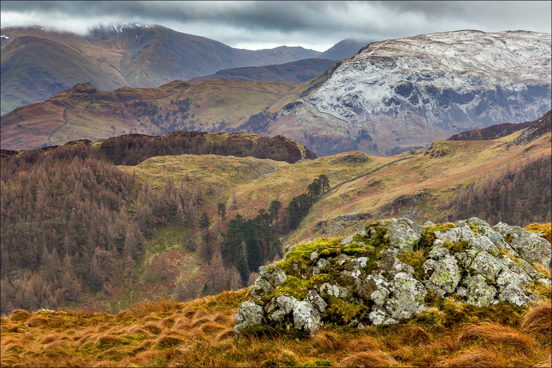
…and looking ahead to Swineside Knott, with Sheffield Pike beyond

Ullswater and Hallin Fell

More views of Ullswater between the frequent showers of hail and sleet…


Another hailstorm heading our way

Glencoyne Wood as we round the corner beyond Swineside Knott

Glencoyne Head from Brown Hills

Tom with Bonnie as we walk over the sodden terrain leading to Dowthwaitehead

Looking along the Dowthwaite Valley, which will be our return route to Dockray


Dowthwaite Crag above Dowthwaitehead

Aira Beck, which will cascade spectacularly down Aira Force further downstream

Approaching Dowthwaitehead

We cross the footbridge over Aira Beck


Old stone buildings in the hamlet of Dowthwaitehead…


We follow the path along the valley floor


Lucy’s Wood

A short road section back into Dockray, and to the left is the col we’d walked over earlier

