
Route: Rye Harbour Nature Reserve
Area: East Sussex
Date of walk: 11th June 2025
Walkers: Andrew and Gilly
Distance: 2.0 miles
Ascent: 150 feet
Weather: Sunny and warm
Having walked around the medieval streets of Rye earlier in the day, we drove over to nearby Rye Harbour. This is a village, a separate settlement from Rye town and is located about two miles downstream, near the outflow of the River Rother into Rye Bay and the English Channel. The purpose of our visit was to walk around Rye Harbour Nature Reserve, managed by Sussex Wildlife Trust. The Reserve is one of the largest and most important wildlife sites in England, set in a coastal and wetland landscape and home to more than 4,355 species of plants and animals including 300 which are rare or endangered
There’s a choice of routes here, the longest being about 6 miles. We didn’t have time for the longer walk today (having driven 250 miles to get here and having walked around Rye earlier), so we contented ourselves with a short introductory walk, starting from the free car park at the edge of the Reserve. We soon arrived at the wonderful Discovery Centre, where it’s possible to enjoy a cup of tea and a slice of cake while gazing over the saltmarshes using the complimentary binoculars provided – birdwatching in luxury
We continued around the Reserve, detouring to several bird hides along the way. Our visit coincided with peak breeding season, and we had good sightings of young oystercatchers, tern and gulls. It was wonderful too to see numerous avocets
The landscape is very flat and doesn’t lend itself to landscape photos, so those which follow are mostly of the birdlife. This isn’t to suggest the the landscape is unattractive, it’s a beautiful place in its own way, made magical by the rare and endangered wildlife which it supports
For other walks here, visit my Find Walks page and enter the name in the ‘Search site’ box
Click on the icon below for the route map (subscribers to OS Maps can view detailed maps of the route, visualise it in aerial 3D, and download the GPX file. Non-subscribers will see a base map)

Scroll down – or click on any photo to enlarge it and you can then view as a slideshow

Entrance to Rye Harbour Nature Reserve

We visit Rye Harbour Discovery Centre

View from the Discovery Centre, where binoculars are provided

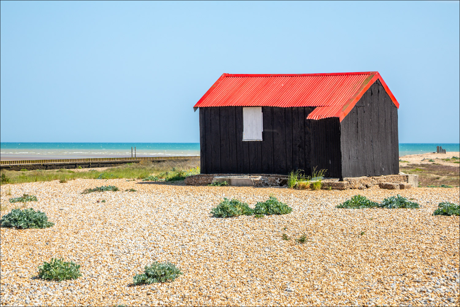
There are various possible walking routes around the reserve, all easy to follow. We head towards Rye Bay. Just before reaching the red roofed hut we visit Gooders Hide


The hide overlooks a saltmarsh pool and we had some good sightings from here. This is an avocet...


Oystercatcher with its mad red eye...

...and with its chick

Redshank


A kestrel hovering above

A well known landmark in these parts - the Red Hut, once used for the storage of fishing gear

Camber Sands on our left

We pass by one of several remaining Second World War pillboxes

The mouth of the River Rother as it flows into Rye Bay and the English Channel


A little egret hunting for food


Looking along the shingle beach towards Dungeness

A black-headed gull (whose head is brown in summer) with its young...


Little grebe

Common terns...


That's all we had time for today, so we head back to the start of a very worthwhile and enjoyable visit
Follow the link for more walks in East Sussex (6)
