
Route: Rannerdale Knotts
Area: Western Lake District
Date of walk: 12th November 2022
Walkers: Andrew and Gilly
Distance: 3.0 miles
Ascent: 1,100 feet
Weather: Some distant sunny patches, but mostly heavy cloud
Rannerdale Knotts is one of the smallest lakeland fells, standing at the modest height of 1,160 feet. What Rannerdale Knotts lacks in height it more than makes up for in its rugged mountainous character and the beauty of its surroundings
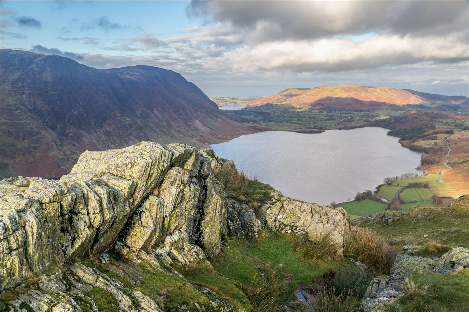
We made an early start and parked in the small National Trust car park at Hause Point. From here the ascent starts almost immediately. Within a few minutes there were lovely views over Crummock Water and Buttermere. It’s a steep climb but made much easier in recent years thanks to the addition of a rock staircase. We were soon on the north top enjoying good views over Crummock Water
We set off along the knobbly summit ridge, clambering down a slightly awkward gully at one point, before reaching an easier grassy section known as Low Bank. At the end of the ridge there’s a choice of return routes – either back along Rannerdale or along the Crummock Water side. We opted for the latter today, as the valley route has restricted views. Such a choice would be unthinkable in May, when the famous Rannerdale bluebells are in flower. The sight – and scent – of huge swathes of these flowers growing on open fellside is unmissable
We descended towards Buttermere down the easy grassy slopes and then joined a narrow path which runs at mid-level above Great Wood, giving good views over Crummock Water along the way. The path is quite faint and little used, and it can be hard to locate when the bracken is high. The key to navigation is to keep Grassgarth Coppice, Great Wood and the post and wire fence close by on your left. Beyond the wood we continued to traverse the fellside, and near Hause Point we met up with our original ascent path. From here we retraced our steps back to the start
For other walks here, visit my Find Walks page and enter the name in the ‘Search site’ box
Click on the icon below for the route map (subscribers to OS Maps can view detailed maps of the route, visualise it in aerial 3D, and download the GPX file. Non-subscribers will see a base map)

Scroll down – or click on any photo to enlarge it and you can then view as a slideshow

The start of the walk from the car park near Hause Point - the climb starts immediately

An early view back over Crummock Water

Looking up to our destination, Rannerdale Knotts

Looking back down our path to Mellbreak on the far side of Crummock Water

Buttermere comes into view beyond the head of Crummock Water

A holly tree clinging to the rock face

Recent heavy rain created a series of small waterfalls in the steep rock staircase

A glimpse of Loweswater, and sunlight on Low Fell...


Looking back down our path to Low Ling Crag on the far side of Crummock Water

A view north past Grasmoor

Dramatic rock scenery as we gain height...


The rocky north summit of Rannerdale Knotts

Sadly the light was rather murky looking towards Buttermere

We set off along the knobbly ridge

Buttermere below

Further along the ridge...


Looking back to Rannerdale Knotts

We reach an easier grassy section known as Low Banks. It's possible to return via Rannerdale on the left (which is a must in bluebell season) but we preferred to return via the other side of the fell, so followed the path on the right

We descend towards Grassgarth Coppice and Crummock Water

Waterfalls in Sourmilk Gill beyond Buttermere

We leave the obvious path to Buttermere and follow a fainter one - the key to this section of the route is to follow the tree line above Grassgarth Coppice

Pines trees framing Sourmilk Gill

A lone herdwick making its way up the path from Buttermere

Haystacks on our left above the woodland...


Looking across to the head of Crummock Water

We follow the grassy path as it contours around the lower flanks of Rannerdale Knotts

Looking back to Wood House at the head of Crummock Water, with Fleetwith Pike in the background

We rejoin our original path above Hause Point and descend back to the start

Later that day, a red squirrel in the garden
