
Route: Rannerdale Knotts
Area: Western Lake District
Date of walk: 18th December 2021
Walkers: Andrew and James
Distance: 3.0 miles
Ascent: 1,100 feet
Weather: Mist in the valley, but sunny with a cloud inversion higher up
In view of a negative weather forecast we hadn’t planned a walk today. However a glance through the window suggested that the forecast was wrong. Mist in the valley persuaded James and I to drive over to Crummock Water in search of photo opportunities. At valley level the mist was too thick, but it was clear that if we could get to higher ground there would be the possibility of a cloud inversion. We parked in the small National Trust car park at Hause Point (no fee) and climbed up the path leading to Rannerdale Knotts. At this stage we hadn’t decided to climb the fell, but within 5 minutes or so we were above the clouds and enjoying wonderful views, as well as the phenomenon of a brocken spectre
At this point we decided to climb to the top of the fell and take advantage of the wonderful conditions. Rannerdale Knotts is one of the smallest lakeland fells, standing at the modest height of 1,160 feet. What Rannerdale Knotts lacks in height it more than makes up for in its rugged mountainous character and the beauty of its surroundings. It’s a short but quite steep climb, made easier these days by the addition of a rock staircase. We were soon on the north top enjoying views of a sea of clouds along Lorton Vale and the Buttermere Valley
After admiring the views we carried on along the knobbly summit ridge known as Low Bank. At the end of the ridge there’s a choice of return routes: either back along Rannerdale, or along the Crummock Water side. We opted for the latter today, as the valley route has restricted views. Such a choice would be unthinkable in May, when the famous Rannerdale bluebells are in flower. The sight – and scent – of huge swathes of these flowers growing on open fellside is unmissable
We descended towards Buttermere down the easy grassy slopes to pass over High House Crag. This brought us to the edge of Buttermere village. Back down to valley level the mist was thick and there were no views. We decided to take the quickest way back, which was along the Buttermere road. The road can be avoided by following a path above it, but we saw no point in this in view of the mist. It had been a red letter day, one of the best
For other walks here, visit my Find Walks page and enter the name in the ‘Search site’ box
Click on the icon below for the route map (subscribers to OS Maps can view detailed maps of the route, visualise it in aerial 3D, and download the GPX file. Non-subscribers will see a base map)

Scroll down – or click on any photo to enlarge it and you can then view as a slideshow

The start of the walk as we look back down to the road - the car park is on the right

It's clear that we're going to enjoy a cloud inversion before long

James on a rock platform, with Mellbreak in the background

Looking down to Rannerdale Farm

Red Pike on the far side of Crummock Water, out of sight below the clouds

My brocken spectre looms out of the mist

The mist thins as we gain height

A glimpse of Crummock Water below

Mellbreak

Crummock Water at the foot of Mellbreak

Looking back down the rocky path

Rannerdale Farm again...


The hills of Scotland are just visible in the far distance...


A lone sheep above the clouds

Crummock Water below the clouds

Zooming in on Loweswater, and Scotland in the distance

Summit of Rannerdale Knotts

Looking down to Great Wood

We set off along the ridge, known as Low Bank

Looking back

Buttermere at the head of the valley

Views down to Great Wood...


Looking back - Rannerdale is on the right and is the usual return route, especially in May when the famous Rannerdale bluebells are in flower. At this time of year the valley is in the shade and it's best to return via the Crummock Water side

Red Pike

Approaching the end of the ridge. Turn left for Rannerdale and right for Buttermere

We turn right for Buttermere and follow the easy grassy path downhill

We aim for High House Crag below

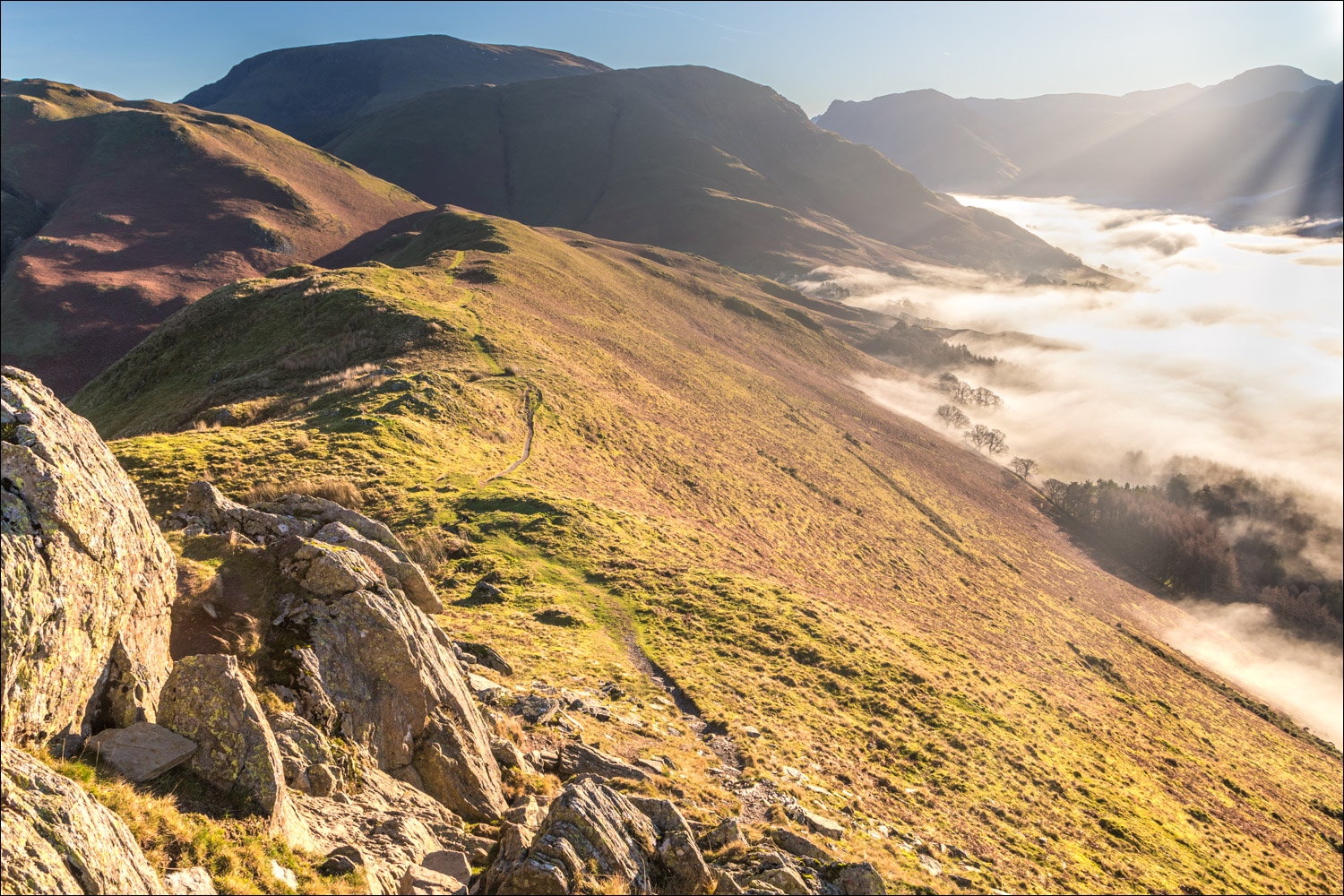
Looking down to Grassgarth Coppice

We follow the path downhill, with a short down and up over High House Crag

Descending back into the mist

We arrive at the Buttermere road and turn right along it

Looking back to Buttermere

We follow the road back to the start - no more photos as there were no views at this low level. Nevertheless, it had been a red letter day and a walk that will live long in our memories

The next day, a seasonal picture of a red squirrel in the garden
