
Route: Rannerdale Knotts
Area: Western Lake District
Date of walk: 29th June 2019
Walkers: Andrew, Gilly, David and Becca
Distance: 3.0 miles
Ascent: 1,100 feet
Weather: Cloudy with a few few sunny patches – very warm, humid and hazy
Rannerdale Knotts is one of the smallest lakeland fells, standing at the modest height of 1,160 feet. We’d planned a more ambitious walk today, but thunderstorms were predicted, so it seemed more sensible to climb one of the lower fells.
What Rannerdale Knotts lacks in height it more than makes up for in its rugged mountainous character and the beauty of its surroundings – this is a fell we’ve climbed numerous times and we could never tire of it
We parked in the National Trust car park at Hause Point and from here the ascent starts almost immediately. Within a few minutes there were lovely views over Crummock Water and Buttermere. After a steep section up a rocky staircase we were soon on the north top enjoying more good views
We carried on along the knobbly summit ridge known as Low Bank. At the end of the ridge there’s a choice of return routes: either back along Rannerdale, or along the Crummock Water side. We opted for the latter today, as the valley route has restricted views. Such a choice would be unthinkable in May, when the famous Rannerdale bluebells are in flower. The sight – and scent – of huge swathes of these flowers growing on open fellside is unmissable
We descended towards Buttermere down the easy grassy slopes and then joined a narrow path which runs at mid-level above Great Wood, giving good views over Crummock Water along the way. The retrospective views back to Haystacks and Fleetwith Pike are particularly good. Near Hause Point we met up with our original ascent path and from here retraced our steps back to the start. The hazy conditions and flat white sky made for poor light for photography, and the photos which follow don’t show the surroundings at their best I’m afraid
For other walks here, visit my Find Walks page and enter the name in the ‘Search site’ box
Click on the icon below for the route map (subscribers to OS Maps can view detailed maps of the route, visualise it in aerial 3D, and download the GPX file. Non-subscribers will see a base map)

Scroll down – or click on any photo to enlarge it and you can then view as a slideshow

Looking back along Crummock Water and the Buttermere road at the start of the climb

High Ling Crag on the far side of Crummock Water

Herdie

Haystacks

Looking back down the path as we gain height...


Rannerdale Farm below

Great Borne in the distance

Looking across to Grasmoor and Whiteless Pike

The High Stile Range from Rannerdale Knotts

Becca and David on the summit of Rannerdale Knotts

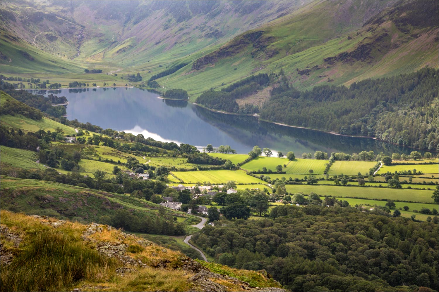
Looking down to the head of Crummock Water

We set off along the knobbly summit ridge

Buttermere

We follow the path along Low Bank

Crummock Water - our return will be along the path at the bottom of the picture

Buttermere, and Haystacks at its head

Further along Low Bank

Buttermere village

We turn right at the fork in the path ahead

Buttermere and Haystacks again

Start of the descent, which is initially in the direction of Buttermere


We turn right just before the line of trees on the right, known as Grassgarth Coppice

We follow a narrow path through the ferns

High Stile and Red Pike

Wood House, set in a wonderful position at the head of Crummock Water

Crummock Water islands

We drop down to join the wider path below

Looking back towards Fleetwith Pike

Becca and David rejoin our original ascent path

We retrace our steps back to the start

From the car park, a view along the path leading into Rannerdale
