
Route: Place Fell
Area: Far Eastern Lake District
Date of walk: 2nd March 2017
Walkers: Andrew and Gilly
Distance: 4.9 miles
Asxnet: 1,900 feet
Weather: sun, hail, sleet and rain
We’ve been up Place Fell before and, like most other folk, have always followed the well known route from Boredale Hause and along Steel Edge. Today we decided to try a different way up the fell
We parked in the Patterdale Hotel pay and display car park and turned right at the George Starkey Hut to follow the track to Side Farm. The wonderful path along the shore of Ullswater – one of the best in the Lake District – runs through the farm, and it was with reluctance that we left it after a short distance to start the climb up to Place Fell
The path leads through an area shown on the OS map as Hare Shaw and it’s clearly not used very often, though the route was never in doubt. Thanks to some sun and blue skies, and snow on the higher fell tops, we were able to enjoy spectacular views back over Ullswater
Beyond Hare Shaw we gained the summit ridge and started the ascent to the top of the fell. The path was covered in snow and we may have strayed from it from time to time, but there were no difficulties and before long we reached the summit cairn. This was no place to linger as a gale force wind had blown up from nowhere, making progress very difficult
We immediately set off on the descent to Boredale Hause, an easy way down – though made harder today by the ferocious wind and showers of hail, sleet and rain which plagued us most of the way down. This didn’t dampen our spirits in any way, since the views we’d enjoyed earlier were of the highest order
For other walks here, visit my Find Walks page and enter the name in the ‘Search site’ box
Click on the icon below for the route map (subscribers to OS Maps can view detailed maps of the route, visualise it in aerial 3D, and download the GPX file. Non-subscribers will see a base map)

Scroll down – or click on any photo to enlarge it and you can then view as a slideshow

Red squirrel in the garden before we set off this morning

St Patrick’s Church Patterdale at the start of today’s walk

Our objective lies ahead - Place Fell

We cross the bridge over Goldrill Beck

Side Farm, where we turn left to join a path along the foot of Place Fell

The Helvellyn range at the head of Grisedale

Further along the path

The head of Ullswater, and Glenridding at the far side of the lake

We leave the main path here and fork off along a grassy path leading up the flanks of Place Fell to Hare Shaw

Heavenly views over Ullswater and the eastern fells as we gain height…

Arnison Crag

Glenridding, home to the Ullswater Steamers

M. Y Raven, launched on 16th July 1889

The path slants up at an easy angle and avoids the crags higher up

Glenridding again

Looking back down the path…


Sheffield Pike and Glencoyne

We reach the top of Hare Shaw

Catstycam

The foot of Ullswater, and Penrith in the distance

Birkhouse Moor, Helvellyn in the clouds, and Catstycam…

…and again, with Dollywagon Pike and Nethermost Pike to the left


Sheffield Pike

The Blencathra range in the distance behind Gilly

Grisedale…


The foot of Ullswater - it was blowing a gale by now

Triangulation column at the summit of Place Fell…


It was no place for a picnic in the howling wind, so without ado we set off on the descent to Boredale Hause

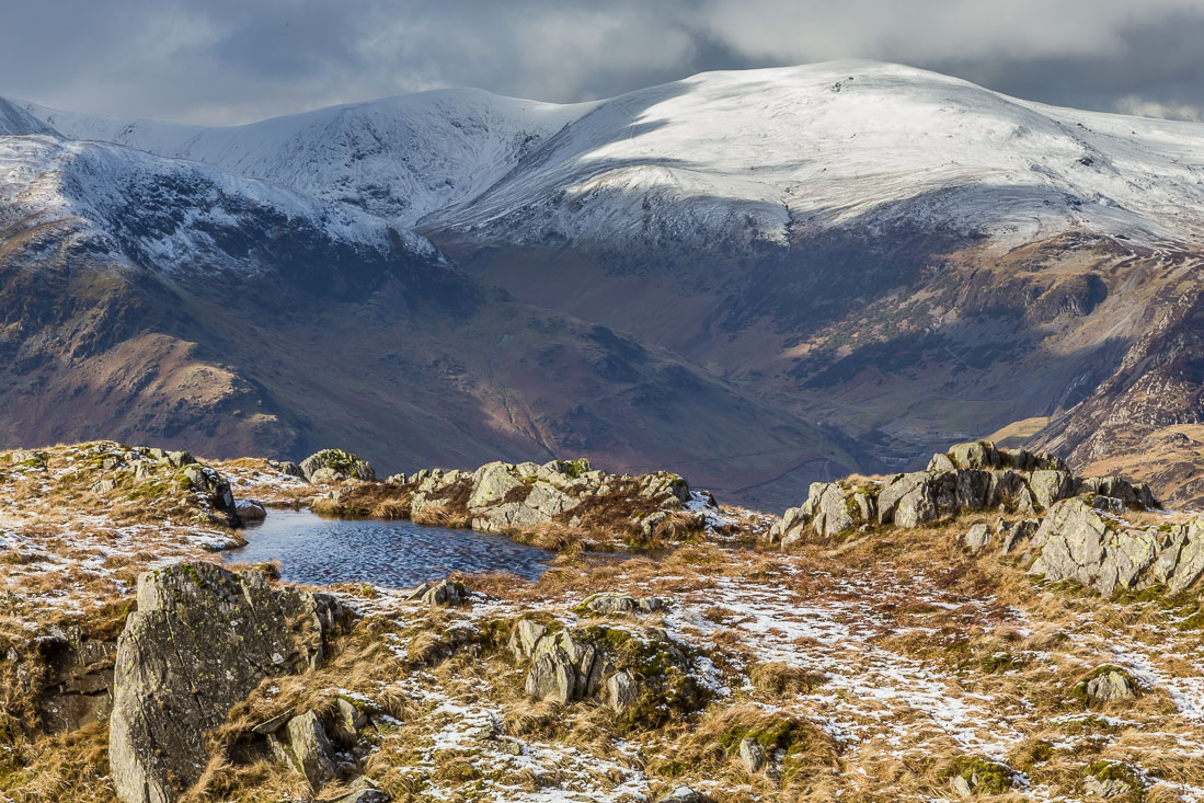
Small tarns, or maybe big puddles, along the way…


The path to Boredale Hause, which is more commonly used to ascend Place Fell

The path heads towards the far eastern fells briefly before winding back towards the hause

Rain and sleet had arrived by now, but there’s a brief burst of sunlight over Brothers Water

The flanks of Beda Fell…


Brothers Water again as we approach Boredale Hause

Descending back towards Side Farm

We pass through the small settlement of Rooking

The track which leads to journey’s end in Patterdale

Side End Farm

The circuit is complete as we reach the track beyond the farm, and from here we retrace our steps back to the end of a wonderful walk
