
Route: Pillar, Steeple and Scoat Fell
Area: Western Lake District
Date of walk: 19th November 2014
Walkers: Andrew
Distance: 12.8 miles
Weather: overcast with a few sunny breaks. Windy on tops
As this was to be a full day’s outing I set off at dawn, but two miles from the planned start at Bowness Knott my carefully laid plans hit a snag – there was a road closure. I apologise to the good folk of Croasdale if they had a rude awakening – literally – as my profanities echoed around the valley
Alternative routes would have added too much time so I decided to approach one of the work force and see if I could wheedle my way through. I exaggerated the distance I’d travelled by a factor of 20, which I suppose amounts to a downright lie, and was kindly given the green light on the understanding that I’d not return along the road until sunset – which was my intention anyway
So, greatly relieved, I parked at Bowness Knott and after that all went according to plan. It’s a long walk in of over 3 miles before the climbing starts. At first it was quite tedious, through serried ranks of conifers and then up a dull slope. But as I neared Steeple the scenery changed dramatically and for the next 3 or 4 hours I was in the midst of some thrilling mountain scenery – as good as it gets
From Steeple I did a quick out and back to Scoat Fell, then it was on to the main objective – Pillar. This involved some boulder clambering and a few very steep sections but eventually I reached the top. Thanks to the road closure there was only one other person about, a fellow walker who’d come via Wasdale. This was the only walker I saw during the whole 7 hour expedition
The weather improved a little at the summit of Pillar and after savouring the wonderful views I headed down the fell via White Pike, steep at first but gradually getting easier. The return to the start seemed to take an eternity but I eventually made it back just as the sun was setting. What a great day out it had been
Click on the icon below for the route map (subscribers to OS Maps can view detailed maps of the route, visualise it in aerial 3D, and download the GPX file. Non-subscribers will see a base map)

Scroll down – or click on any photo to enlarge it and you can then view as a slideshow

Dawn breaks over Pillar in the distance as I approach Bowness Knott

The road closure mentioned in the introduction

Start of the walk beside Ennerdale Water


Crossing Char Dub

And shortly after that, crossing Woundell Beck as I walk into the Ennerdale Forest

A third bridge, this time over Low Beck. I turn right here to follow the beck upstream

Climbing up through the forest

Above the tree line now, and following Long Crag towards Steeple, with Pillar to the left

Looking back over Ennerdale Water

Looking across Windgap Cove to Pillar

My pulse quickens as I approach Steeple

Dramatic skies over Haycock

Summit of Steeple - there follows a short but steep down and up to gain the ridge ahead

On the ridge now, looking towards Black Crag and Pillar

Looking back at Steeple

The Irish Sea in the distance

Scoat Fell

Ennerdale Water from Scoat Fell

The summit of Scoat Fell has no distinguishing features apart from this small cairn and another one on top of the dry stone wall nearby

Heading back along the ridge now in the direction of Pillar

I pass by Steeple again, looking down into Ennerdale

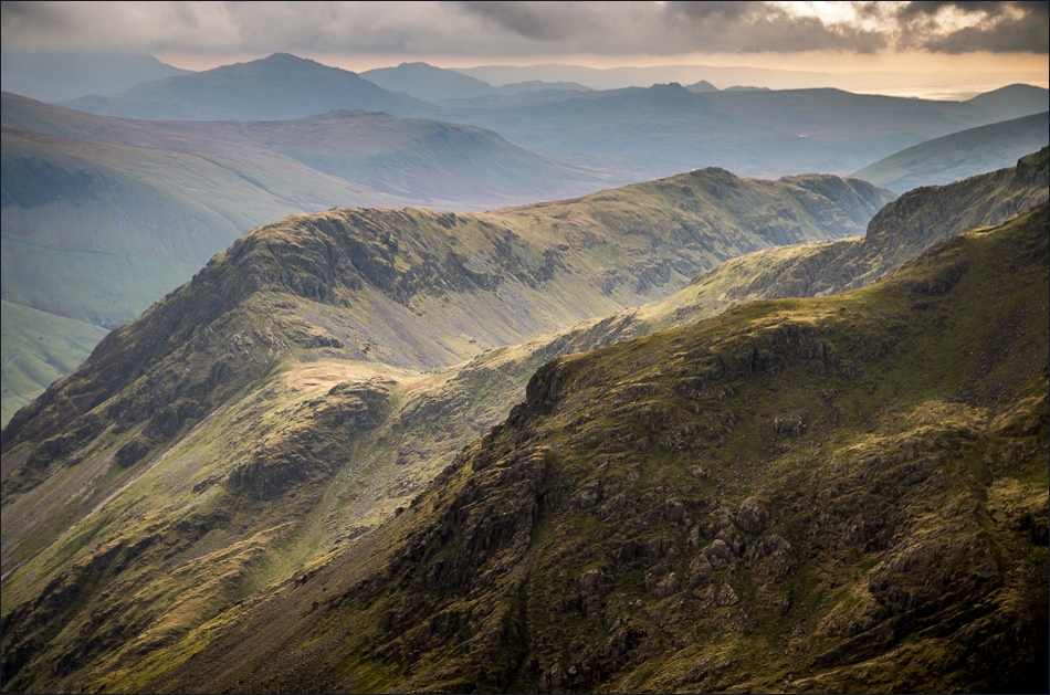
Looking along Mosedale to Wasdale Head

Yewbarrow

Wind Gap, and a steep climb ahead to reach the top of Pillar

As I approach the summit, some sun and blue skies appear

Summit of Pillar


High Crag and Haystacks on the other side of Ennerdale

High Stile


High Stile again, with Grasmoor beyond


A final view from the summit - time to be getting down now

Descending towards White Pike

A long way down into Ennerdale

The gradient below White Crag eases at last, but it’s still a long way back to the start

I gingerly cross High Beck via a collapsed and rickety old bridge

Back down to valley level as the sun begins to set


A last look back to Pillar and Steeple at the end of a memorable day
