
Route: Oeschinensee (Lake Oeschinen)
Area: Bernese Oberland, Switzerland
Date of walk: 15th June 2019
Walkers: Andrew and Gilly
Distance: 2.6 miles
Ascent: 450 feet
Weather: Cloudy with some sunny spells, light rain near the end
Oeschinensee is a famous lake above the village of Kandersteg, our base for the first 3 nights of a walking holiday in the Bernese Oberland. The area above the village is a UNESCO World Heritage site, and the lake is included in the designation
Having walked to the Uschene Valley in the morning, there remained time for a short walk in the afternoon and this gave us the opportunity to visit the lake. We walked from our hotel in Kandersteg to the base station of the cable car and bought 2 return tickets
An enjoyable ride, with spectacular views along the way, brought us up to the Bergstation at an altitude of 5,500 feet above sea level. We set off along the waymarked path to the lake. There were quite a few other folk around, as this is a popular tourist destination, but we were able to leave them as they followed the main path to the lake, while we diverted to the left. The diversion took us along a higher path, recommended by our hotel. We were grateful for the good advice, as the view over Oeschinensee was spectacular, despite the fact that the tops of the surrounding mountains were shrouded in cloud
Having drunk our fill of the view, we followed a waymarked track to the foot of the lake, where there is a hotel and a restaurant, and in consequence it’s rather busy. It was tempting to walk back down to Kandersteg, which would have added an hour to the itinerary, but rain was forecast (accurately as it turned out), and so we simply followed the main track back to the Bergstation and caught the cable car down into the valley
I realised during the course of the walk that this would be the 1,000th walk to appear on this site since I started it in 2013. The spectacular scenery which we’d witnessed made this a fitting way to mark the milestone
Click on the icon below for the route map
![]()
Scroll down – or click on any photo to enlarge it and you can then view as a slideshow

On the way to the cable car station we pass by the catholic church on the edge of Kandersteg

Looking back down to Kandersteg and its valley

View from the top station at the start of the walk

We follow the main track, which diverges after a short distance - we take the higher path on the left which has a better view of the lake

The mountain tops are hidden by low cloud

Dramatic rock formations


We pass by a series of waterfalls


Oeschinensee is out of sight just beyond the trees


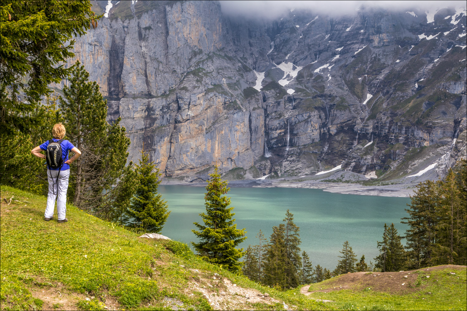
The lake comes into view


Oeschinensee - it’s considered one of the most beautiful lakes in all of Switzerland and one of its best kept secrets

The lake is at an altitude of over 5,000 feet and is fed by glacial waters

The steep cliffs of the Blüemlisalp mountain range provide a natural amphitheatre


Having enjoyed the views from the higher path, we descend to the foot of the lake

An awesome scene...


Reluctantly we turn our backs on the lake and start the return, using the lower path this time

The cable car station comes into view in the distance


A view down to Kandersteg as we arrive back at the top station

Down we go

A black squirrel runs across the path as we walk back into Kandersteg

Approaching Kandersteg


We pass by the catholic church again - it had been a wonderful short walk
Follow the link for more walks in Switzerland (38)
