
Route: Nether Wasdale
Area: Southern Lake District
Date of walk: 12th May 2021
Walkers: Andrew
Distance: 5.9 miles
Ascent: 400 feet
Weather: Mostly cloudy, a few patches of sun and some light rain
Wasdale is home to England’s highest mountain and its deepest lake. The head of the valley is a springboard to some of the finest fell walks in the Lake District. However the fells enclose the valley head to such an extent that low level walking opportunities there are very limited. Nether Wasdale, at the foot of Wastwater, is a better choice for a low level walk, and offers wonderful views towards some of the finest landscape in the country
I’ve followed this walk, or variations of it, on several occasions. This time I was hoping that I’d timed my visit to coincide with bluebells flowering in Low Wood, having been either too early or too late on previous visits in May. I parked as usual in the free National Trust car park at Cinderdale Bridge, at a triangle of roads just beyond Nether Wasdale. After turning right out of the car park I crossed the bridge over the River Irt, and then joined the track leading to Easthwaite. The path formerly passed directly through the farm, but has now been diverted around it. Beyond the farm, confusion may arise when a path to Lund Bridge, clearly marked on the OS maps as a public footpath, bears a sign ‘PRIVATE – no public right of way’. Either the OS map is wrong or the landowner has created a diversion in order to keep walkers away from his field. It’s not an issue, as the extra distance is not significant and the surrounding scenery is so good
I joined the path beside the River Irt and crossed Lund Bridge to enter into Low Wood, and was pleased to see that my timing was right – the bluebells were on good form. I followed a path through Low Wood and arrived at the foot of Wastwater. The view from here is one of the finest mountain landscapes in the Lake District, and didn’t disappoint today
I continued along the lakeshore path and just beyond Wasdale Hall climbed up to the road. I followed this as far as the junction to Greendale, and then turned my back on Wasdale Head to start the return leg. The road section ended when I turned off at Buckbarrow, a farmhouse named after the fell which towers above it. From here I followed a series of paths and tracks back to the start, enjoying some lovely retrospective views as I went along
For other walks here, visit my Find Walks page and enter the name in the ‘Search site’ box
Click on the icon below for the route map (subscribers to OS Maps can view detailed maps of the route, visualise it in aerial 3D, and download the GPX file. Non-subscribers will see a base map)

Scroll down – or click on any photo to enlarge it and you can then view as a slideshow

The start of the walk as I cross the River Irt. I'll turn left to Easthwaite just beyond Cinderdale Bridge

I follow the track to Easthwaite...


Easthwaite ahead, and I follow a path to the left which passes around the farm

Beyond Easthwaite and heading towards Wast Water, unseen from here

The gate on the left leads to Lund Bridge, and a public footpath is clearly shown here on the OS maps. However the sign on the gate is now marked 'Private - no public right of way'. I continue along the track as the alternative route, though longer, is more interesting

Looking across to Middle Fell

The Wasdale Screes ahead

Buckbarrow on my left, which I'll pass by near the end of the walk

The Screes again

I make a there and back detour to the boathouse at the foot of Wast Water

Yewbarrow at the head of the lake

I retrace my steps beside the infant River Irt, and in a few minutes time will be following the path on the other side

I cross the River Irt via Lund Bridge and enter into Low Wood

Bluebells in Low Wood


I pass by the boathouse again, this time on the other side of the river

I follow the path around the foot of Wast Water

The view to Wasdale Head as I continue around the lakeshore path...


Bench with a view

The classic view to the head of the lake can be enjoyed for most of this section of the walk...


I join the lakeside road and follow it as far as the junction with Greendale

Middle Fell

Last of the views along Wast Water as I reach the half way mark of the walk

Looking along Countess Beck to the Wast Water Screes

The Screes

I turn left and follow the sign pointing to Gosforth. The road section is not an issue, there's very little traffic as Wasdale Head is a dead end

The Screes on the far side of Wast Water. There's a path along that side of the lake which I tried once. Never again

Buckbarrow ahead, towering over the small hamlet of Greendale

The flat landscape ahead contrasts with the dramatic mountain scenery looking back...


I leave the road below Buckbarrow and follow the track to a farm of the same name

I walk through the farm at Buckbarrow

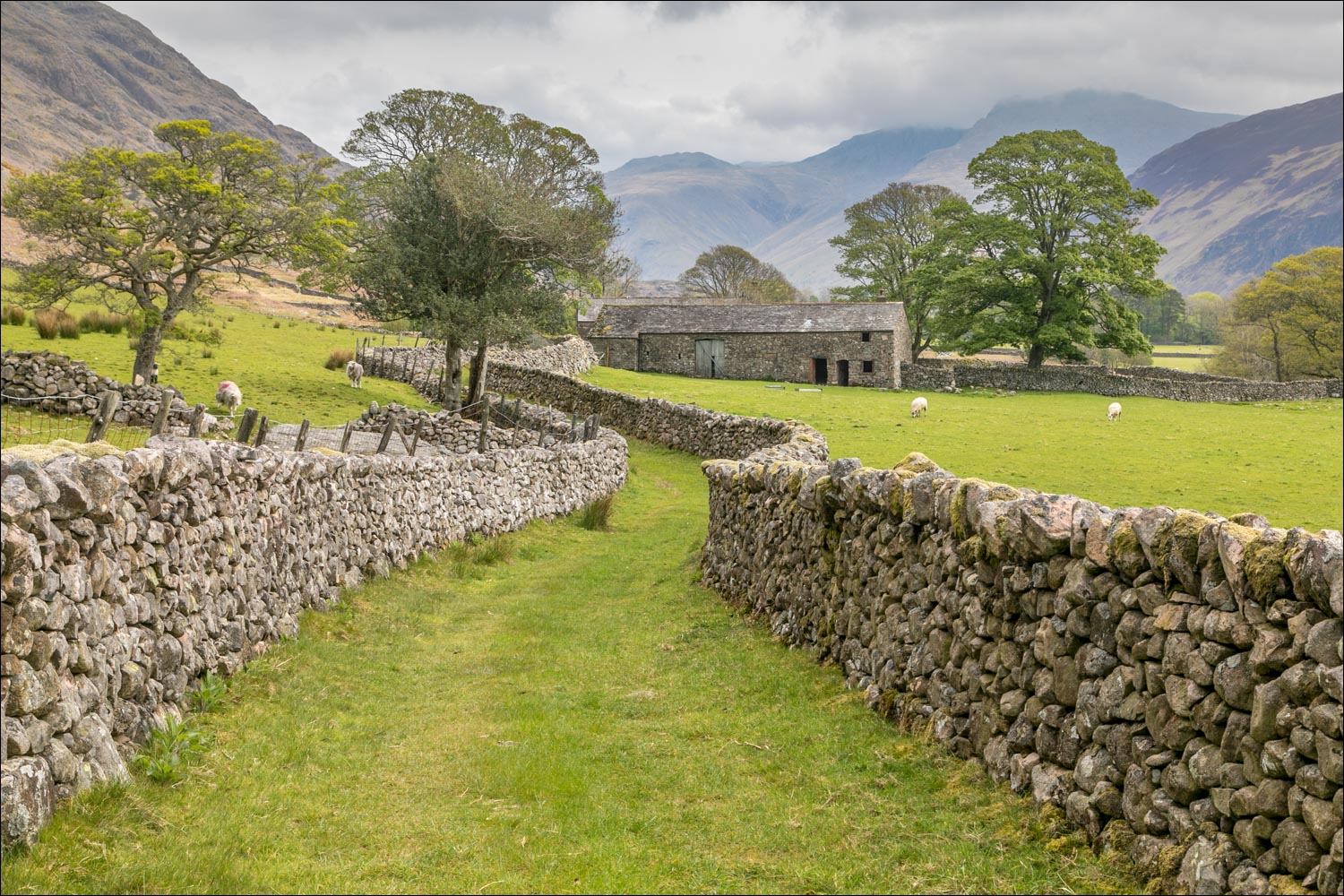
I follow a delighful path between dry stone walls...

Looking back to Buckbarrow (the farm)...

...and to Buckbarrow (the fell)

A view back to Lingmell at the head of Wasdale

The Screes on my left

Last of the views back to Wasdale Head as I follow the path back to the start....


Mill Place ahead, and the end of a wonderful low level walk is just around the corner
