
Route: Low Rigg and Castlerigg Stone Circle
Area: Central Lake District
Date of walk: 30th November 2017
Walkers: Andrew
Distance: 5.2 miles
Ascent: 800 feet
Weather: Sunny then gradually clouding over, icy cold
I parked in one of the roadside spaces by Castlerigg Stone Circle and after spending a few minutes wandering around this atmospheric place returned to the lane, leaving it at Goosewell Farm to follow a path through the fields to Naddle Bridge. The views across the valley to Blencathra were tremendous and I was accompanied on this section of the walk by the plaintive cries of a family of buzzards circling overhead
After a short but quiet road section I headed across the field towards Low Rigg, passing by jewel-like Tewet Tarn along the way. There were some lovely views as I gained height. The path passed by the highest point of Low Rigg but I didn’t bother with the 5 minute detour to the top and carried on until I reached the tiny church of St John’s in the Vale
I turned right at the church to follow the lane, leaving it after a few minutes to walk across the fields to Low Nest and High Nest. The path would normally have been muddy and squelchy but thanks to the frozen ground I was able to keep my boots clean. After High Nest there followed a simple climb back up to the stone circle
During the course of this enjoyable walk I’d covered 5 miles of beautiful and unspoilt countryside and in all that time only passed two other walkers
For other walks here, visit my Find Walks page and enter the name in the ‘Search site’ box
Click on the icon below for the route map (subscribers to OS Maps can view detailed maps of the route, visualise it in aerial 3D, and download the GPX file. Non-subscribers will see a base map)

Scroll down – or click on any photo to enlarge it and you can then view as a slideshow

Early morning light on this red squirrel...


A short while later, Castlerigg Stone Circle at the start of today's walk

The circle is believed to have been constructed about 3000BC


Looking towards the north western fells...

...and now looking east in my direction of travel towards Low Rigg

I follow the lane as far as Goosewell Farm

I leave the lane to walk across the fields

Looking across to the Blencathra range

The road is rejoined at Naddle Bridge

A short road section with good views of Blencathra...


Looking back to Skiddaw Little Man

I turn off to follow the Old Coach Road for a few yards


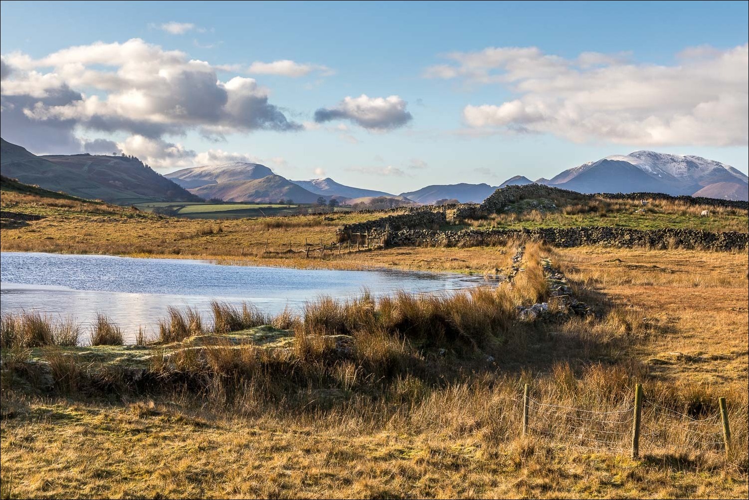
Having left the road, the path takes me past Tewet Tarn

Looking towards the north western fells...


Blencathra

The Skiddaw fells

I climb the slopes of Low Rigg, with views over St John's in the Vale to my left

Bonnie climbs a ladder stile

Descending to the youth centre and the small church

St John's in the Vale again...


Looking back along the path

St John's Church

Blencathra again

I follow the lane towards Sykes...


I leave the lane at the gate below and follow the path across the fields...


Skiddaw and its Little Man

High Rigg...


...and Low Rigg

I cross the footbridge over the beck

High Rigg, and the eastern fells beyond

Looking back to Helvellyn in the distance

Zooming in on Helvellyn

Blencathra again as I climb back to Castlerigg Stone Circle

Another view of the stones looking towards High Rigg

Now that's what I call a tripod - a fellow photographer seeks a better viewpoint of the circle

Some good light at the end of the walk - a roadside photo of the north western fells from the parking space
